
Hiking Dude Blog
2025 - Aug Jul
2024 2023 2022 2021 2020 2019 2018 2017 2016 2015 2014 2013 2012 2011
02/27/2012
I Love It When...
 ... a plan comes together.
This weekend was a flurry of progress on final plans for my AZ Trail hike. Still a lot more to do, but big progress.
- A Buddy: For the first few days at least, from the Mexico border to Patagonia, I'll be hiking with Colton. I met his dad online, chatted on the phone, and talked with Colton today. Sounds like a great guy and we've got similar goals and plans for our hikes. It's good to have someone else on the trail, especially in that part of the state, so I'm told. My mom can relax now.
- A Flight: I bought my plane tickets from MSP to Tucson, arriving on March 15.
The travel industry is crazy. I had an alert set up on kayak.com and the prices went up and down daily like a yo-yo for two weeks. I wound up paying $160 for a one-way ticket. I'll get my return flight when I'm nearly done with the hike. - A Room: a friend from college is letting me bunk overnight in Tucson. I'll have Friday to buy food, ship a package down the trail, and do last minute stuff.
- A Start Date: We're hitting the trail at about 6:00am on St. Patrick's Day - how cool is that? Gives us a long day to make our first miles.
So, the actual plans for the hike are pretty much done. Now, I just have to actually do it. The rest of my To Do list are support things, like enabling my ability to blog from the trail, email subscribers to my updates, map tracking, and other fun stuff.
Oh yeah, we're supposed to get a foot of snow tomorrow so I'll be taking a few rest days from hiking.
I'm visiting a scout meeting tonight to tell them about my hike, show my gear, and promote the ScoutStrong Program.
Hike On
02/28/2012
What I Really Do - AZ Trail
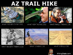
Click the image for a larger view.
Which one do you think of when you hear someone is hiking 800 miles across Arizona?
Hike On
03/02/2012
Electronics Prep

Very busy couple days getting electronics gear ready for the AZT.
A friend figured out that I could just use his cellphone that he just keeps forwarded to another work phone, so I don't have to buy one or add a line to our plan. (My family all have phones, but not me) It's good to have generous friends like this one!
We tested out all the possible situations that might occur while I have his phone and he still has calls coming in - I'm sending a text, I'm talking, I have the phone off/on/airplane. We checked that texts and calls I make go through and texts come to me, but calls continue to forward to his other phone. It all works just as we hoped. Pretty cool!
So, today I did the coding for my autoblog on my website. I can now send a text message from the trail and it becomes a blog entry. I can compose a text in airplane mode or without a cell signal and it will be held until it can be sent. The only thing I still need to tweak is including a photo - it almost works.
I should be able to send you all great updates as I
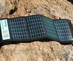 I also tested the solar charger with the phone. The Boy Scouts provided me with this charger and I really appreciate their support of my hike. It has two AA batteries in it plus a USB port.
The charger is made by PowerFilm and will most likely spend most of its time hanging on my backpack or my umbrella.
It makes sense to use a solar charger in Arizona, especially when I'll be hiking generally north the whole time. When I get back from this hike, I think you'll be interested to hear about my new power source for my Ice Age Trail if it gets released.
Hike On
Leave Comment
Posted: 03/02/2012
Posted: 03/02/2012
03/05/2012
Trail Journal
 I hiked 4 miles to Gander Mountain to pick up three 1-liter platypus water bags. They weigh about 5 ounces all together and take up very little space when rolled up. I'll have them as extra storage in case water is more scarce than I imagine and for a couple of looooong dry stretches.
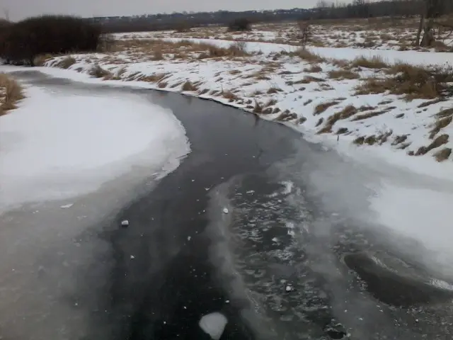
I hiked over this frozen river and dropped a big snowball on it just for fun.
Hike On
Leave Comment
Posted: 03/05/2012
Posted: 03/05/2012
03/06/2012
Trail Journal
 The lake has puddles on the ice after this 60 degree day. What an amazingly beautiful day for a nice hike.
I traveled about 11 miles today.
Check out my current location on the map.
03/15/2012
Leaving on a Jet Plane...
 Don't know when I'll be back again, but I'm hoping it's by May 1st.
They say every journey begins with a single step, but this one begins with a couple long plane rides. I fly to Tucson via Dallas today to start my 800-mile Arizona Trail hike. A friend is picking me up at the airport and letting me stay with her family for two nights. Then, it's a 100-mile ride to the Mexico border and trailhead early Saturday (St. Patrick's Day!) morning to take that first step. I've found a hiking buddy to give me a ride and join me for the first 4 days or so and then we'll probably go our own ways.
So, after about 6 months of planning, purchasing, making, and practicing, it's time to actually start the adventure. My wife and son are off to school and I'm waiting for a good friend to give me a ride to the airport. The backpack is wrapped in plastic for the baggage
It's been quite a few days with no posts on my blog here since I've been so focused on final preparations. For the next 6 weeks, I'll hopefully be posting from the trail so the posts will be short and mostly chronicling my hike. You can follow my progress at my AZ Trail page.
Hike On
Leave Comment
Posted: 03/15/2012
Posted: 03/15/2012
Tucson
Plane ride to Tucson was fine.
Dallas was all green flying in, but Tucson has roofs the color of sand and sand the color roofs. But, the 85 degrees sure feels nice!
I got a great tour of Tucson, including the university and Arizona Children's Association where my friend works. I love the architecture and character of the buildings here.
Tomorrow, I shop for food and repack it all to take on the trail. I'll also pack a box to send down the trail to pick up in a town a week or so from now. Well, that's the plan anyway.
Hike On
03/19/2012
On the Trail
I've been saving texts on my phone each day but t-mobile has no coverage around here so the texts are waiting. Oh well. So, here's a recap of the first three days. You can check out my progress map at AZT page since my Spot has been working pretty well.
Saturday at about 9am, we started hiking to the Mexico border which is the start of the AZ Trail. We started north at about 9:30 and made it up the very rugged first 6 miles to the top of Miller Peak. The weather was nice and warm, but not hot. It was amazingly windy. Some pines broke not long before we walked past.
We wound up hiking about 20 miles, stopping shy of Parker Canyon Lake. This was farther than I had planned to go, but I felt terrific - no real pains, blisters, or soreness.
I'm saying 'WE' because I'm hiking with a guy named Colton that I met online. His father is supporting us these few days and that has made the hike much more enjoyable at the beginning. We plan to hike together for a couple more days and then go on our own. Anyway, his Dad made us an awesome dutch oven elk meat loaf and biscuits for dinner! Great way to end the first day of hiking.
Yesterday, the big storm moved into the area right after we started hiking. We heard thunder, but at a distance and lucked out that didn't get close. We did get high winds, rain, and snow all day. It was quite an experience and the closest I've come to going hypothermic. When you see pics of my 'raingear' you'll know why. :-)
We made it about 16 miles to Canelo Pass where Colton's dad met us and drove into Patagonia to stay in a hotel since it continued to snow ad blow. Bought two pizzas at Velvet Elvis and stayed at Stage Stop hotel - the only spots in town. I got my money's worth in just my long shower at the hotel.
Today, I was hoping for the storm to blow over, but it hung around. Drove back to our stop point and hiked into the wind and rain again. Stayed with us aaaaaall day until we hit the road 2 miles from Patagonia when it just stopped! Gave us 45 minutes of hiking to dry out quite a bit. We're at the same hotel as last night, but the forecast is for much warmer and nicer weather tomorrow.
I'm hoping to stretch our distance tomorrow, but we'll see how it goes.
On the trail, I've met Phil from Florida on his way to Utah and moving just a bit slower than us. Also ran into a couple in a tent in the snow, but they are ahead of us on the trail now. At the trailhead on Saturday, I met Bill who's starting the trail next Friday on his 70th birthday!
Well, there you go. Hopefully, my cellphone posts will go out in the next day or two. Otherwise, I'll post the next chance.
Hike On
03/22/2012
1st Day on AZTrail
I walked 44184 steps on the trail today.
I traveled about 23 miles today.
Got picked up in Tucson at 5am. Started hiking at 9am. Super windy on Miller Peak.
Check out my current location on the map.
Leave Comment
Posted: 03/22/2012
Posted: 03/22/2012
2nd Day - Snow
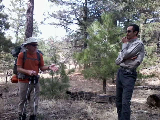 I walked 34654 steps on the trail today.
I traveled about 16 miles today.
Met Phil from FL yesterday. Hit by a desert snow storm today. Exciting hike!
Leave Comment
Posted: 03/22/2012
Posted: 03/22/2012
Older Posts Newer Posts
Find more Hiking Resources at www.HikingDude.com


Follow Me
Recent Comments