
Hiking Dude Blog
2025 2024 2023 2022 2021 2020 2019 2018
2017 - Dec Oct Sep Aug Jul Jun May Apr Mar Jan
2016 2015 2014 2013 2012 2011
07/27/2017
Day 14: Thumbs Up
 I walked 11400 steps on the trail today.
I traveled about 5 miles today.
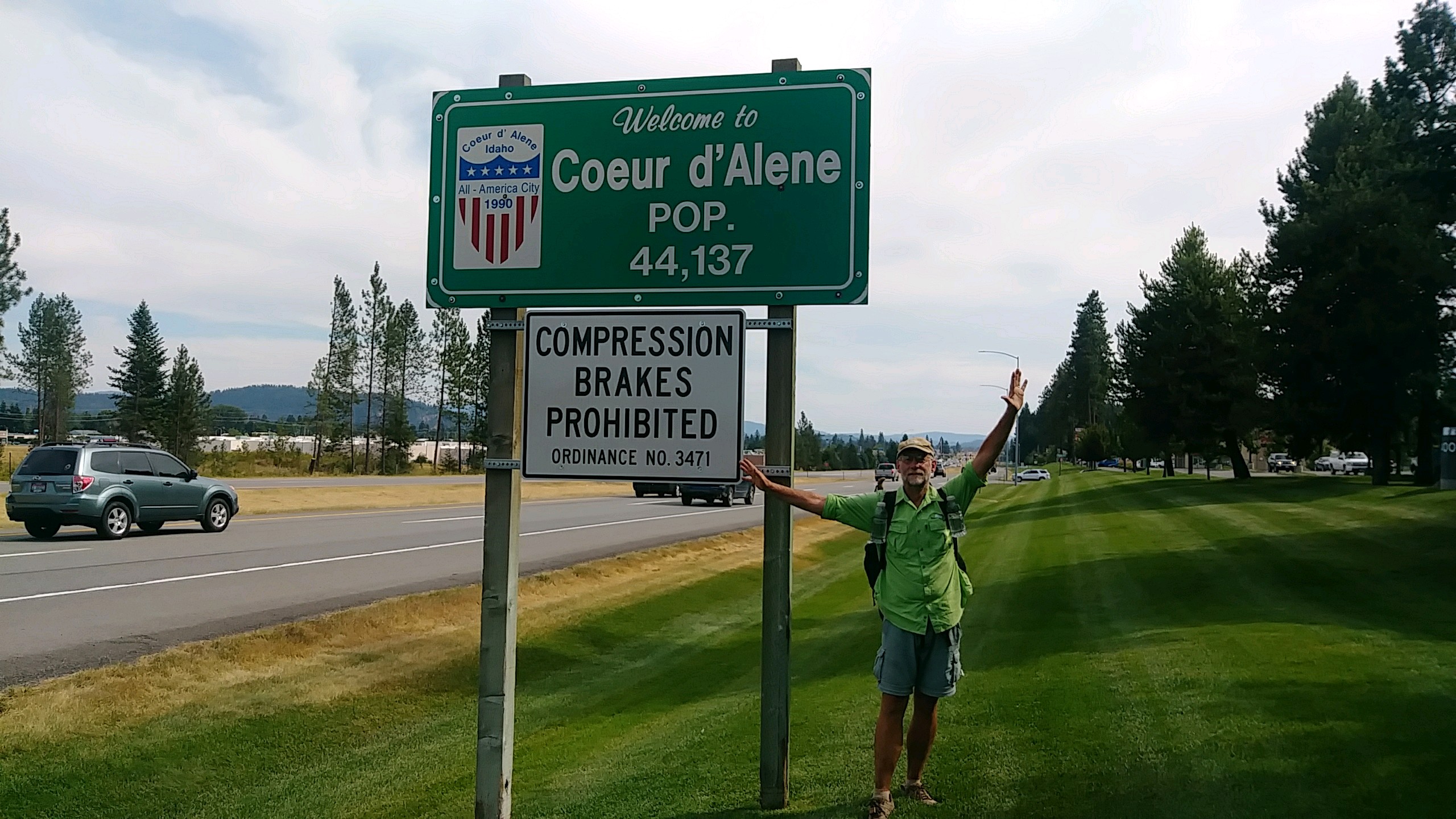
7/26/17 We actually walked about 18 miles today, but only the first 5 were on the PNT. The rest were along us95 trying to get from the trail crossing about 15 miles north of Bonner's Ferry down to Coeur d'Alene about 90 miles south. We will be off trail for 10 days working at Camp Lutherhaven. Josh worked here for 2 summers and I worked here 37 years ago. This is where my wife and I met and its our 30th anniversary next week. She is driving out here with a friend to be here this weekend for a dutch oven cooking and wine tasting ladies event. I've been asked to present about cooking so that should be fun. Next week, we're just doing whatever is needed. Anyway, we made it to CDA but it was a fun, long day getting here. Up at our usual time but in a new time zone so we were actually starting wire early. No water except that which we had carried over the mountain yesterday. We walked the miles on dirt road down to the busy us95 and headed south. We hiked on for two hours as cars zoomed past. I used my 'To Town' sign and cars zoomed past. We stuck out our thumbs and cars zoomed past... Continue...
Leave Comment
Posted: 07/27/2017
Posted: 07/27/2017
Trail Journal
Day 14 part 2 We were getting pretty disappointed when Lynn stopped her little pickup. She stashed her garbage can by a tree to make room for us in the back and we were on Bonner's Ferry a few minutes later. At the grocery store, we bought more than we could eat, sat in the cool store and had lunch. Then, back into the 90+ degrees slowly walking south with thumbs up and new CDA sign we made at the store. 90 minutes later, Gavin offered us a ride to Sandpoint so we upgraded to an air conditioned pickup. He is just starting his own construction company and is waiting to hear if he won his first house bid. In Sandpoint, we cooled off in McDonald's and then back to the road. This time, we decided to try for an hour and, if no ride, we would stay and watch the Spiderman movie. Just as our time was up, a guy stopped his pickup and honked. We piled in the back and were off down the road. A fast hot windy ride got us to the northern reaches of CDA. From there, were walked a couple more hours, stopping along the way to cool off in stores. About 7pm Josh's friend at camp contacted him and then picked us up. So, for $25 and 17 miles of walking and 13 hours, we made it from trail to 'home'. I won't be posting much until we head back out.
Leave Comment
Posted: 07/27/2017
Posted: 07/27/2017
07/26/2017
Day 13: Idaho
 I walked 60454 steps on the trail today.
I traveled about 22 miles today.
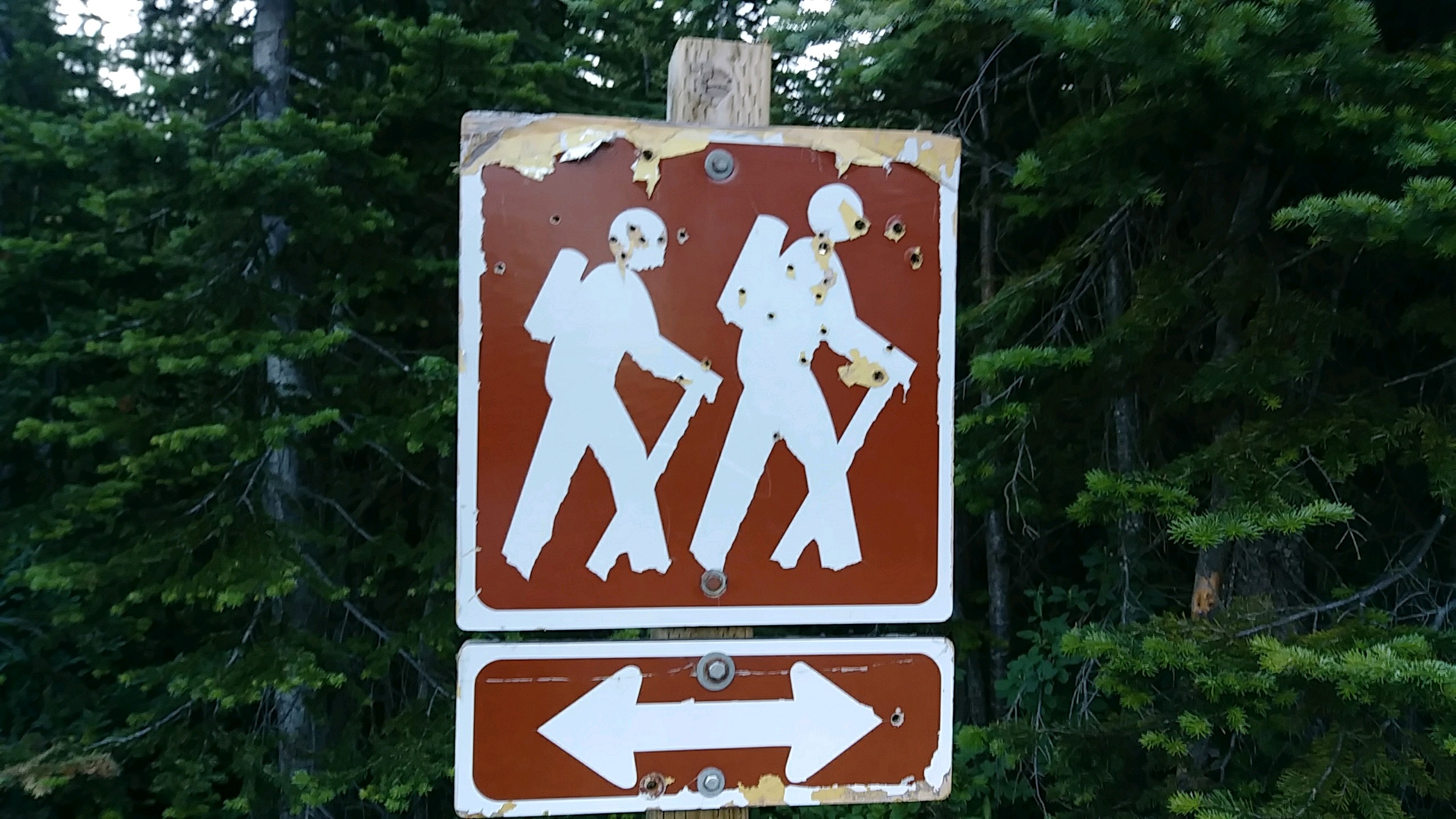
7/25/17 We camped nearly right on the ID/MT border last night so all of today was spent hiking through Idaho. Not much difference :-) But, as you can see, they are good shots and some don't seem to care for hikers. The hike down to the Moyie River was dry but cool. We stopped at the Feist River Falls resort but it was dead because we were pretty early I guess. So, on we hiked to the base of Bussard Mountain and our last water source for a dozen miles or more. The 3400feet up the hill went better than hoped but it was the usual hot, steep, and sweaty. At the top, there was a surprise - about 100gallons of water in 5gal jugs. They were probably for trail crews but we borrowed a bit from an open jug. After that, we passed many dry spots but no water so it was a good idea. The rest of the afternoon and evening was spent following old dirty roads down toward Bonner's Ferry and we camped just a few miles from the major road crossing. Not much to report but I think it's because I'm very tired and looking forward to our adventure tomorrow - trying to reach Coeur d'Alene.
Leave Comment
Posted: 07/26/2017
Posted: 07/26/2017
07/25/2017
Day 12: Rock Candy Mountain
 I walked 45866 steps on the trail today.
I traveled about 20 miles today.
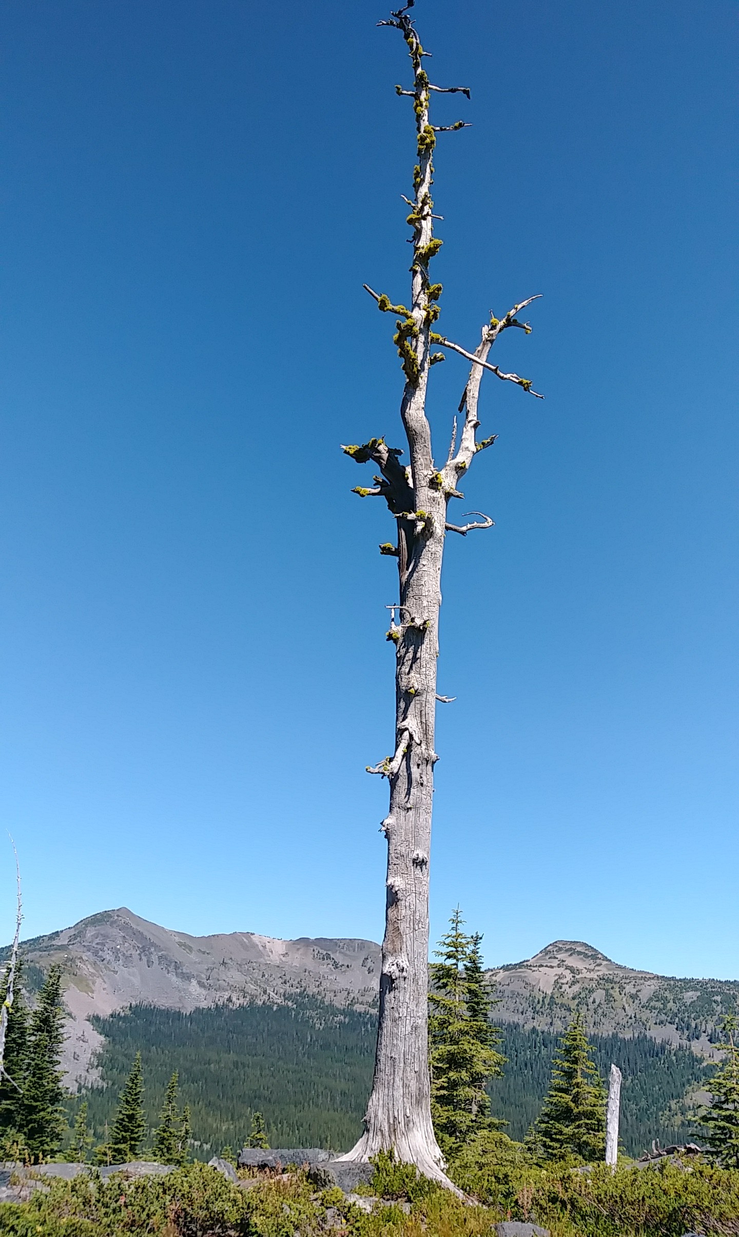
7/24/17 Annelise, Batman, and the two of us all got up about the same time. Since we aren't cooking, we were on the trail (road) first but Batman caught up to us in a couple hours and we played leapfrog all day long. We've not seen Annelise but left a note for her in the second trail registry of the trip - out in the middle of no where. In the registry, we saw that three people hiked by yesterday so there are some not too far ahead. A 6-mile roadwalk followed by another 5 miles of mostly uphill trail brought us to a beautiful saddle and views on both sides. Rock Candy Mountain dominated the south and still had plenty of snow cornice along its ridge. It was a wonderful spot to rest a bit. Way up here above timberline, rock cairns were very helpful. Also, some very over zealous crew did an astounding amount of work on the trail coming up - thank you! We carried all of our water containers full from the last supposedly reliable water source, but there were many spots along the trail for water. Oh well, just extra weight. Many fresh elk tracks and droppings along the way, but that was all. I did get hit on the ankle by a grouse though. She was right on the slightly overgrown trail and I didn't see her. Her baby fluttered to the side, taking my attention, and then she exploded just as I stepped where she sat. Pretty cool. We've seen many grouse, dozens of them. Now, we stopped at just 4:30 and plopped the tent by the trail after doing 20 because we're ahead of schedule. It's a flat spot up high and has breeze but no water around. This does change the usual uphill first thing in the morning though. We'll have a huge climb up Bussard Mountain around midday - yuch. Oh, we are filthy dirty!
Day 11: Annelise, HikerBot, and Berries
 I walked 60434 steps on the trail today.
I traveled about 26 miles today.
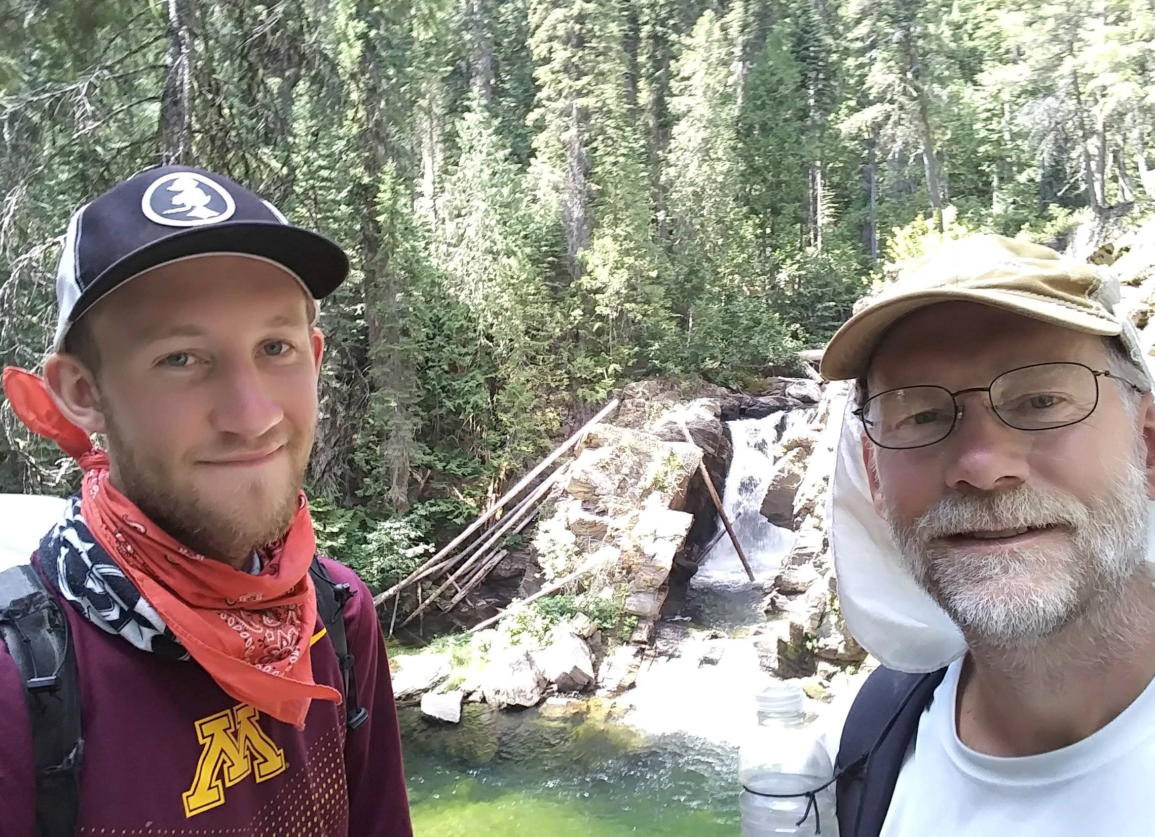
7/23/17 Tonight, we ran into Annelise at Pete's Creek camp and got to chat for a couple hours. She is hiking the trail alone, has great determination, and is gradually putting miles behind her. An injury slowed her up but she's back on trail. She was fun to talk with and never let the conversation pause very long. Our day began with the usual steep strenuous uphill climb. Starting at 6:30 makes a huge difference with the temperature being in the 40s instead of the 80s or 90s. Up the hill, we found our first good patch of huckleberries so we sat down and picked awhile for a break. I sat right on a small bush and now have purple stains on pants, underwear, and skin. It was worth it. We dropped into the Yaak valley for another long roadwalk. Josh found out that Yaak is a Kootenai word for arrow. We just walked across the valley. We stopped for water before our second long uphill at the spot we thought the trail started. It turns out this was just a short trail to a beautiful waterfall. After admiring the falls and figuring out it was a deadend, we slogged the very long hot dirt roadwalk up Garver mountain. On the way up, while we were filtering yet more water, a truck stopped. The pastor from the Yaak church was giving Batman a ride up the hill. We had heard of Batman in Eureka and thought we might run into him. He is covering the trail collecting data for an app called HikerBot that hikers use to navigate the trail. One key thing he is gathering is water sources along the way!!! You should check out HikerBot. Josh is planning to download it in a few days. Our day ended with yet another long downhill in the hot late afternoon sun, dropping down to Pete's creek. In general, the eastern slopes seem more gradual and forested while the western slopes are rocky, steep, and bare. Makes for nice morning hikes and not so nice afternoons. Tonight's camp was right at mile 200 on the maps!
Leave Comment
Posted: 07/25/2017
Posted: 07/25/2017
Day 10: Bob Benny and Huckleberry Pie
 I walked 40833 steps on the trail today.
I traveled about 14 miles today.
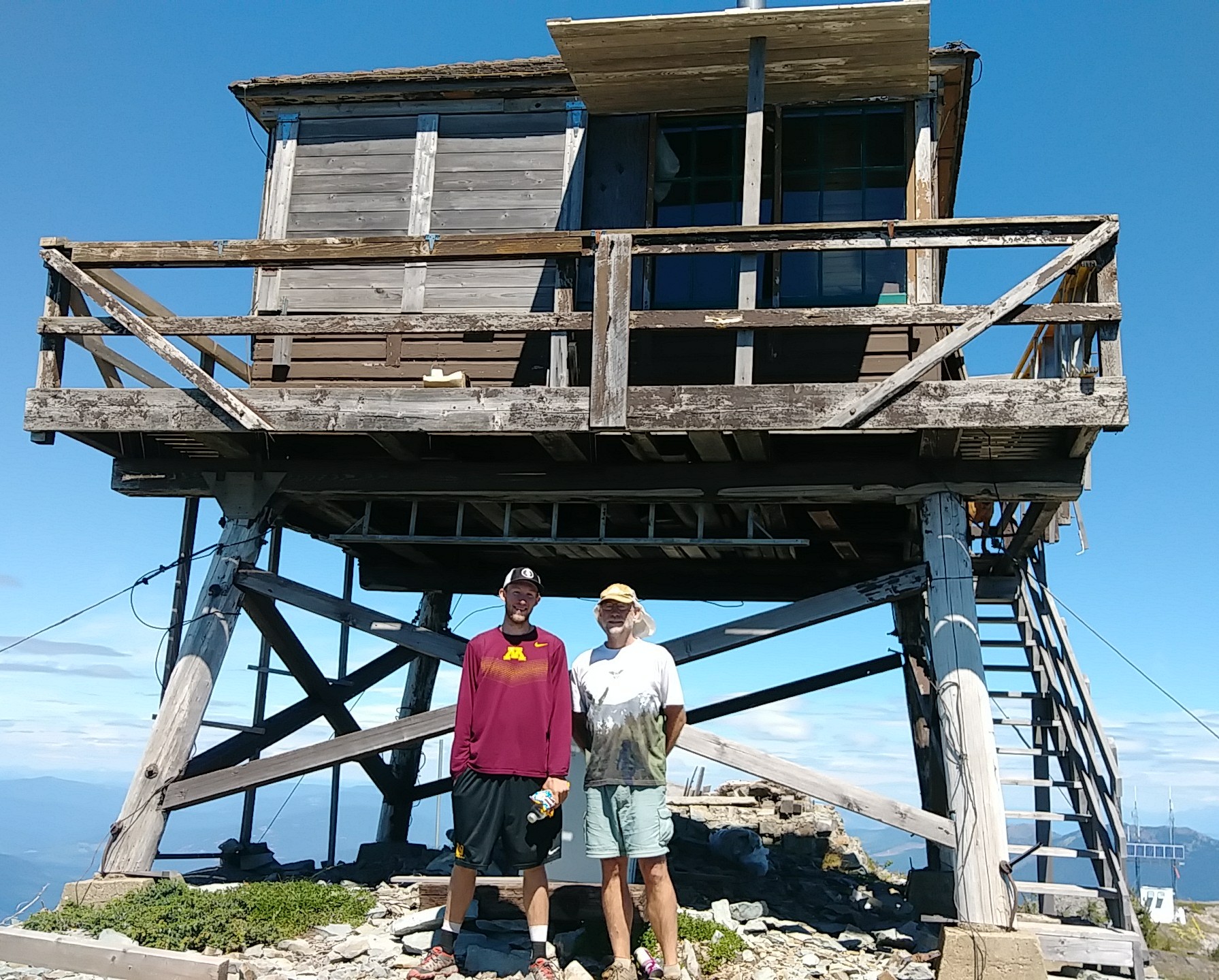
7/22/17 Both yesterday and today found us high on mountains with the noon sun pounding mercilessly. But, today we planned our hike for it and the coming days appear to be similar. Water scarcity on the PNT is much more of an issue than I expected. We filled 3 liters each before leaving camp with an expected 10 dry miles to a possible spring on Mt. Henry. If that spring was dry then we'd have 4 more downhill miles to a large creek. It was a good plan. From 6:30 to noon, we hiked up and down mountains and ridges with no water sources. Fortunately, it was a cool morning which made the climbs more manageable. The spring we hoped for had a small pool of water, so we could refill and add a small extra climb to the summit of Mt. Henry and see the lookout. As we approached, a loud dog barking welcomed us, then a friendly hello from a man in the lookout. Bob, and his dog Benny, had hiked up from his truck yesterday to do volunteer maintenance on the old structure. It was a wonderful time chatting with Bob while the relentless wind roared over the mountain, chilling us in the bright sun. After a long restbreak, we still had to descend the mountain to water and over one more climb to our camp site...
Leave Comment
Posted: 07/25/2017
Posted: 07/25/2017
Older Posts Newer Posts
Find more Hiking Resources at www.HikingDude.com


Follow Me
Recent Comments