

Hiking Dude Blog
2025 - Aug Jul
2024 2023 2022 2021 2020 2019 2018 2017 2016 2015 2014 2013 2012 2011
07/25/2017
Trail Journal
Day 10 part 2... The trail down was on the west side and brutally hot! Once off the summit, the cool wind stopped and we continued to descend through open, arid, shadeless stretches. One interesting thing about the hot sun is that it bakes the smells out of the trees and plants. Some are good, some not so much. In a few places, it smelled just like someone was baking a huckleberry pie! We reached Turner creek about 3pm and decided to cool off in it - very nice. Checking the maps, we still had 10 miles to go which included a 1600foot climb during the hottest part of the day and possibly no water until the end. Yuch!!! Since we are already a couple days ahead of schedule, we stopped here at Fish Lake for a very short (but strenuous) day. The climb will wait for tomorrow and we will need to do a 25 mile day in order to complete a dry ridge and find water - see a pattern here? I did see a huge owl silently swoop through the trees in front of me, being chased by a small, screeching bird of some kind. Oh, almost forgot, last night in camp around 10 or so, some large animal visited. It crunched out in the brush making a very strange noise, not like a whoof of a bear, more like a horse huffing and more high pitched than I'd expect a bear to sound. Anyway, we both grabbed our bear spray and waited until our tired eyes took over again.
Leave Comment
Posted: 07/25/2017
Posted: 07/25/2017
Day 9: Miracle Puddle
 I walked 59580 steps on the trail today.
I traveled about 26 miles today.
7/21/17 Josh checking in today! (Dad's looking at tomorrow's routes at the moment, so I'll jump into the spotlight). Sticking true to our recently self-imposed morning routine, we got rolling bright and early at 5:30am. Started hiking from Jeremy and Nikki's backyard down the main street, leeching all the free WiFi that we could from outside the stores as we strolled by. Made our way past some tiny convenience store along Lake Koocanusa, so I bought a snickers bar and twinkie (mostly so that I wouldn't feel crummy about enjoying the luxury of their clean bathroom and water refill in the sink. I love getting water without having to filter it!!). We knew that water sources were going to be tricky today, so we chugged a bunch before refilling and pressing onwards. While still fresh from all the rest yesterday, we quickly cranked out 17 miles of road walking and found ourselves at the bottom of Mt. Webb just minutes before 1pm. We nearly witnessed a family of deer get obliterated by the highway traffic, but luckily it didn't go down that way cuz we very well might've been in the splashzone! Feeling good about our pace in the pleasant low-temp hours of the morning, we began ascending Mt. Webb, which we had heard about plenty from the folks last night. The further we climbed, the more the incline seemed to steepen, and the hotter it felt like the sun was shining overhead. Conserving water was at the forefront of both our minds, and to accomplish this we needed to maintain a steady, yet efficient pace to minimize our exposure to the sun beaming down on our side of the mountain. We zig-zagged up to the top by 3:30pm, stopping once to nibble on some huckleberries; we were cutting it close with a few drips of water to spare, and at least 2 more miles until the next water source that we could see on the map. We hiked the trail along the ridge line as it flattened out, expecting to see a pond to refill with....
Leave Comment
Posted: 07/25/2017
Posted: 07/25/2017
Trail Journal
Part 2 of Day 9... But we could see nothing but forest. Huh. Water was the number one priority for the moment, so we made a mental note of our location and hopped off the trail to begin wandering downhill where any rainwater might pool up. After 10 minutes of climbing over, under, and around downed trees (that place could benefit from a forest fire to clear it up one of these years... Knock on wood) we made it to what I like to call the Puddle of Life. Or miracle puddle. Both get the point across - I was very happy to see that water. Admittedly it was more the size of a pond than a puddle. We got our water, navigated our way back to the trail, and pressed on to a creek about 5 miles further where we set up the tent, ate our calorie-dense dinners, and did the calculations to realize we had just finished our third marathon day of 26 miles. We're gonna have to slow down so we get to our destination on time!
Leave Comment
Posted: 07/25/2017
Posted: 07/25/2017
Done Hiking Today
I finished hiking for today. You can check out my current location on the map and I'll post about my day when I am in coverage.
Leave Comment
Posted: 07/25/2017
Posted: 07/25/2017
07/24/2017
Done Hiking Today
I finished hiking for today. You can check out my current location on the map and I'll post about my day when I am in coverage.
Leave Comment
Posted: 07/24/2017
Posted: 07/24/2017
07/23/2017
Done Hiking Today
I finished hiking for today. You can check out my current location on the map and I'll post about my day when I am in coverage.
Leave Comment
Posted: 07/23/2017
Posted: 07/23/2017
07/22/2017
Done Hiking Today
I finished hiking for today. You can check out my current location on the map and I'll post about my day when I am in coverage.
Leave Comment
Posted: 07/22/2017
Posted: 07/22/2017
07/20/2017
Day 8: Eureka!
 Walking 7 miles of country road followed by 4 miles of fast highway traffic isn't a great morning hike but we did it. The day turned into a great relaxing break meeting a bunch of fun folks.
First off, I emailed a listed trail angel named Nikki letting her know we were heading into town. Then, we walked. We passed a pizza place with buffet but didn't open until 11 - it's only 9:30.
As we passed a gas station across the road, a guy waved at us and hollered so we crossed over to see what was up. This guy is hiking the PNT also and had Melanie McManus' book 'Thousand Miler' about the Ice Age Trail and had just read about me in it, checked out hikingdude.com and saw our live map showing that we were walking his way. How weird! Besides that, his trail name is 'Parks' that we saw in the registry awhile back. He hiked out today so we'll probably see him on trail again.
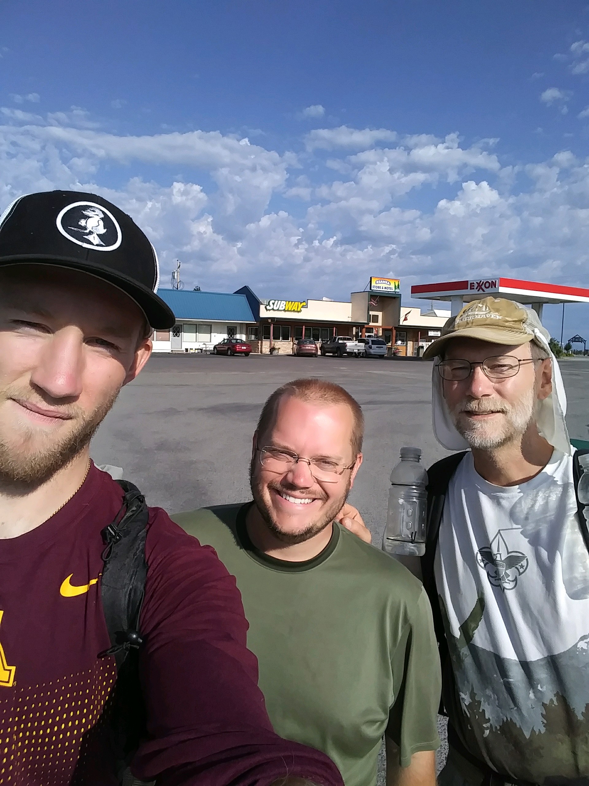
After meeting Parks, we got a snack at Steins grocery just down the road to sit and figure out where to stay and resupply since I had no reply from Nikki yet. Just as we sat on the demo patio chairs outside the store, Nikki replied and was there 5 minutes later taking us to her home where we are tenting for the night! Another traveler named Lars from Sweden is here tonight on his way bicycling around America. Showers, food purchase, laundry, and loitering around town took the rest of the day. Nikki's husband, Jeremy, made dinner and a friend named Bob came by to visit. So, it was a nice time chatting with new friends about 'stuff'.
We're loaded with food for our push to Idaho and I hope some water flavoring and a couple new food choices will help my appetite. Tomorrow has a big climb up Mt. Webb right after I walked 17490 steps on the trail today.
Walking 7 miles of country road followed by 4 miles of fast highway traffic isn't a great morning hike but we did it. The day turned into a great relaxing break meeting a bunch of fun folks.
First off, I emailed a listed trail angel named Nikki letting her know we were heading into town. Then, we walked. We passed a pizza place with buffet but didn't open until 11 - it's only 9:30.
As we passed a gas station across the road, a guy waved at us and hollered so we crossed over to see what was up. This guy is hiking the PNT also and had Melanie McManus' book 'Thousand Miler' about the Ice Age Trail and had just read about me in it, checked out hikingdude.com and saw our live map showing that we were walking his way. How weird! Besides that, his trail name is 'Parks' that we saw in the registry awhile back. He hiked out today so we'll probably see him on trail again.
After meeting Parks, we got a snack at Steins grocery just down the road to sit and figure out where to stay and resupply since I had no reply from Nikki yet. Just as we sat on the demo patio chairs outside the store, Nikki replied and was there 5 minutes later taking us to her home where we are tenting for the night! Another traveler named Lars from Sweden is here tonight on his way bicycling around America. Showers, food purchase, laundry, and loitering around town took the rest of the day. Nikki's husband, Jeremy, made dinner and a friend named Bob came by to visit. So, it was a nice time chatting with new friends about 'stuff'.
We're loaded with food for our push to Idaho and I hope some water flavoring and a couple new food choices will help my appetite. Tomorrow has a big climb up Mt. Webb right after I walked 17490 steps on the trail today.I traveled about 11 miles today.
a long roadwalk.
Leave Comment
Posted: 07/20/2017
Posted: 07/20/2017
07/19/2017
Day 7: Trail Angels
 Enjoyed a peaceful night's rest along the trail right by a bridge over a cascading stream. Our Ursack bags have been keeping the food safe - but there have been no attempts anyway.
The trail had another long stretch of high ridge hiking with no water. With very high temps and very low humidity, water has been at the top of my priorities.
We took our first unintentional detour offtrail today heading up Mt. Wam. I just happened to check the avenza map on my phone at the start up the mountain and the red line showed we were on the old alternate path. We stopped and dutifully followed the red line straight up a slope, and fortunately ran into the trail about 30 minutes later.
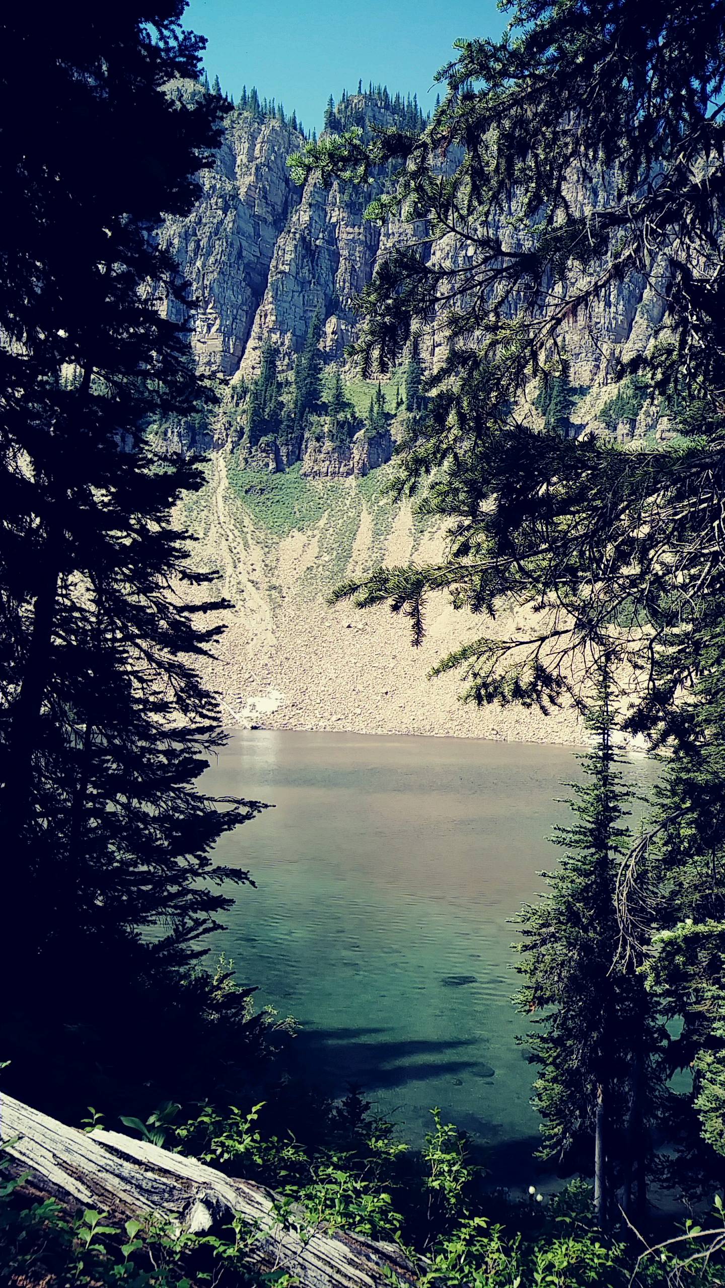
Visited a couple high mountain lakes, watched a couple Canadians fish, and hit our northern most of the trail - standing on the border at the 40th parallel clear cut.
Highlight of the day was meeting trail angels Stan and Betty from Eureka - out hiking on the Trail with their kin. Nice little chat with a nice family.
The views were great, the mountains were tough, and I finally felt like I got enough food in me today.
Tonight, we found a flat spot on an earthen fan of a small reservoir about a dozen milI walked 62190 steps on the trail today.
Enjoyed a peaceful night's rest along the trail right by a bridge over a cascading stream. Our Ursack bags have been keeping the food safe - but there have been no attempts anyway.
The trail had another long stretch of high ridge hiking with no water. With very high temps and very low humidity, water has been at the top of my priorities.
We took our first unintentional detour offtrail today heading up Mt. Wam. I just happened to check the avenza map on my phone at the start up the mountain and the red line showed we were on the old alternate path. We stopped and dutifully followed the red line straight up a slope, and fortunately ran into the trail about 30 minutes later.
Visited a couple high mountain lakes, watched a couple Canadians fish, and hit our northern most of the trail - standing on the border at the 40th parallel clear cut.
Highlight of the day was meeting trail angels Stan and Betty from Eureka - out hiking on the Trail with their kin. Nice little chat with a nice family.
The views were great, the mountains were tough, and I finally felt like I got enough food in me today.
Tonight, we found a flat spot on an earthen fan of a small reservoir about a dozen milI walked 62190 steps on the trail today.I traveled about 27 miles today.
es from Eureka. Real food again tomorrow!
Leave Comment
Posted: 07/19/2017
Posted: 07/19/2017
Day 6: We Walked
 I walked 63358 steps on the trail today.
I traveled about 26 miles today.
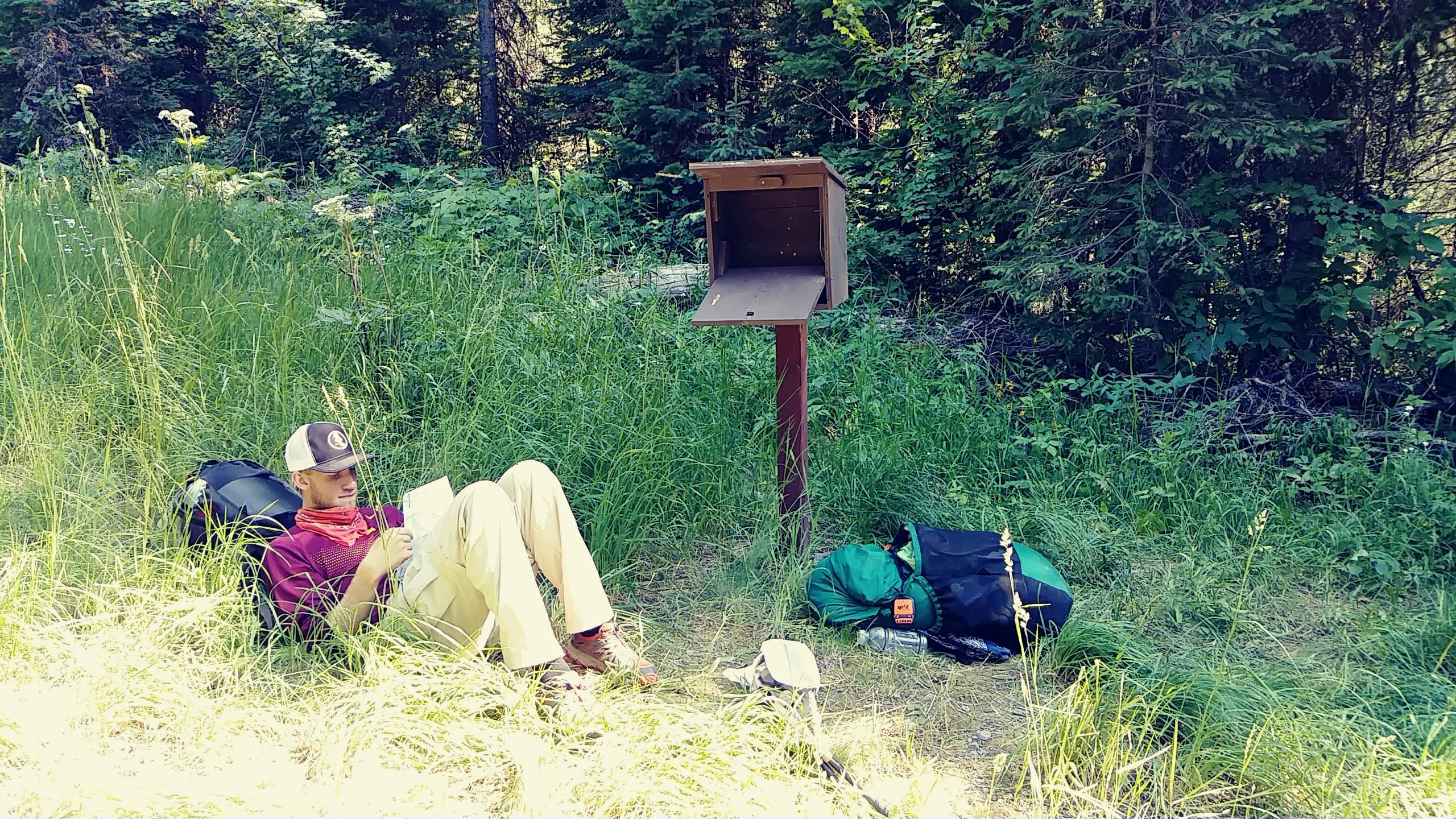
38 degrees when we got up at 5:30 this morning and there was fog rolling off the little lake. We were on the trail by 6:05 with full water and rested bodies, and it's a good thing! This12 mile section had no water at all and, even though it looks like a nice ridge walk on the map, was up and down STEEP peaks and saddles all morning. The first fresh spring on the trail at 6000 feet after dropping into the Blue Sky Creek drainage was beautiful to see. Mt. Locke was a killer climb. From the spring on, the trail was relatively easy all day so we added some extra miles of roadwalk on at the end. We saw our first PNT trail registry out here and signed it - a map page someone no longer needed in a box. Saw that 'Parks' signed it today before us so maybe we'll find him on trail. Other than that, all entries were days or weeks old. So, today we walked. And had great views of the mountains!
Leave Comment
Posted: 07/19/2017
Posted: 07/19/2017
Older Posts Newer Posts
Find more Hiking Resources at www.HikingDude.com
Follow Me
Recent Comments