
Hiking Dude Blog
2025 - Aug Jul
2024 2023 2022 2021 2020 2019 2018 2017 2016 2015 2014 2013 2012 2011
10/19/2017
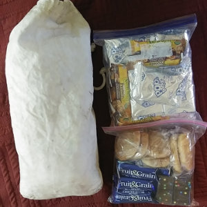
 On the Pacific Northwest Trail this summer, I tried some different foods - some good, some not. Here's a few tidbits that might make your next trek more successful...
We did no cooking. This meant there was no stove, cook kit, fuel, or cleaning items to carry. Eating was much faster and easier and we could eat whenever wherever we wanted. This simplicity was a much bigger benefit to us than the cost of having no hot food. And, with the severe fire season, it was good to not have fire of any kind.
I historically have eaten a lot of chocolatey food on trail. At the start of this trek, chocolate just did not sound good to me so I wasn't eating enough. At our first resupply, I picked up some alternatives and here are some that worked great for me:

 Tart and sour chewy candies were a huge hit! A bag of Sourpatch Kids was always in my sidepocket and we would each eat a few at most rest breaks. Again, that fruity, citrus taste was what I craved this trip.
- Jerky - I very seldom take jerky along but it tasted good this time around.

 Little Debbie - We ate waaaaay too many Little Debbie desserts but I'm now quite an expert. Their cakes, muffins, and doughnuts squish too much, so don't take them. The brownies are dense and perfect for packing. The peanut cluster cookies are great, but the oatmeal cookies fall apart. Honey buns squish flat but taste good. Nutty Buddy bars are awesome! My favorite was the Cosmic Brownies and I still long for them off trail. :-)
 Peanut Butter and Jelly - mixed in a plastic jar, this saved weight and the fruity jelly taste was just what I wanted.
- Fig Bars - Newtons are very expensive but off brands taste just as good. They are dense and once again have a fruit rather than chocolate flavor.
- Spicey Trail Mix - This was new to me. I found an off brand hot trail mix that was hot rather than sweet. I loved it!
- Summer Sausage - As a change from tuna, we split a small sausage on tortillas. They are heavy but have a lot of calories and packed just fine for days on end.
- Tortillas - In the past, I've used ritz-style crackers because they have a lot more calories per ounce than tortillas. But, tortillas pack a lot better, hold food better, and taste good.
If you have an ALDI store near you, or find one along the trail, I've found they are a perfect place to find backpacking food. Much of it is inexpensive and calorie-dense. Wal-mart is the next best place for this type of food.
To figure out how much food you need for a long trek,
I've got a food needs calculator that comes pretty close.
Hike On
Posted: 10/19/2017
10/12/2017
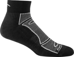

I bought two pair of Darn Tough Vermont socks for my AT section hike. They were pretty expensive ($17) but have a warranty that states they can be returned for free replacement whenever they wear out.
I'm tough on socks. Hiking 20-30 miles a day for two months in dust, dirt, sand, and rock tends to wear everything out. Sure enough, I wore holes through the bottom of all four socks this summer - but not until I'd worn them for over 1,500 miles. They lasted longer than three pairs of shoes!
For perspective, when the Darn Toughs wore out, I bought a pack of 4 pair of other socks and wore through all of them in the last 500 miles of my PNT trek.
When I returned from my PNT thru-hike, I sent back the Darn Tough socks and crossed my fingers, hoping the warranty was legit. The return postage was a couple dollars.
Well, sure enough, this week I just got a small package with two brand new pair of Darn Toughs and my feet have been skipping in comfort on my morning walks the last couple days! Nice padding on the bottom and no extra weight up the ankle.
If you are looking for durable, comfortable, light hiking socks with a great warranty that is fulfilled with no hassle, give Darn Tough Vermont a look. I like the 1/4 length ankle socks, but they've got a bunch of styles.
(I bought these socks and have received no compensation for posting my thoughts. I just really do like them.)
Posted: 10/12/2017
10/08/2017
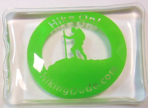
 Just in time for cooler fall hikes and Christmas gifts, you can get Hiking Dude hand warmers!
Unlike iron powder hand warmers that get used once and tossed, you use these over and over for years. They get reset by sitting in a pot of hot water for a few minutes.
Watch the video below to see how fun they are to activate, watch the chemical reaction, and feel the heat. They heat to 130 degrees and last about 45 minutes to an hour. The best thing is that they contain sodium acetate and water - non-toxic stuff.
Buy handwarmers and get some free stickers, too.
Guess what all my relatives are getting in their stockings for Christmas this year. :-)
09/25/2017

Having reached the end of the Pacific Northwest Trail on Friday afternoon, we had a leisurely 4-mile walk east to the Ozette Ranger Station on Saturday. Our friend wouldn't be picking us up until 3pm, so we lounged around camp on the coast enjoying the calm, misty view of the tide working its way in and eating our extra food.
We finally packed up and headed inland. The trail was easy, well maintained, and very crowded with folks hiking to the coast for the day or weekend. Long sections of the trail are a cedar boardwalk, so that was fun but a bit slick in spots.
We got bored at the ranger station and decided to walk another 1/2 mile or so down the road to the Lost Resort. As we discovered, they have a well-stocked convenience store and eatery at resort prices. Plus, they have WiFi which we were allowed to use. Eating ice cream and drinking my first soda in a long time, we passed the time.
Our ride arrived around 3:45 and we were off. A quick stop in Forks to return the bear can we had rented from Forks Outfitters. Another 3+ hours to Hoaquim where we stopped for a Subway dinner. Finally arriving in Puyallup around 9pm. Bethany was a real trail angel, driving a long round trip to help get us home.
In Puyallup, we met Josh's friends and went to a hotdog bar - a restaurant that sells high-priced, fancy-named hotdogs. It was fun to meet them and visit awhile. As it was getting late, we made it to Karin's place where we'd spend the night. We got to sleep in a clean, dry shed in her backyard after taking showers.
Sunday was spent in airports and on planes. My wife picked us up at 6:30pm in Minneapolis and we had pizza at home for dinner. That was the end of the trip!
I lost about 17 pounds on our trek. Josh lost a lot, but less than that.
Our gear took a beating, but most of it had already seen many days and miles on trail. Both backpacks have rips and tears so they'll be replaced. My inflatable sleeping pad and pillow from ExPed both had internal baffles separate so they are unusable. My two pair of Darn Tough socks wore holes through them so I've returned them for free replacements - we'll see how that works out. Two of our four hiking poles broke, one snapping and one losing the tip. And, I threw my two t-shirts away - they weren't worn out, I was just tired of wearing them after 5 years. :-)
If you'd like more info about our trek and the Pacific Northwest Trail, I've updated my PNT Page with our trail journal, map track, gear, expenses, and other info.
Please feel free to ask about our trek, especially if you are planning a PNT thru-hike and have questions.
Posted: 09/25/2017
09/16/2017
 I walked 29626 steps on the trail today.
I traveled about 11 miles today.
9/15/17 We did it! We're camping at the end of the trail tonight with a huge fog bank rolling in from the ocean.
We've been waking to an alarm every morning so we can hike early in the cooler temps. Today we slept in for the first time in trail because we have to wait for the tide to go out to cross a headland a couple miles north. We started hiking around 10am with our first task to take an overland trail above the headland right by our campsite. After that was 3 miles of easy beach before the next headland. Here, we ran into a couple guys that were camping and drinking so we chatted with them and waited awhile for the tide. Actually, we mostly listened as they rambled on.
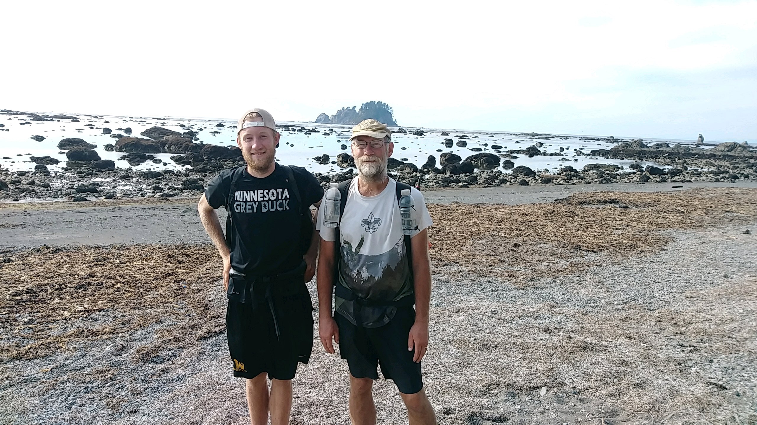
The second day hiking on the coast was much like the first - some rocky, some sandy, some slippery - all of it wonderful. We got to climb a couple overland trails and even squeeze through some holes through the rock cliffs. The weather was perfect and we had no problem finding water from small streams falling down the cliffs along the way.
On one remote beach, we found a full grown seal that could barely move - pretty sad but nothing we could do. At another spot, near the end of our hike, there was a black bear on the beach! So, we saw a bear at the very start of our trek and at the very end. We were really hoping to get to use our bear spray that we carried all this way but no luck.
The strangest coincidence also happened today. We were hiking along and someone came hiking down the beach toward us. As he got closer, we saw it was a NPS ranger so we waved and said hello. He said 'Didn't I see you by Cameron Pass?' It was the same ranger that checked on us when we were recovering from the storm up in the Olympics a week ago. Ranger Dave Turner - a great NPS guy!
Tomorrow, we hike 4 miles out to Ozette to get picked up before the rain hits.
Posted: 09/16/2017
 I walked 55555 steps on the trail today.
I traveled about 25 miles today.
9/14/17 We were up before the sun for a 16 mile roadwalk to Rialto beach from Forks. It was a very cold morning with fog so we just bundled up and walked. Josh got a coastal camping permit vis his phone at 8am and we continued walking.
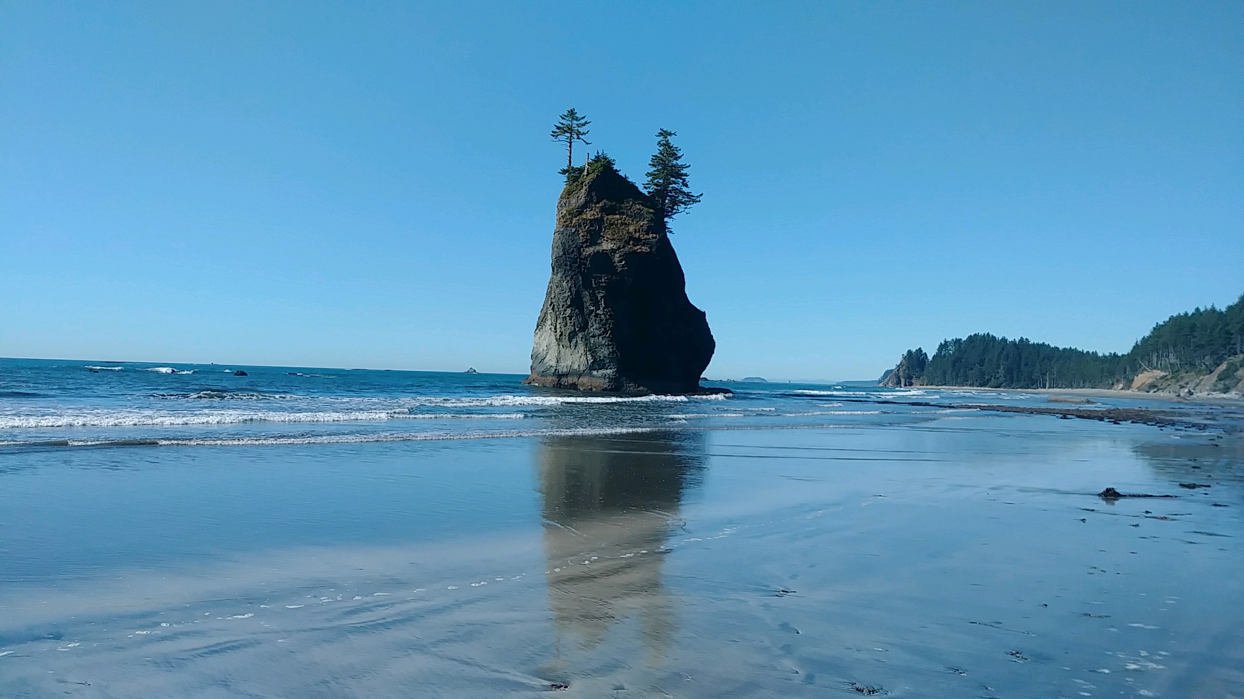
Close to the ocean, we saw a seal in the river then 6 otters. Then, we got our first real look at the ocean. At Rialto beach, we took a break to dry the tent, fill up all our water containers, and use the restroom. We couldn't stay long though because along the coast there are many headlands that stick out and are impossible to pass except when the tide is out. So, we had about 4 hours to get around a handful of these before the tide rose and cut us off.
We hiked down a very nice, very crowded sand beach for a couple miles. It eventually turned into rocks, then slippery rock, then a variety of surfaces. Our progress wasn't too fast and the tide was coming in. On one beach, I saw a sea lion ahead of us and he dashed for the water when he finally noticed us. He barked at us as we walked past.
Our final headland had seawater crashing up on it when we reached it so we could not walk around. Fortunately, this was one that had an overland option. A rope hanging down a fairly steep path up and over the headland to the beach on the other side. It worked out great.
When we dropped to the beach, I saw a little white seal laying high on the sand not looking very good. After some deliberation, we wound up coaxing him towards the water since he would not let us get too close to him. We left him close to the water with hopes that he makes it, but I don't know.
The rock formations in the ocean, the driftwood, the cliffs and forest, everything about this day on the coast has been amazing. We are alone at a remote campsite right on the beach with the surf pounding, the sea breeze blowing, and the sun slowly setting. If there is a green flash at sunset, I wouldn't be surprised.
Posted: 09/16/2017
09/15/2017
I finished hiking for today. You can check out my current location on the map and I'll post about my day when I am in coverage.
Posted: 09/15/2017
09/14/2017

I finished hiking for today. You can check out my current location on the map and I'll post about my day when I am in coverage.
 I walked 50320 steps on the trail today.
I traveled about 20 miles today.
9/13/17 Being in the Bogachiel River valley this morning, we had no big climbs or descents all day! The trail was much nicer than yesterday and we made good time through the rain forest. After 10 miles, we hit road and had another 10 miles into the town of Forks. Completely unaware of some twilight thing going on this week, we found out all the motels are full. The campground shown on our hike app doesn't exist so we were getting a little desperate when we saw a placard on the sidewalk saying the Last Chance campground was now open with an arrow pointing down a side street. A mile later, we met Virginia and Charlie that run the place. It's a very nice open field laid out with picnic tables, fire rings, and flat spots for tents or vehicles.
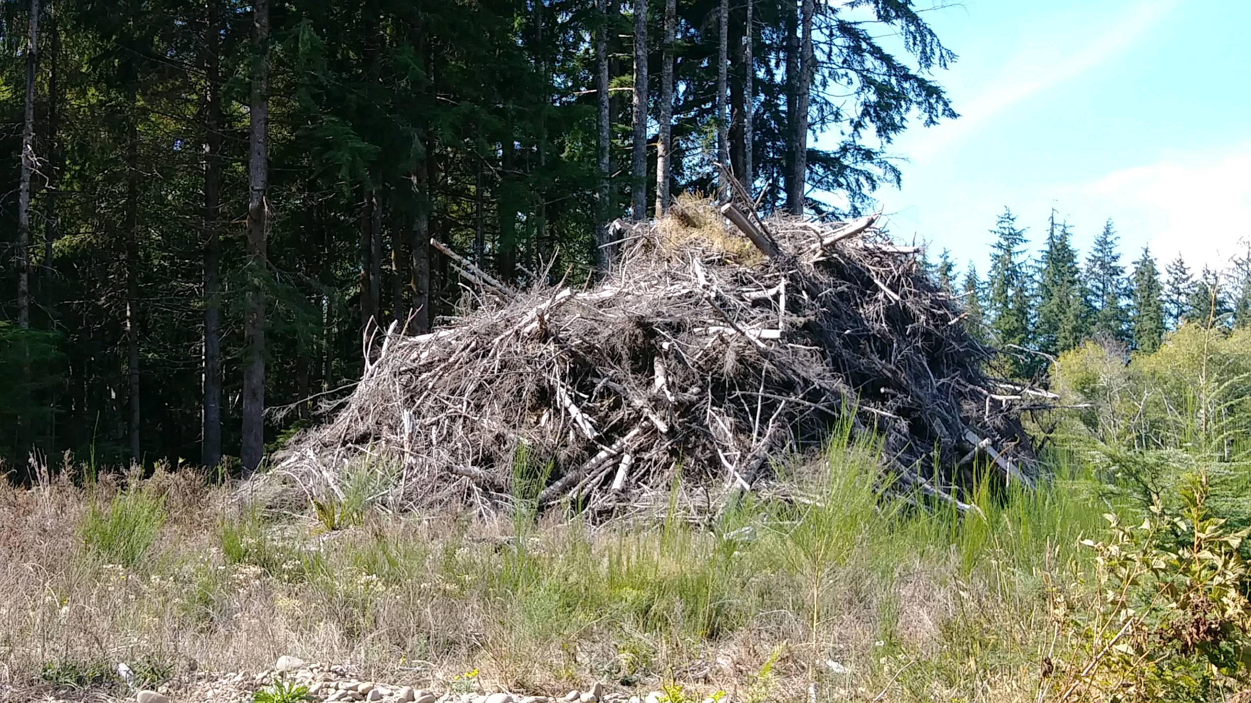
I've been searching for Sasquatch this entire trip. I found some signs along the way but today I got a picture of a real Sasquatch house. What do you think? >br>While restng at the.Bogachiel park, Bernie, Becky, and Hank drove up and stopped to get water. Becky is driving her van named Bernie on an adventure around the country and her big dog Hank is riding along.
Posted: 09/14/2017
09/13/2017
 I walked 53855 steps on the trail today.
I traveled about 22 miles today.
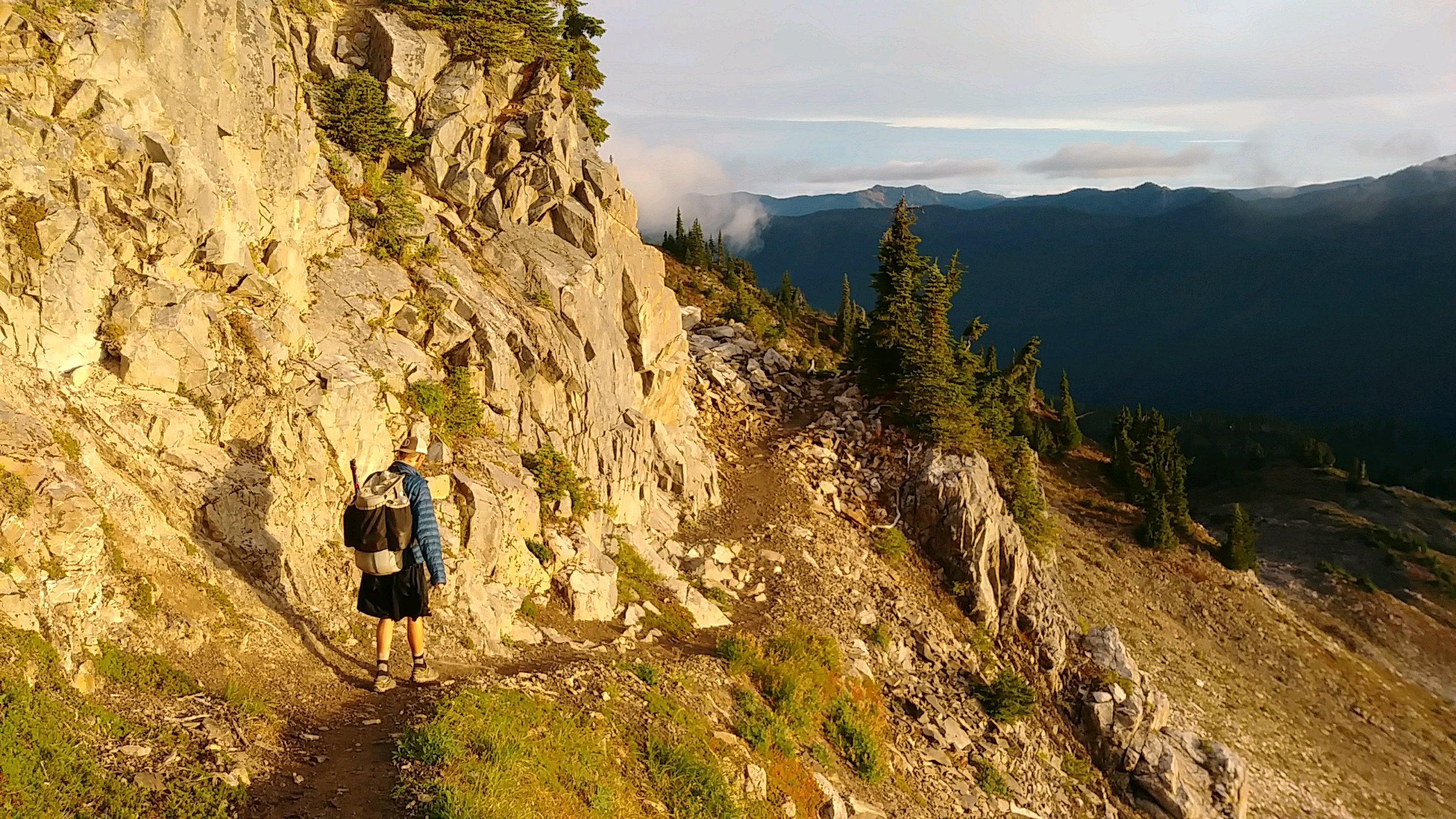
9/12/17 What a wonderful hike through all the environments on the Olympic Peninsula today. Our day began way up on Bogachiel Peak with a beautiful sunrise over mountain peaks iced with glaciers. Two deer ran through our campsite to see us off. As we descended down the mountains to the Bogachiel River, forests encroached over our path, blocking the sun but giving us our last chance to sample huckleberries and enjoy the fresh smell of pine warming to the day. Our long day ended in the thick, green, moist rainforest down in the valley. The trail down here is simply awful but that's all I have to say about that.
While pushing through overgrown trail vegetation in the afternoon, we came upon three PNT thru hikers - Ozark, Lushy, and ??? - resting, eating, and waiting for a friend named McFly who was behind us on the trail. These guys are nearing the end of their long walk also. After a nice chat, we continued on.
We made it to our destination camp with lots of time left in the day so we hiked on another few miles to make tomorrow a bit shorter. We're along a river all alone it's been a good day!
Posted: 09/13/2017
Older Posts Newer Posts
Find more Hiking Resources at www.HikingDude.com


Follow Me
Recent Comments