

Ice Age Trail Thru-Hike 2013 Journal
 I hiked along the 1,100-mile Ice Age Trail from Sturgeon Bay in NorthEast Wisconsin to the Minnesota border at Interstate Park near St. Croix Falls, WI.
 This is a journal of my trek. I would be happy to answer questions you may have about my trip, or when planning your own adventure. Enjoy your Hike!
Ice Age Trail hike - Day 01 to 07 - East Terminus to West Bend
Ice Age Trail hike - Day 08 to 14 - West Bend to Janesville
Ice Age Trail hike - Day 15 to 30 - Janesville to Gibraltar
Ice Age Trail hike - Day 31 to 40 - Gibraltar to Polar
Ice Age Trail hike - Day 41 to 49 - Polar to Gilman
Ice Age Trail hike - Day 50 to 57 - Gilman to West Terminus
Mon - 09/02/2013
Day 31 - Merrimac Ferry
 Up early and hiking by first light to avoid any early morning hikers encountering our tents. It was good that we found our own place to camp last night since the specified distributed camping area above Lake Wisconsin was ridiculously sloped when we reached it this morning.
Crossing the lake on the Merrimac Ferry was fun - the only part of the trail that you don't have to walk!
Tip: [The public restroom at the north ferry landing has hot water and soap.]
The weather is practically perfect and the miles are flowing past in the cool morning.
We've met a couple out birding, a female trail runner, and a couple going biking.
 The Ice Age Trail leaves Merrimac following Cemetary Street - if you hike it, you'll figure out why. Bluff Road runs directly north out of Merrimac and is joined by the Ice Age Trail about 2.5 miles north of town. In that 2.5 miles, the IAT covers over 20 miles of trail around Devil's Lake State Park! Quite a big horseshoe!
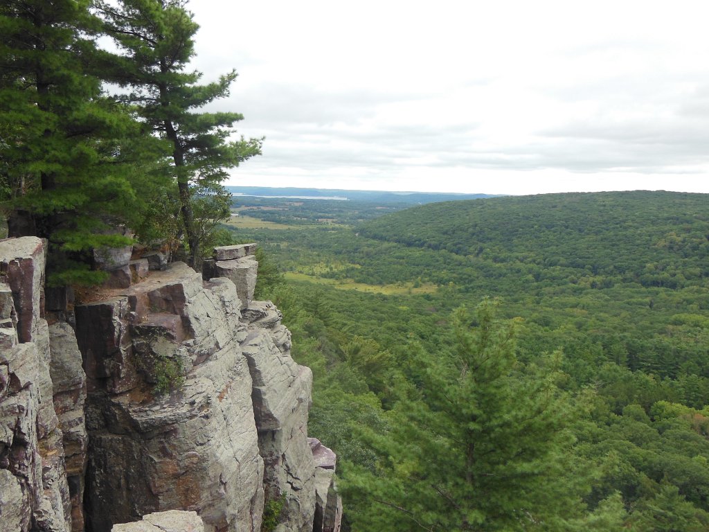
This part of the trail is about the most adventurous. The trail goes up, across, down, and around cliffs, rocks, lakeshore, and moraine. It was the one portion of the trail that had noticable elevation and views out over the surrounding hills. From the top of the East Bluff, I could see past Lake Wisconsin and the Merrimac ferry which I had ridden 10 miles back.
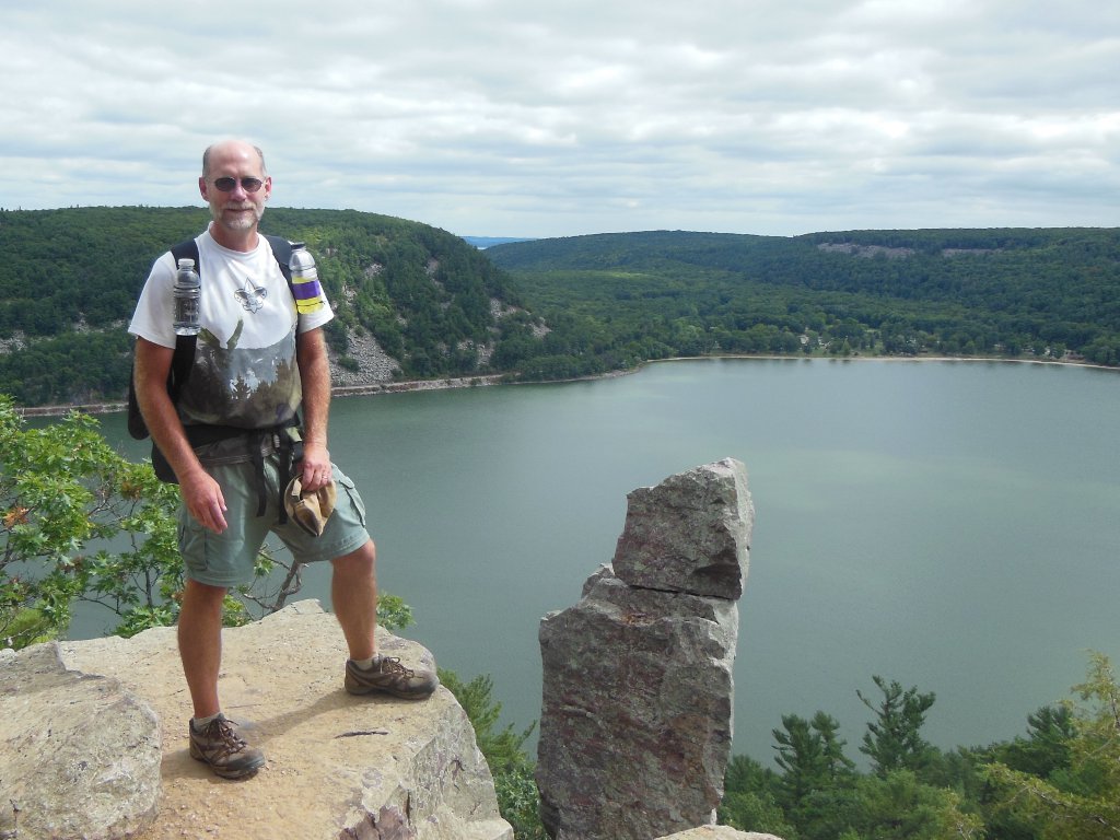
Devil's Lake itself was beautiful.
 Since Devil's Lake is the most popular state park in Wisconsin, it would have been better to hike through on any other day than Labor Day :-( but I survived the traffic jams going up and down the rocky, boulder-choked trail of the East Bluff.
 The view from the West Bluff is the best of the entire Ice Age Trail, as far as I'm concerned. Again, you can see Lake Wisconsin in the far distance.
Coming out of the park, a 7-mile ridge trail with no water brings you to Parfrey Glen with restrooms and a water pump.
Tip: [The Parfrey Glen water pump is broken and there is no water. The restrooms are dry also.]
 This 24 mile day was dragging on now that there were 21 miles of road ahead. With the sun sinking and no way to stop it, it looked like another secluded spot for tents might be our campsite for the night.
Good fortune again was with us when Lori returned our "Hello" as we walked by her homestead and allowed us to get some water from her well. When her husband, Lee, offered to let us camp in their yard by the road, the day was complete! Another hospitable trail family that I was priviledged to meet. As it turns out, Lee is very knowledgable of the local geography and environment so it was interesting to listen to his thoughts.
Tue - 09/03/2013
Day 32 - Aldo Leopold Center
 We're up before daylight and on the trail through a foggy sunrise. It's cold this morning - about 44 degrees - so we walk to warm up.
The entire hike today will be roadwalking heading to Portage, so churning it out is all we can do.
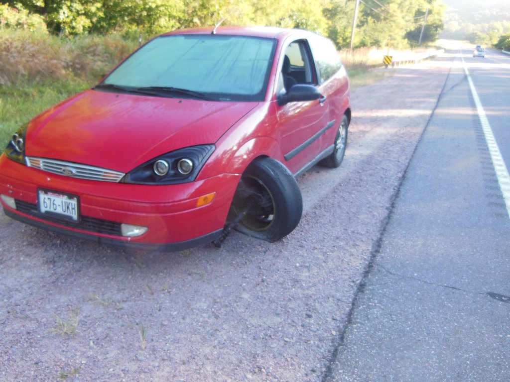
Along Highway 33, I spied this unfortunate driver's road trash. It looks like the front axle just broke. I'm sure glad it happened yesterday and not this morning as I'm walking by. One of the concerns of walking hundreds of miles along roads.
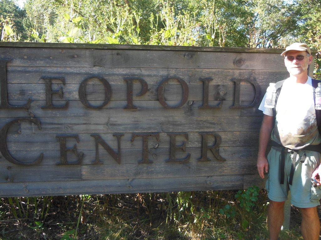 Along the Wisconsin River west of Portage, and 10 miles of hiking for me, the Aldo Leopold Center waits for visitors interested in learning more about the origins of outdoor ethics and the life of a very interesting local man. Mr. Leopold learned much about nature over his lifetime and his contributions to promoting and protecting wild places are inspirational.
If you're driving along US 90/94, and have an extra hour, this is a great facility to visit. It makes use of natural heating and cooling, has terrific bathrooms and water, and many educational displays and artifacts are free to the public.
After another 10 miles walking beside the Wisconsin River, Portage beckoned us to cross the river. The roadwalk from Aldo Leopold center to here was about the most UNscenic part so far but the weather was great so we chewed it up.
Reaching the van, we searched for some place to eat. We found an all-u-can-eat $8.00 Chinese buffet and nearly put them out of business! After checking email at the Portage library right by the trail and restocking our packs with food, we'd spent 4 hours in town. So, we set out to hike a few more miles before nightfall. The van stays in Portage and we'll come back to get it from some point down the trail.
We met Jon and Nancy from Waupaca on the trail coming into Portage. They were biking and stopped to talk. We're the first thru-hikers they've met while they are biking and hiking all the trail segments. We're hoping to run into them again later in the hike, maybe getting a shuttle.
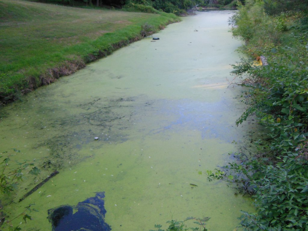
The trail through Portage was missing a couple key blazes and took us through a pretty cruddy area along an old, swampy, derelict canal, but that was just a small bit.
 The Marquette trail segment made up for the Portage backwater. It was an interesting walk along the Fox River with 21 little bridges and lots of opportunity to view birds, frogs, turtles, and deerstands - but no deer.
Weather makes a big impact on the fun level of a hike but so does the time of day. We hit this section in the evening - dry and cool. In the morning, our feet would be soaked and in midday we'd be sweating away.
So far, it looks like our decision to wait out the heat for a week was good. There have been few bugs and much nicer hiking conditions.
After 25 miles today, camp is just pitching shelters right on the trail. We've seen no one since Portage and this remote bit of trail is the last for over 35 miles ahead. There's nothing but swampy ground so the trail is the best bet and a few overhanging trees help keep some dew off the shelter.
Wed - 09/04/2013
Day 33 - John Muir and Johnny T
 Yet another moring of heavy dew. It's comical how a quarter mile of grass is enough to soak the feet. Today, the hike started with less than a mile of trail of which maybe a half mile was grass. That was enought to do this! And, it took a few hours to walk the shoes dry. With the nice weather, the dew is the worst challenge, so that's a fine trade-off.
The small, brown cube on my shoe is my pedometer. I'm tracking steps per day just for fun. It turns out that I average around 2000 to 2100 steps per mile which is a bit over 2.5 feet per step.
At that rate, it should take about 2.25 million steps to complete the trail. :-)
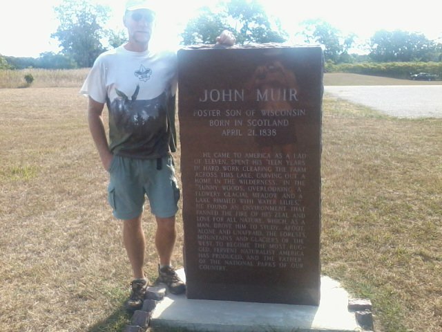 John Muir had a huge impact on the wild places of our country and is known as the father of America's National Parks. He founded the Sierra Club and lived here at the location of this small memorial park as a boy. The park has a spring-fed kettle lake with a trail circling it. This short side-trail is part of the Ice Age Trail - the only bit of trail for many miles of road in both directions.
It was just enough to moisten the feet again after they were nearly dried!
 Packwaukee sits on the north shore of the long, narrow, shallow Buffalo Lake. The lake normally has wild rice beds harvested by native Americans.
 When I crossed, the lake was nothing more than a mud flat that smelled terribly. The lake is empty because they've drained the reservoir behind the dam that is being worked on in Montello - evidently an issue of contention among the locals. I stayed out of it.
To my surprise, a second Johnny T's welcomes hikers into Packwaukee as soon as you step foot off the low bridge. It's hard to pass by when they have $1 barbeque sandwiches on Wednesday. :-) (You remember I saw a Johnny T's by West Bend? It's a small chain of a handful of restaurants.)
After a $3 lunch, a stop at the public library allowed for email checking and another hour of rest. The librarian was a wonderful soul!
Tip: [ Most public libraries allow free use of computers. A few have draconian librarians that strictly follow time-of-use policies, but most allow you to extend your time if no one is waiting. Water, restroom, internet, and a cool rest all in one spot! Even the smallest of towns often have nice libraries, so check ahead for times before you hike.]
A 2-hour break at mid-day sure does make the legs feel better! It rests the muscles and avoids the hottest part of the day. After such a rest, I can hike on another 10 miles or more.
 We ended this 20 mile day of roadwalking with an hour walk north to the home of a trail angel couple. Mary and Gary are another perfect example of the great folks we've been fortunate to meet. They are actually one couple I really hoped to see because I had heard of them before my trip started.
Gary welcomed us to their farm which has been in his family for generations. After we chatted and got to know each other a bit, Gary gave us a big sample of his special BBQ pork that he makes - it was awesome! He also showed us his antler carving which is very interesting.
Mary joined us and I enjoyed our talk immensely. She is an elementary school teacher and I believe her students must really enjoy being in her class.
It was so nice to have a couple people to talk with about so many things, learning about each other's lives and interests. It was a relaxing evening for two weary hikers, and a generous helping of Trail Magic.
Our campsite for the night is a dry, soft pine forest that Gary and his family planted about 25 years ago. How cool is that?
Thu - 09/05/2013
Day 34 - HALF WAY!
An early morning goodbye to our wonderful hosts and a roadwalk north to Westfield. The designated route stays east of Highway 39, but we went into town for breakfast and water and then north on a road - added no distance to the walk.
Each day the weather has been getting nicer as fall slowly approaches. Today, it is breezy and cool.
We are making good miles and now have some nice trail sections ahead after so many miles of roads. I still don't mind roadwalking because:
- You cover many miles.
- The route is straight, rather than snaking around and back and forth.
- You can see farther, not boxed in by heavy brush.
- Every farm and homestead is interesting.
- Cows never get boring. :-)
Tip: [If you don't mind a little offtrail work, cutting due north off of County CH just south of the Highway 39 wayside on map 53f will save almost 4 miles of roadwalk.]
Richford is the last small town we expect to see for awhile. So, we stopped to rest and have a big meal of chicken at Johann's tavern right on the trail. Yet another night free of camp cooking. I've done so little preparing of food in camp, I will have many meals left at the end of the trek.
 It appears that this may be the last clean water source for a couple days. I'll carry more than usual, but I may have to gather my first raw water of the trip tomorrow. I've also been fortunate to have toilets when needed for the first 500+ miles and tomorrow may see me digging my first cathole - we'll see. :-)
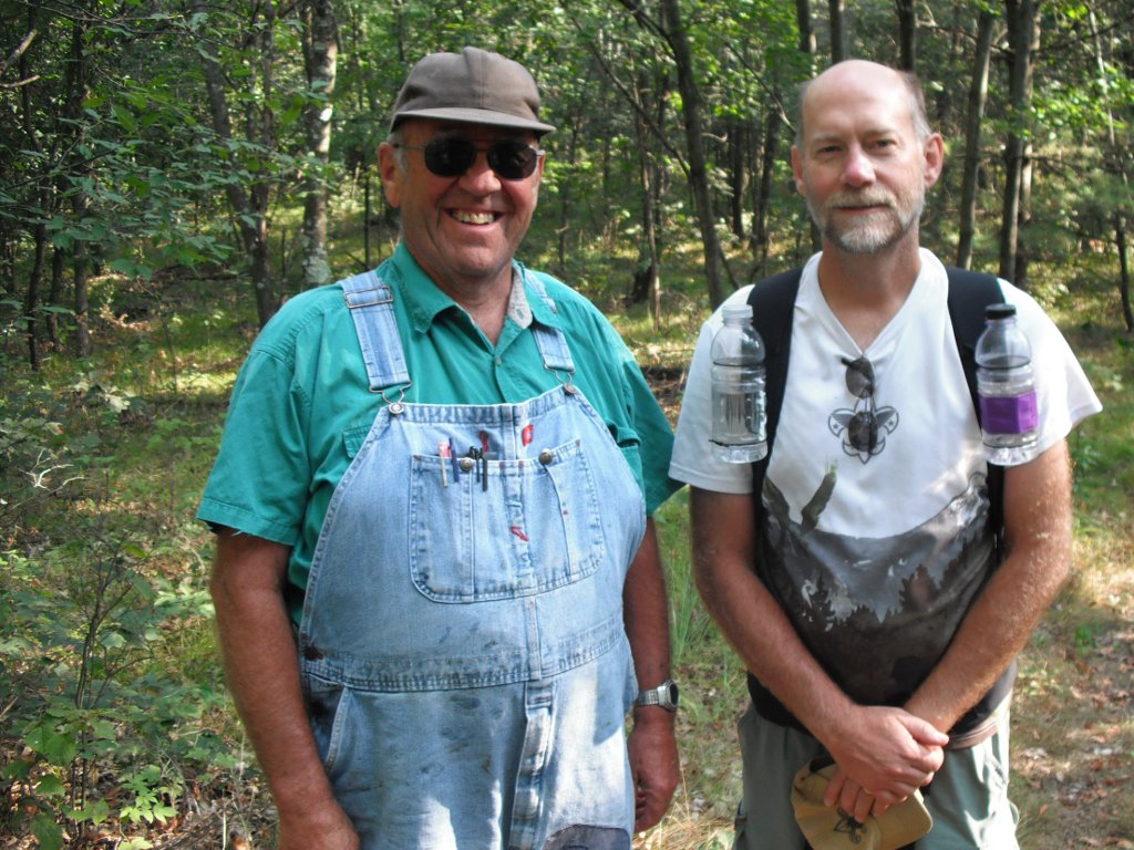
Another name to add to my list of great trail encounters is Randy.
Certainly not dressed for long hikes, Randy wore overalls and work boots, and had no water! I met him north of Richford, out enjoying his day hike in the woods of the Mecan River segment. Randy walks the short sections of trail in this area whenever he can get out. This is true for many folks living close to the trail. It gives a sense of ownership and I've seen people refer to it as "my trail" or "our trail" in online forums. This helps with maintenance of the trail since many volunteers are needed to keep the trail clear and feet on the ground is the best way to do that.
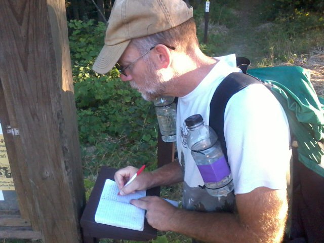 Finally found a trail register to sign!
Nearly halfway through the trail and there is a register at north parking area of the Mecan River segment.
I expect there have been other registries earlier, but I sure missed them. Registries are a great way to see who has been on the trail ahead of you recently. Sometimes, on long trails, seeing a name a few days ahead can be motivation to keep going with the hopes of meeting them soon.
I saw that two thru-hikers signed it way back in June but only a few day-hikers since then. Papa Bear and I left our marks.
By the way, the Mecan River is the first clear, beautiful river I've seen - all the rest have been warm and colored. It is spring-fed and crystal clear. This Mecan River trail segment is very nice - away from roads, buildings, and civilization.
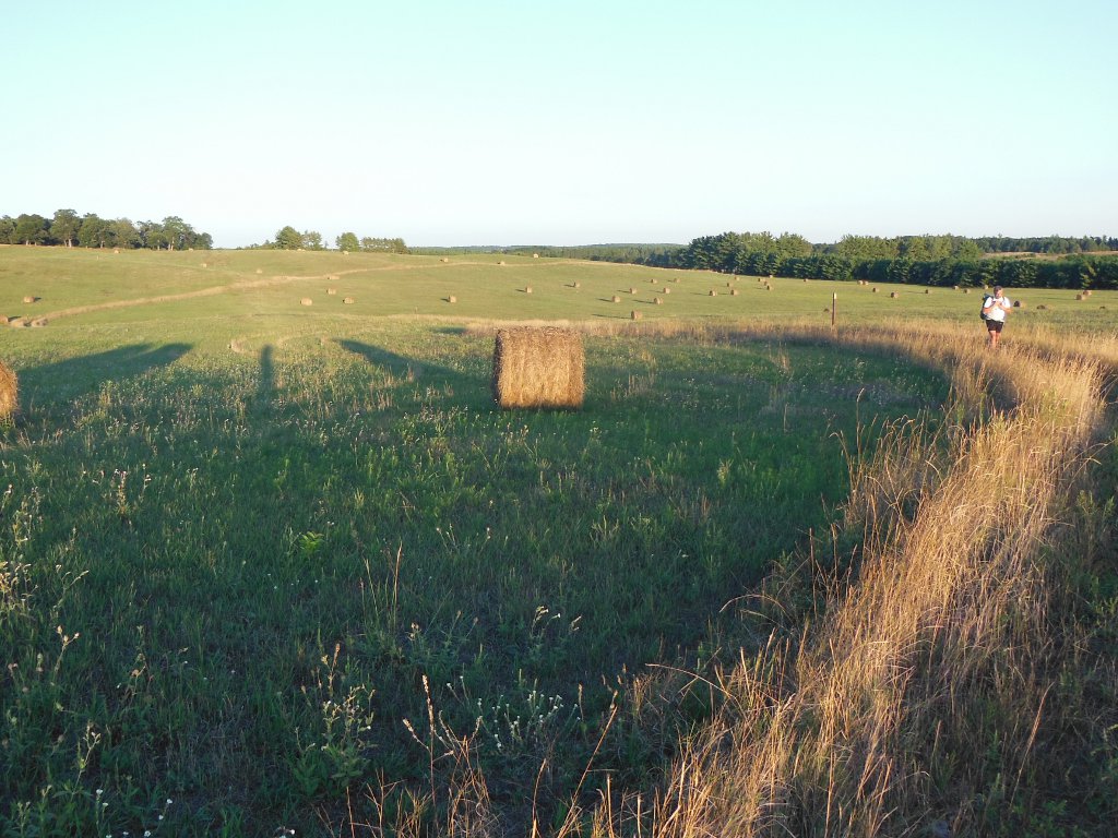 The generosity of land owners is crucial for the completion of the Ice Age Trail.
Many farmers have allowed the trail to skirt their property, and some have even let it cut right across. This field is the first one in which the farmer actually manicured the trail and had it slightly meander through, making it seem more natural.
With the setting sun, harvested hay, and yellow blaze posts, it was a very enjoyable walk in the late afternoon while looking ahead to camping out in the forest.
So, Thank You to this farmer and all the others that have helped make the Ice Age Trail possible!
 HALF WAY!!!
Tonight's campsite is almost exactly at the halfway point of the trail.
I know the actual trail miles change as new sections are created and reroutes occur, but with the best data we have this is the spot. I expect the second half to go quite a bit faster since our legs are stronger, the weather has cooled, and there will be fewer restaurants and such to visit. :-)
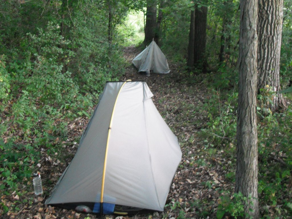
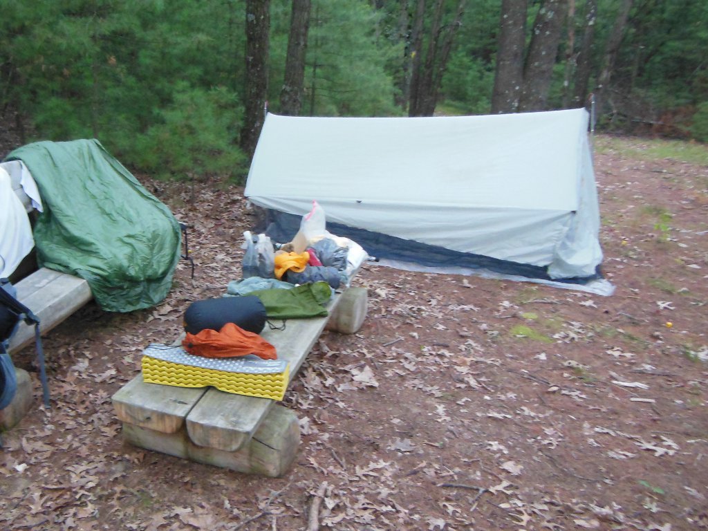
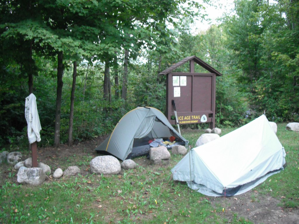
So, here's a picture of what my home away from home looks like now. This is an official DCA (Distributed Camping Area) site created just for Ice Age Trail backpackers. There are more being created and they will make thru-hiking much easier for future visitors by reducing the stealth camping need.
The few DCAs I passed earlier on the trail were not really usable due to steep sloping ground, but this one is wonderful. It's on a flat rise in a pine forest. The ground is soft and smooth.
The deer that came to visit during the night were not sure what to make of us. Lots of snorts and pawing of the ground all around in the woods. Pretty cool ending to this 26 mile day!
Fri - 09/06/2013
Day 35 - Snake
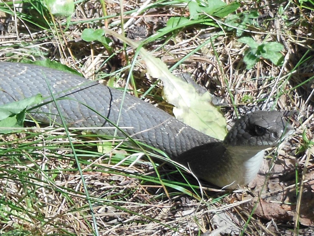 Met two friends on the short 18 mile hike today.
First, I nearly stepped on this guy basking in a small spot of sunlight in the woods. He was stretched out right in the grassy, leafy trail and did not budge at all.
I don't know what kind of snake he is, but I'm glad he didn't come for a visit last night.
Randy, the farmer/hiker we met on the trail yesterday, was out for another walk today. It was a pleasant surprise to see him again, but he was figuring on seeing us since he knew we'd be hiking this section today. (As it turns out, Randy also ran into Kehley on the trail when she hiked through a few weeks after us. :-) )
 The forest over the past couple days is migrating from prairie and oak to more pine. Many acres of land have been planted in pine to be harvested just like any other crop. Pine forests make great camping spots as we've experiened the past two nights. They also hold many deer at night that get startled and snort when they discover our tents. It makes for fitful sleep but still fun.
Many turkey and deer crossed our path today, as well as the snakes. I don't mind the first two but could do without the last.
Total miles is short today because I got ahold of trail angels Jon and Nancy. They met us on a roadwalk, drove us to Portage to bring the van up to their place by Waupaca, and let us spend the night. We met them just outside Portage as they were biking a few days ago.
It's a real treat to have a bed after 5 nights of camping. I washed most of the grime off in their lake before a quick shower.
Sat - 09/07/2013
Day 36 - Waupaca Slackpack
 Jon and Nancy biked today while we hiked.
We drove to our start point and then they shuttled the van to our end point, 20 miles up the trail, which allowed a day of slackpacking.
With an early start, we were finished by 1pm. That was good since the days have warmed up quite a bit again and pesky insects continue to be a bother. Tiny gnats hover around our heads. Papa Bear calls them face flies, Jon calls them suicide gnats, and they remind me of no-see-ums. Whatever they are, their constant buzzing and flitting by your eyes is obnoxious.
 The afternoon was a real treat!
We swam in the lake and Jon got out his kit speedboat that he made himself.
What an exhilirating ride!
Thunderstorms rolled in and cut our riding a bit short, but it was sure nice to have a house in which to escape the weather.
Half the day was roadwalking, and the Emmons Creek and Hartman Creek sections were nice trails.
Sun - 09/08/2013
Day 37 - Scandinavian Influence
 Our latest trail angel friend, Barb, whom we met at dinner last night, dropped us off at our start point in Cobb Town early this morning after helping us leave the van at our end point. So, we are forced to hike at least 27 miles today to reach the van.
Excellent weather with a breeze to keep the bugs away and cooler temperature made the morning hike through beautiful moraine country very enjoyable.
It also brought us to the small town of Scandinavia. This is off the recommended route but doesn't add any distance and lets us enjoy some great bakery at Country Comforts Cookies run by Audree. It was a nice break, but a little early in the day.
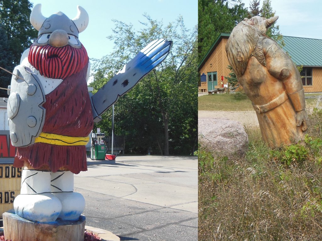
As the name implies, there is some strong Scandinavian influence in this part of the state, including Hagar the Horrible in Scandinavia and a norske ski-jumper (I believe) at the Iola ski hill.

After leaving Scandinavia, we just hiked without much to report. Took no other breaks and reached the van around 3pm. This allowed us to go to Stevens Point to take my niece out to a pizza dinner at Polito's. Papa Bear collects t-shirts and has been wanting to visit Polito's and get a shirt since we visited my relatives way back in West Bend.
After dinner, we borrowed her car and shuttled the van up to Hatley, then returned. My niece dropped us off at the trail around 8:30pm and we continued hiking. It was completely dark, but a 5 mile roadwalk in the cool air got us to a secluded pine forest by a Lion's camp around 10pm.
This was certainly our longest day so far.
Mon - 09/09/2013
Day 38 - Larry Saves the Day
 Since hiking in the dark was so fun last night, we did it again this morning. It's actually pretty fun and much cooler.
This school is an example of the many I've noticed across the state. Most small towns and rural areas "used to" have a school, but they have now all been consolidated into fewer schools spread farther apart. Now, these old buildings are either left to ruin or repurposed as homes or businesses.
We hiked 24 miles of road to Hatley to find the van in the library parking lot where I left it. After a visit in the library and a filling Subway sandwich, it looks like bad weather is heading this way. A visit to the local tavern netted no one interested in shuttling the van, so we need a different plan.
 Fortunately, everything worked out again - with some effort and luck.
I contacted my friend, Larry, that I met on the Superior Hiking Trail last fall. He lives in Wausau but is supposed to be out of town all summer. Surprisingly, he is in town this week!
So, we drove to his place, got showers, dinner, and a tent spot in his yard. Early, early tomorrow we shuttle the van ahead and he drops us back at the library in Hatley with food for a week in the north woods. If it all works out, we'll reach the van again a week from today.
It was a great evening getting to catch up with a hiker buddy and find out what he's been doing.
A major cool-down is forecast for the day after tomorrow which will be helpful out in the forest with no convenient taverns.
Tue - 09/10/2013
Day 39 - Wolf?
 Larry got us to Hatley without a hitch and the van is waiting for us up ahead.
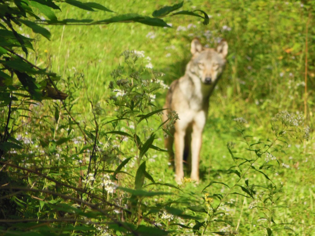
About 5 miles into the day's hike, I came around a bend in the trail, concealed by brush and saw this fellow walking down the trail ahead of me so he didn't see or hear me. Excited as I was, I hopped back behind the brush and got my camera.
When I peeked back out, he had noticed me and was coming to investigate. Unfortunately, my zoomed shot auto-focused on the small twigs in the foreground rather than on the animal, so he's blurry. About half the people I've shown think he's a wolf, the others say just a coyote. What do you think? He was gone down the trail before I could get another shot.
Since today is supposed to be the last hot day, a 3 hour break at the Dells of the Eau Claire park allowed us to rest in the shade. I cooked a parmessan noodle and tuna dinner for a late lunch rather than tonight to get rid of trash and lighten my load a bit.
The trail along the river was very nice and the park is empty except a young fisherman that just drove in and parked. He gave it a good effort, but had no luck. He was the only person I met today.
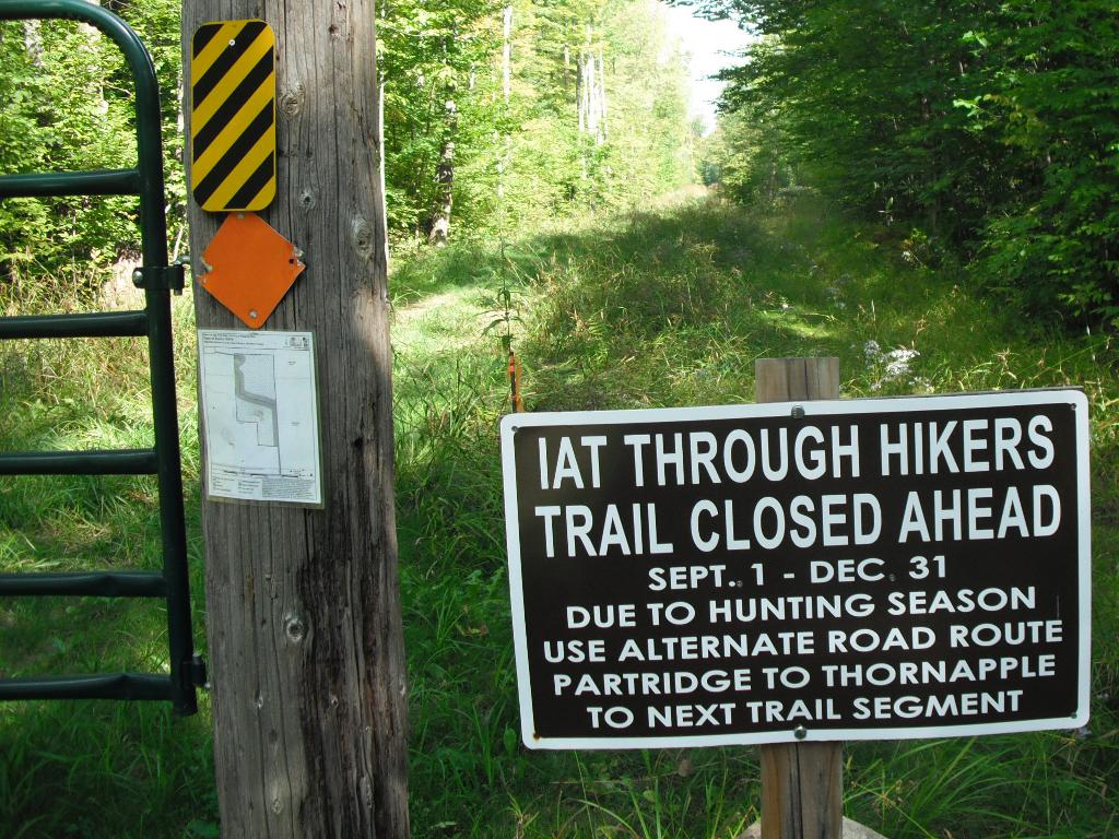
While yesterday was all road, today's 21 miles were almost all on trail. The roadwalks were a bit longer due to hunting season trail closures.
Being in the shade and along the river helped with the heat, but I'm looking forward to tomorrow and hoping the weatherman is right this time.
 As the sun sank, we left the park on the one short road section of the day and then into the Plover River area.
Clouds rolled in and the forest got dark quickly, so we hustled to a trailhead and plopped down the tents just as a few raindrops let loose. Lightning and thunder in the distance but nothing gets close to our site. Hopefully, this will be the humidity dropping out of the air for a drier, cooler tomorrow.
Considering the late start due to moving the van, today's 21 miles felt pretty good.
Wed - 09/11/2013
Day 40 - Plover River and Antigo
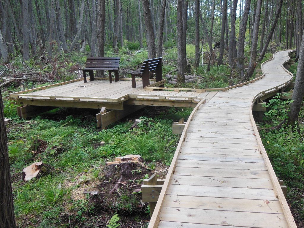 The newly constructed Plover River section features an amazing pair of boardwalks and some great rock steps placed by the trail volunteers. The amount of effort to create this just to keep hikers out of the swampy sludge is herculean at least.
Here's a big Thank You to the IATA folks that pushed this part of the trail through during this past year!
I scared up three turkey right on the trail in front of me and saw a huge read-headed woodpecker - I'm not a birder so I'm not sure of the exact name.
Following this wonderful trail section, a half dozen or so miles of road led us to Antigo. The roadwalks are not so interesting up north. Fewer farms and more open pasture land, but still interesting. I'm looking forward to getting into the woods tomorrow.
Antigo is by far the largest town close to the trail since Portage, and through to St. Croix Falls. A detour off the suggested route offered a stop for a $5 large pizza at Little Caesar's for lunch - that's a large pizza for each of us! This route change added no miles which is always a goal.
We spent the entire afternoon in Antigo - pizza right away, library for a couple hours, McD's for a snack, and Walmart for blaze orange hats on the way out of town.
The day kind of got away from us so we need to hike into dark tonight.
It's a straight shot east on highway 64 to Polar where a 180-degree turn will take us west, finally heading the right way towards Minnesota!
 A funny thing happened on the way to Polar today...
Papa Bear read in the Ice Age Trail guidebook that a bar-n-grill in Polar is hiker-friendly and may let you camp behind their place. With that in mind, we set our goal for today to be that grill.
Heading due east, the sun setting behind us, it was a nice walk to Polar. When we got there, we thought the grill was farther ahead so we walked past the recommended route turn in the dark. After going farther than we figured was appropriate, we called the place. We could continue on and turn north or backtrack and turn north to reach them - same distance. So, we went forward.
A few minutes later, a car pulled up by us and asked if we were hiking the Ice Age Trail. Brian and Karen invited us to their place along the route just up the way. They had seen us on the road earlier when they drove to Antigo and hoped they would find us again. TRAIL MAGIC!!!
So, after hiking 24 miles, taking a shower, eating more food, and having wonderful conversation, I get to rest in the home of yet more amazing trail angels.
You have opportunities to be a trail angel all the time - no trail is really needed to offer hospitality to others. It's up to you to notice and take those opportunities.
Continue with: Ice Age Trail hike - Day 41 to 49 - Polar to Gilman
Find more Hiking Resources at www.HikingDude.com
Follow Me
Recent Comments