
Superior Hiking Trail Thru-Hike Journal
 I hiked the Superior Hiking Trail from September 15 to September 28, 2012 traveling from the Canadian border at Otter Lake road above Hovland, MN to the Normanna Road trailhead just northeast of Duluth, MN. This trek took 12 days of hiking and 1 rest day halfway through.
These pages are a composite journal of my adventure. Starting with my daily blog entries, I've added more pictures, details, and things I learned on the trail.
I hope you gain some insights from my experience when planning your own hike. Please holler if you have questions or want more information about something you read here.
If you just arrived here to read my trail journal, you really should start with Superior Hiking Trail Journal - Part 1
 Bryan drove me back to Temperance River state park and I was hiking by 9am in a cool, sunny morning with yet more colorful forests all around. I left about 3 pounds of food and a little gear in my car in Duluth since I won't need it to finish.
The day started with a 600 foot climb up from the lake, along the river up to a ridge that dropped me over into the Cross River drainage. There are four very nice campsites on the Cross River - all of them had campers when I hiked by so I said Howdy to everyone. There was an Eagle scout and his brother who lamented a few times about not reaching Eagle - they had noticed the BSA logo on my shirt. Another site had a guy and his dog and a very big pile of coals still hot - no idea how he planned to put that out.
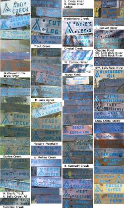
When I got out my camera to take a photo of the first campsite sign for my collage, I noticed the camera felt a bit light. I pushed the power button and nothing happened. Huh? Pushed it again - still nothing.
When I popped the battery compartment open, there was a dark, empty hole where the battery should be. The fully charged battery was still sitting in its charger plugged into an outlet in Duluth! Rats! For the rest of the trek, I'll only have the cellphone for pictures. And, to make it worse, I decided to leave my solar charger for the phone back in Duluth (on purpose) to lighten my load. Now, I'd need to see how long the cellphone battery would last taking pictures.
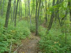
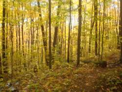
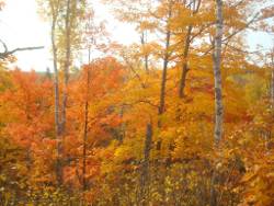
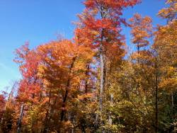
With nice weather, no one to talk with, and a fairly good trail, I practically flew through the woods. I occasionally found myself being startled by a glow around me. When I focused, I noticed the high tree canopy was bright green, yellow, or orange in the sun and the low ground cover was the same color. For as far as I could see (which wasn't far), the world was flooded in one color. I expected to see pixies or leprechuans dancing around any minute. Very beautiful, magical scenes.
These are just a couple pictures of some of the spots to give an idea.
Before noon, I met at least a dozen backpackers, all of them out on 1 or 2 night trips. After that, I saw no one as I hiked farther from the popular trailheads. I enjoyed my day alone, but felt bad that Bryan had such poor weather and it was now simply super.
On this part of the trail, there were a few bogs, such as Alfred's Pond area, some nice ridge walks, and not much gratuitous elevation changes. For the most part, I was away from the big lake and enjoyed the forest rather than the vistas of open water.
Reaching Crosby Manitou state park, I had to push 5 miles to the next SHT campsite at Aspen Knob since the campsites in the park are fee-based even though this park is backpacking only and gets little traffic. There was a pretty cool Adirondack style shelter right on the trail that was tempting.
I really enjoyed the two-mile hike along Horseshoe Ridge also.
The Manitou River provided my drinking water for the afternoon and night since I fgured Aspen Knob would have no water around. The Manitou was a great river canyon. The bridge was cool and the water clear and fresh. The climb out wasn't bad either.
All this day, as I cheerfully met other hikers, I worked a common question into the conversation:
"Hey, you don't happen to have a Sony digital camera, do you?"
My ever hopeful imagination had me running into someone with a camera that used identical batteries as mine. And, they had an extra battery. And, it was fully charged. And, they didn't need it. And, they'd give it to me to mail back to them in a week.
No such person ever materialized. :-(
But, I met and chatted with some great fellow hikers in the process.
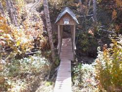 I blasted out the western boundary of Crosby Manitou in the late afternoon, crossed county road 7, and climbed the short 1/2 mile up to Aspen Knob, arriving just before dusk at 6:45pm.
One nice, flat spot waited for my shelter. One tree had a nice limb to hang my food. And, two crazy rabbits bounded around as I set up camp. Strangest behavior I've seen - they hopped all around the site as I went about my tasks, not seeming to be concerned with me at all. I half expected to find them curled up under my quilt when I went to bed, but they were gone.
After another scrumptious meal of noodles and tuna, it was dark so I called it a day having gone about 25 miles in 52319 steps. I know I've not been eating enough and need to force more food down during the days going forward.
Sometime during the night, I visited the latrine and this was one of the few nights where I got to enjoy the bright stars. The sky was completely clear, the nearly full moon had set, and it was crisp (cold, actually). Very easy to find Polaris and then gaze at the thousands of pinpoints of light across the band of sky I could see hemmed in by large aspen and pine.
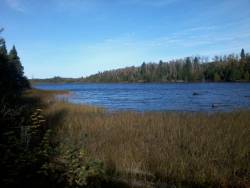 A wonderful fall day, perfect for hiking and experiencing the sights, smells, and sounds of the north woods. Evidently, many others felt the same as I met quite a few day-hikers - none with a Sony battery, though. :-(
This leg of the SHT pulls far away from Lake Superior - about 6 miles back into the woods - which is a nice change for a day. The rest of the trail until Two Harbors fairly hugs the shore in comparison.
The first 15 miles were fairly even and meandered around some amazing bogs, woods, and small lakes. This is Sonju Lake which contains quaint Lily Island, named for a dog that loved the trail and which you can walk to on a short boardwalk - take the time to do this. The view around the lake is wonderful and it's a great spot for a snack. Don't camp there, though.
Yet another very cool beaver pond rests between Sonju Lake and Egge Lake. The trail goes right by it but, yet again, I saw no beavers. All through this section, I expected a moose to appear out across a lake or bog, but no luck for me this trip.
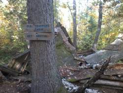 Just before reaching Egge Lake, I came across an old trapper's cabin right on the trail. I knew it was that because there's a sign and thetrapper's name was Art Griffin, I assume. It's kind of funny what things the SHTA folks have decided to post information about. An occasional overlook name, such as Hellatious Overlook, one spur trail but not another, and distances to some key points but not others. I imagine over time they'll get signage for everything of interest - but the blue blazes are all I need.
My Sawyer water filter continues to work just fine with its new dirty bag. I'm giving it steady, firm pressure and being patient for the water to stream out. I sure don't want to spring a leak in this one! I got water from Sonju Lake today and it was the most clear water I could find.
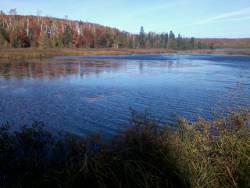 Walking the eastern edge of Egge Lake, I continued to keep my eyes peeled for any sign of moose, bear, or beaver as I walked briskly through the shadows. Nothing. If it weren't for the poop and tracks I saw the first day, I'd start being suspicious about the stories.
Egge Lake is another pool of shimmering blue trapped in a bowl of kaleidoscopic colors. A handful of viewpoints along its length provide opportunity to stop and soak in the goodness of the surrounding nature.
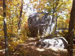 There were very few glacial erratics along this trail, but this one was pretty magnificent resting high on a ridge around the Finland area.
Nearing Finland, the trail goes through a recreation area. Mowed ski trails, lots of different signs, and potential confusion. This was the only place I lost the trail. The SHT joins onto a ski trail for about 30 yards, then the ski trail splits into a Y - both arms identical in use, absolutely no signage, blaze, nor indication of any kind which way to go. I backtracked to the point where the SHT joined it and checked the sign - Yep, turn left here.
I went back to the 'Y' and cussed a bit. Then, I took the right-hand arm since in general I needed to head westerly. About 5o yards down the trail I found a blue blaze - whew! Other than this one spot, the SHT is very well marked.
I got water out of Leskinen Creek (one of the few flowing 'creeks' on my trek) and actually got a mosquito bite. Then, I met two nice day-hiking ladies at the Leskinen campsite taking a break. Nope, no Sony digital camera, just a Canon.
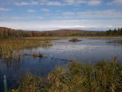 As I walk each day, chewing up miles, I occasionally calculate distance to the next few campsites, amount of time left, and which sites I might reach. Today, I'm traveling quickly and could possibly reach the East Palisade campsite before sunset, putting me through Tettegouche state park. The problem is that it is 8 miles past the next closest campsite at Kennedy Creek. If I arrive at Kennedy Creek after 4pm, I'll stop there for a shorter day and a longer evening of sitting around. But, if I'm earlier, I'll push through for a loooong day and short night. We'll see.
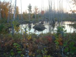
For now, I discover a huge beaver pond filling the valley! The lodge is sturdy and there is active work on the dam - but no beavers in sight. I stop for a break, snack, and hope of seeing an animal. No luck.
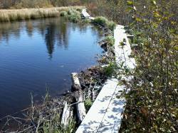 This beaver dam serves as the foundation for the SHT. The beavers have been so busy that the ends of the dam are being flooded with water so the trail needs to be elevated soon.
While crossing this narrow passage, another hiker approaches from the other direction. I asked him, "OK, do you want to be Robin Hood or Little John?" since the narrow boardwalk offered no room to pass. He stepped onto a support as I passed and then we chatted a bit.
'BookSmarts' was out for about 17 days, 6 done and 11 to go. He's hiked the Appalachian Trail and was heading north, no real goal to reach the end but just moving along. He said he had seen 'Pilgrim' back a couple hours, so I may run into him again.
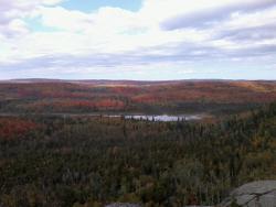 The most serious climb of this section came next on the way up to Section 13 which is a rock climbing area, I'm told. It offered this magnificent view back over the valley with the beaver pond once I reached the top.
From here, I dropped down 400 feet just to climb right back up 350 feet to the top of Sawmill Dome and another wonderful view. The spur trail to Picnic Rock didn't look to exciting so I skipped it, but later heard it would have been a great view. Well, another great view of the same valley I guess it was ok to skip.
Droping off Sawmill Dome, the SHT comes back to the high ridge over Lake Superior and enters Wolf Ridge ELC property. Huh?
ELC stands for Environmental Learning Center and is used to educate kids about nature and hold other seminars, conferences, and such.
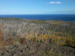 This late afternoon view of the big lake from this ridge shows many dead and bent birch trees. I found out this is mostly from a huge ice storm from a few years ago. It weighed down and broke many trees. Another reason so many of the birch are dead is just due to the end of their life cycle. When you walk though these stands of trees, you notice thousands of new birch, only 3 to 8 feet tall, beginning their life standing against the storms to come.
With my stops to chat, great views to enjoy, and not too big of a hurry, I reached Kennedy Creek too late to continue on. So, I made camp at West Kennedy campsite, alone in the wilderness yet again.
 Well, just after sunset, as YANM (Yet Another Noodle Meal) was heating up, I heard strange noises in the distance towards Wolf Lake. Almost sounded like kids screaming and yelling. Huh? Maybe it was wolfs or coyotes.
As the wind died down, it became obvious that, Yes, those were kids. I guess I wasn't really out in the wilds as I imagined. They continued yelling, boating, and splashing in the lake until almost 9:00pm - which in Hiker Time is midnight. Sounded like a great, fun time to me but I was glad they wrapped it up and I zonked out right away.
It was about a 23 mile day using up 48240 steps. Oh, there was very little water at this campsite but Kennedy Creek did have enough for me to filter some out. Remember, River = Water and Creek = Dirt.
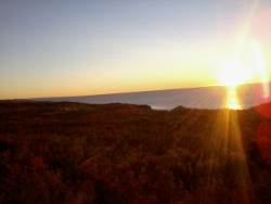 Gooooood morning, America!
I broke camp early and got on the trail, planning on covering some major miles. As soon as I left camp, the trail sliced across a ridge facing Lake Superior and I got to see my first true sunrise over the big lake.
It's 35 degrees and I'm having two PopTarts for breakfast so I have on my arm warmers and can't stay in one spot very long - have to keep moving to stay warm. But, man on man, what a fantastic start to a beautiful day. Really reminds me that "Life Is Good".
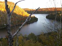 Once around the hillside, I can see Wolf Lake where the little rascals were raising cane last night. I can see why - what a beautiful little lake. There are some buildings with a wind turbine on the hill behind the lake, but this photo didn't capture them.
The hills are now completely covered in all the fall colors you'd expect to see here.
I'm thinking I might run into Pilgrim today. I actually thought he might be at the campsite last night, but I guess he's moving along at a good clip.
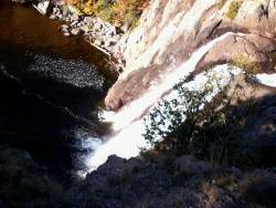 I stumbled into Tettegouche state park before 9am. This park gets TONS of traffic, and there's good reason why. Minnesota's highest waterfall is here on the Baptism River, good trout fishing in the river, and walley plus pike in a handful of lakes. Trails crisscross the park and it pays to keep your eyes open and your map handy when traversing the area.
The High Falls were pretty impressive even though they were very low on water flow. Above the falls, an interesting suspension bridge swayed as I crossed. The sign said no swinging or jumping, so I'll let you imagine what I did.
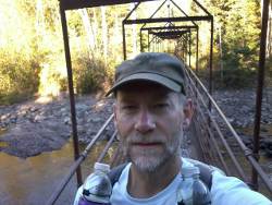 Across the no-swinging bridge, I dropped 1/4 mile off the trail to the campground. A very nice restroom/shower house stood vacant and inviting. I went in, plugged in my cellphone, and took a quick shower. No other people came in so I guess it was too early for camper folk, and I was glad I wasn't holding anyone up from using the facilities.
After my shower, I enjoyed a warm sit on a bench in the sun eating a snack and got to talk with 7 or 8 people that walked by. They were all impressed that I was hiking from Canada to Duluth and asked lots of questions. Nope, no moose, bear, or beavers, but lots of grouse!
Hey, anyone got a Sony camera? Nope.
Ensuring I did not forget the cellphone (!), I packed up and continued on towards Silver Bay.
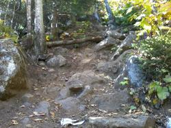 I believe the trail through and west of Tettegouche is generally considered the roughest part of the SHT and I'd go along with that. It is terribly eroded in some spots and plenty of Ups and Downs. A section of trail even gets its own SHT sign here - The Drainpipe - which you can see is quite eroded and rocky. It's steep, but is so short that it only takes a couple minutes to scramble up. Nothing that will slow down your thru-hike.
Once out of the Baptism River canyon, many high points are available for those that want to stop. Raven Rock, Mt. Trudee, and Round Mountain all offer short breaks.
Sorry to say, I didn't take advantage of any of them.
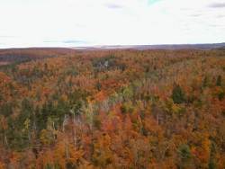 alt="SHT silver bay"
Right along the main SHT, I was treated to views like this, so adding more miles on spurs didn't make sense to me.
I get a kick out of looking at the map and seeing that seemingly remote view like this are just a couple miles from a town, in this case it's Silver Bay.
At this point, I met a single lady backpacker heading north. She barely slowed to say 'Hi' in response to my 'Howdy' so I guess either she didn't appreciate my freshly washed smell or was in a big hurry to get someplace up the trail.
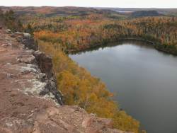
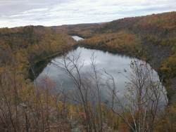 South of Palisade Creek, a healthy climb brings you to what I remember as the 2nd most beautiful view of the trail. Bear Lake and Bean Lake are nestled below a sheer drop-off of a cliff with steep rocky ridges rising above them on the other side.
The campsites by these two lakes are heavily used for obvious reason. This overlook was the one place I'd be a bit nervous taking a group of youth. The cliff plunges traight down with slippery gravel right to the edge.
In this general area, I noticed a piece of paper garbage on the trail. I reached down to get it and it was a paper inside a zip-loc pinned to a tree root - right in the middle of the trail. Written on it was, "Hiker Dude" - not really my name but close enough to check it out.
 A couple had found my website, had a cabin in the area, and invited me to visit them! How cool! No T-Mobile coverage there so I continued hiking.
When I got a bit closer to Silver Bay, I got a signal and talked with Mary Anne. I explained I would be reaching a trailhead around 4pm or so and would to visit with them if a ride could be arranged. I'd call her back later when her husband (Jeff) was back from golfing.
I followed the SHT around the town of Silver Bay and down to the Beaver River - this section was probably my least favorite on the trail. The mining refuse, town buildings, antennaes, and trains dominate the view. Plus, it was hot and dry. But, I did meet three day-hikers heading north and chated with them just a bit.
I called Mary Anne back but no word from her husband yet so I said I'd hang around the trailhead until 5pm - if he showed up that would be great, but if not then Thanks for thinking of me. I figured I wouldn't have coverage once I dropped over the hills surrounding the town.
The Beaver River was ugly - that's the best I can describe it. It looked like someone had dumped milk in it and there's no way I would suck up any of that water even though I was nearly empty now.
When I reached the trailhead, I had no coverage. I waited. Just me and a car with North Dakota plates sitting her.
As I was waiting, those three hikers I had met pulled up in a car - they had gotten a ride from the far trailhead back here to their car. The N. Dakota car was theirs. I asked if anybody might have cell coverage and BINGO one of them did. I called Mary Anne; Jeff was there; he'd pick me up in 15 minutes; BINGO!
 So, by 6:30 I was showered, warm, and enjoying a wonderful meal in a resort cabin on top of a hill with a commanding view of the north shore all the way to Grand Marais, chatting with a couple of the nicest people you'll ever, ever meet. It was a definite highlight of the trip. Unfortunately, not considering the cellphone a camera, I didn't take any pictures so maybe it was just a dream. But, it was a dream that included a great night's rest! Now, that's what I'd call Trail Magic!
A couple things I was reminded of this day: Always take the time to say Howdy because you might run into someone again. Always look for ways to help someone evey day, even strangers.
With the early stop, I walked 19 miles in 42384 steps today.
 With a good porridge and cantalope breakfast in my stomache, Jeff dropped me at the trailhead at 8am. As it turns out, they live in Eden Prairie so I left a couple pounds of extra food with them. When they get back to town, they'll get it to me. I had way too much food since I'm traveling faster now.
The trail rose up to Fault Line Ridge which is only 1300 feet and from there it was downhill 8 miles to the Split Rock River. Along this stretch, I ran into Pilgrim again, taking a break on the trail. We chatted and hiked on together for a few miles. I gradually was pulling away so I let him know I was hoping to reach the last Gooseberry River campsite and would see him there if he went that far. I figured that was more polite than simply walking ahead - but I'm not sure about trail etiquette.
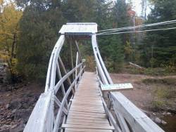
The SHT on the Split Rock is hilarious. You walk up one side of the river for 1.5 miles, then cross this very, very shaky bridge, then walk down the other side for 1.5 miles. So, it takes about 3 miles to move less than 1/4 mile - but, Hey, it was a nice walk.
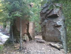 I don't know if this rock structure is why the river got its name, but it was right there so maybe. Just after passing this, I caught sight out of the corner of my eye of an older woman sitting by the river as I walked by. I kept walking a few steps, but then remembered to take time to say Howdy and went back. There were actually three women having a snack break. They told me this was amazing how dry the river was - it's NEVER this dry! I guess that's the theme for this trip - low water.
A few miles past Split Rock River, Gooseberry Falls state park suddenly appears out of the forest. The SHT practically runs into a building and there's no signage, so I was glad I had printed the map of each state park.
I dropped off the trail to visit the visitor center, use the restroom, and get free clean water. There's also soda machines and snacks there, but I wasn't interested. Very nice visitor center and worth checking out!
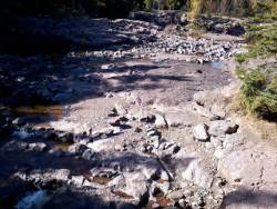 Just like the Split Rock River, the Gooseberry River was practically dry. I imagine the falls are much more spectacular in spring.
The SHT follows the Gooseberry River upstream about 4 miles or so with 4 campsites along the way. This river was wiped out this spring from the flooding. This is the first river where I noticed obvious damage. Along the way, beavers have been very busy rebuilding 5 or 6 dams that were demolished, but they are all still quite small. Debris is stuck in the trees and brush along the river trail and parts of the trail are caved in and need to be rebuilt.
When I reached the last campsite, I thought there was still one more - Ooops! So, I hiked on to Crow Creek Valley campsite and arrived around 5:30pm. It was a much nicer site, but absolutely no water around. Fortunately, I had drunk a lot at the visitor center and still had plenty in my bottles.
With time to spend, and hoping maybe Pilgrim would make it this far, I gathered wood, broke it to lengths and made a nice pile. With my camp set up and it getting dark, I built my own little fire but left most of the wood stacked for the next folks coming through.
I walked 57322 steps on the trail and covered about 28 miles today. My first marathon day this trek - over 26 miles. It was wonderful weather and easy trail. Lots of grouse, a few snakes, but still no beavers.
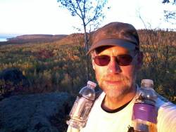 Reviewing the maps last night, the SHT pulls far away from the lake shore in about 5 miles and the terrain really flattens out so I'm not expecting much in the way of scenery. I'm getting a little anxious to finish up and wake early to get going. I start hiking before 7am.
This is sunrise by Wolf Rock just down the trail from camp. It winds up being my last real view of the big lake.
With the smooth land, fine trail, cool dry air, legs feeling good, and no other hikers around to talk with, I fly down the trail. The only concern is that my radiator is nearly empty. I need to get some water soon.
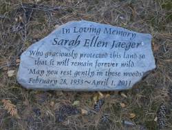 Walking through a pine forest along a ridge, I noticed this carved rock just sitting there along the trail. When I got home, I did some research and discovered that Ms. Jaeger died in a car accident on April 1, 2011, along with her dog named Odie.
I continued on to the Encampment River with high hopes for water since River = Water and Creek = Dirt.
When I reached the river, a brand new bridge was waiting there - a bridge over rocks and a fairly small trickle of water. Well, at least it was water and it looked pretty clear.
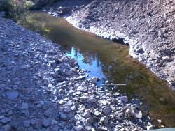 I took almost 30 minutes to filter and drink my fill, eat a Snickers, and drink some more. Since this 'river' was so dry, I stocked up on an extra liter just in case the rivers farther inland were worse.
There really isn't much to tell about the next dozen miles. I followed the trail through forests, across some roads, up Silver Creek for a couple miles. I did spook three deer getting water in Silver Creek. I ran into a couple guys that were backpacking but had no real destination - just hiking here and there. Then I reached the end of map #1 at Reeves Road - but I'm not done because there's still map A for the most recent trail sections that were just added.
Just before Reeves Road trailhead, the trail comes out onto county road 2 and there is a restaurant smack dab in the middle of nowhere. I've heard it's a good place to stop, but I already have extra food that I'm not eating and it's not even 11am yet, so I continue on. I scare up three grouse on Reeves Road just before a hunter on an ATV zooms past.
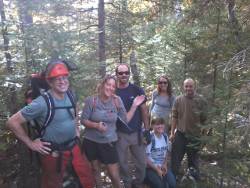 Walking into the afternoon, I heard a chainsaw in the distance. As the trail twisted and turned, it drew me closer to the noise. Finally, just as I was getting concerned that a tree might fall on me, the saw stopped. Around a corner, I came upon a guy on the trail putting his saw into a pack. He was the leader of a trail maintenance crew from Two Harbors - the first volunteers I've seen on the trail.
He's also a founder of Granite Gear based in Two Harbors, and involved in Boy Scouts. He recognized me from an email I had sent earlier telling about my planned trip so we talked awhile.
Since he was the first Scouting person that knew what I was doing, I sent his troop the Scout Shop gift card.
I also tried my best to make sure they understood how much I appreciated their work at clearing the trail. They had responsibility for a certain section, kind of like adopting a stretch of road to remove litter. So, thanks again to Dan's Crew!
 I thought I might stop for the night at McCarthy Creek but it was was only about 2:30pm when I flew past - no need to stop yet since there's a campsite 6 miles farther and another one 7 miles past that. I might be able to reach the far site and actually do a 40-mile day!
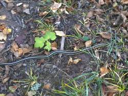
More easy terrain and nothing but grouse and snakes, like this big guy. He refused to get out of the trail until I nudged him with my pole. I didn't want to step over him and have him get all grumpy and hissy at the worst moment.
As I closed in on the nearer campsite, I figured I could make the second one. Just then, as I was flying through the forest a young man appeared heading toward me on the trail. Right away, I thought it strange that he had no water or any gear. Then his father appeared behind him. How did I know it was his father? He's a scout from home!
They were following my progress and drove up to surprise me. They got my last location using wifi at a McD's and figured where to intercept me.
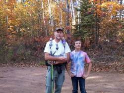 We walked a few minutes to the trailhead where they were parked and I got a cold Mt. Dew! Not only that, he had a Sony battery - exactly the one I needed for my camera.
After chatting a bit, I knew I wouldn't make 40 miles today. When they asked about getting a Big Mac in Two Harbors, I said YES.
A half hour of driving to town and back plus 45 minutes eating (and taking advantage of the facilities) and I was back at the trailhead.
So, Benjamin and Duncan, THANKS for an unforgettable helping of trail magic!
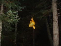
 The remaining two miles went quickly, passing by an old beaver pond just as the nearly full moon started its trek across the sky. I reached my very nice Big Bend campsite just at dark, with no need to hydrate yet another bag-o-noodles after my dinner in town. So, I just hung my food bag and climbed into bed for another cold night.
I did hike about 34 miles in 64380 steps today. The longest day by far.

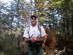
I walked 39150 steps on the trail today and traveled about 16 miles.
I stepped out of the woods at the Normanna Rd. trailhead around 1:30pm, almost exactly 13 days from my start on Otter Lake Rd. This last morning of hiking dragged on and on and I felt pretty slow. But, I continued on and ran into more Trail Magic once I left the trail. One big thing I learned on this hike is that the world is full of helpful, friendly people and I will assume that is what every person I meet is like until they prove me wrong.
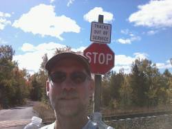
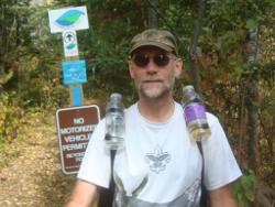 This is me at the final trailhead. I originally planned to hike through Duluth, but the Normanna Rd. to Martin Rd. segment is not open and I could not find the start point for it. Plus, the last 10 miles or so of the Duluth segment is still closed from flooding. So, I'll complete that last part once the trail is officially open next year.
Now, I'm standing at the corner of two dirt roads about 15 miles from town and not really wanting to walk country roads all that way. I also did not know if I'd find more traffic if I headed west or south from where I stood. I had quite awhile to figure out a plan, so I sat down, got out my one blank sheet of paper and my pen and wrote a bit U M D on the sheet. I figured holding that up would help my chances of getting a ride into town. (That's University of Minnesota Duluth)
Just as I finished the sign, a small car drove by and I flagged it down. It was the local mailman and his honda civic was crammed full of letters and packages. I explained I had just hiked from Canada on the SHT and asked him which way I should start walking. He said West would be my best bet. I should hit pavement in about 3 miles. And he drove off in a cloud of dust.
 As I folded up my maps and slung on my pack, an SUV towing a trailer with an ATV came by. I figured he was stopping at the trailhead since it is also an access point to the multi-use North Shore Trail. He stopped and asked if I needed a ride so I explained my situation again. He was heading north but could take me to the intersection a couple miles West where the pavement starts. Cool!
A few minutes later, I was out on the side of the road again. I attached my quaint UMD sign, hefted my pack and didn't even get to stick my thumb out when a big, silver pick-up stopped (heading south) and asked if I needed a ride. Oh Yes! Threw my pack in the back, hopped in, and gave my story again as we drove away. He could take me a few miles but had to pick up his kids at day care.
As we talked, I guess Neil figured I was an OK guy because when we stopped to get his kids, he said they could sit in the back of the king cab and he'd take me in to town. No way!
So, less than an hour from hitting the trailhead, and without even getting to stick my thumb out, I was in my car driving home. Can you believe that? They talk about 'Minnesota Nice' but really? I was home and showered before the time I had expected to be walking into Duluth.
Oh, anyone want some left over poptarts, Snickers, or trail mix? :-)
Hike On
All Comments:
May 24, 2013 - Wayne Vrioni
May 29, 2013 - Ann Snodgrass
Sep 01, 2013 - Bob Svenningsen
Sep 03, 2013 - Hiking Dude
Nov 27, 2013 - Dan Engelhart
Nov 27, 2013 - Hiking Dude
Nov 28, 2015 - Kris
Oct 19, 2018 - Stephanie Rasley
Jul 03, 2022 - Twitch
I hope this late response still finds you happy, friendly, and hiking! I am hoping to hike with a friend, the first week of his Sept two-week hike of the SHT... But only... If I get in good enough shape.
I've started to search SHT information and was looking for info about the dress for that time of year. However, I learned enough other things that I'm not even going to ask! I did realize however, that I'm going to keep the slightly big but packable down jacket in lieu of getting a nano puff. The weather by the Lake can't really vary!
Thanks for sharing your hikes with us. I just wanted you to know that even years later others are still enjoying it and benefiting from it!
Ask a Question
Find more Hiking Resources at www.HikingDude.com


Follow Me
Recent Comments