
Hiking Dude Blog
2025 - Aug Jul
2024 2023 2022 2021 2020 2019 2018 2017 2016 2015 2014 2013 2012 2011
09/18/2012
Highs and Lows
 Check out my current location on the map.
One the first day, I passed the hi point of the SHT at 1829 feet. This morning, a beautiful but grinding 1.5 mile walk right on the shore of Lake Superior was the lo point at 602 feet. The small pebbles really made for tiring walking but there were thousands and thousands of practically perfect skipping stones.
Now, it's uphill from here.
Leave Comment
Posted: 09/18/2012
Posted: 09/18/2012
Day 3 - To G.M.
 I walked 43686 steps on the trail today.
I traveled about 21 miles today.
My shelter and I survived our first rain last night. About 4 hours starting before midnight. I stayed mostly dry.
I decided to hike with Larry today since he's going the same direction. Met a group on trail and they said it should get down to 25 tonight. Grand Marais is a few extra miles past the E. Devil's Track campsite. When we reached that camp, we had to decide to stay or go on for 6 more miles.
So, after a very long 12 hour day of hiking up and down, we're at the Aspen Lodge in G.M. - the only place left in town with vacancy.
Shower was great and the rest will be helpful. Tomorrow will be a very short day.
On the trail, we saw a very cool eagle, some deer and grouse, tons of red squirrels and tiny birds. The leafs are changing some but the next week should bring more color.
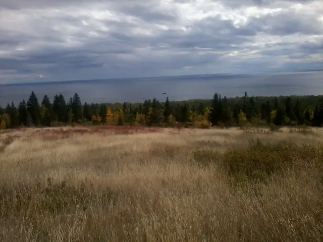
This pic is overlooking the lake from Wildflower Hill - the prettiest place on the trail so far.
Hey - finished map 4 today and started in on map 3! The maps are numbered for NOBO hikers.
09/19/2012
Day 4 - New Friend
 I walked 18725 steps on the trail today.
I traveled about 7 miles today.
After a wonderful, warm, soft rest at the Aspen Lodge in G.M. (no idea how their continental breakfast, sauna, or pool are) we got hiking about 10:30 on a very windy, cold morning. I think we made a good choice to take this night offtrail.
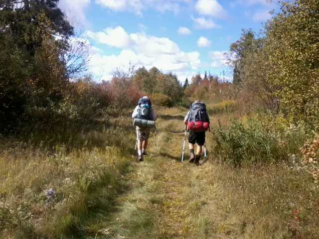
I got us a short ride up the Gunflint Trail to the SHT by using my trusty thumb and winning smile :-). Right at the trail sign, we saw another hiker and it was Pilgrim - a guy Larry had met in the shuttle riding to the northern trailhead. They had hiked together the first couple days. This picture is of them in a beautiful marshy area south of G.M. on the trail.
We three stooges are camped together tonite at a great site only 7 miles from GM so it was a short day. No need to go farther since I'm meeting Bryan tomorrow night just 12 miles from here.
It's already cold so I expect freezing temp tonight. Clear sky, but I won't be out to enjoy the stars. We did have a campfire which was a treat.
Leave Comment
Posted: 09/19/2012
Posted: 09/19/2012
09/20/2012
Day 5 - Rain Rain Go Away
 I walked 26026 steps on the trail today.
I traveled about 12 miles today.
Another fairly short day to reach Cascade River State Park where I'm supposed to meet Bryan tonite. We'll hike together until Sunday when he has to return to school. Larry and I hiked together to the park then he went on ahead. I expect Bryan and I will find him on the trail since he's stopping to fish tomorrow.
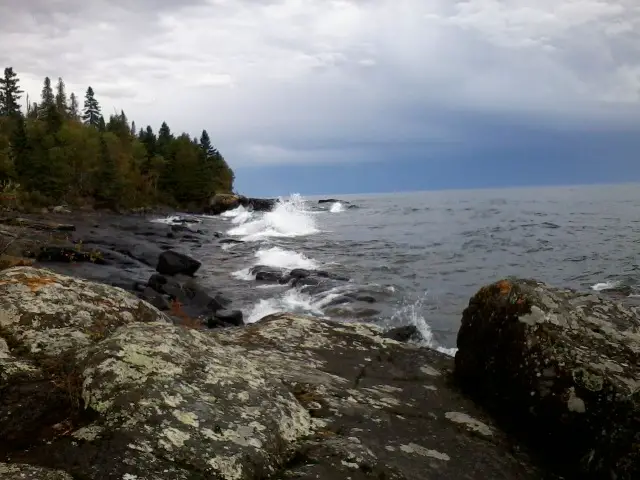
Five days have seen lots of ups and downs, animals, forest types, and weather. This pic is the shore of Lake Superior this evening after an hour of rain just passed through. I spent that time huddled under a cedar tree :-). It's now clearing a little to the south so my fingers are crossed.
Last night, it cleared at sunset but then came right back raining for 5 hours during the night. Better then while hiking.
My arm warmers from Northern Star Council have been a useful idea the past couple days.
Hopefully, my online map is updating regularly but with the thick forest I expect some pings get lost - Check out my current location on the map.
Leave Comment
Posted: 09/20/2012
Posted: 09/20/2012
09/21/2012
Day 6 - New Hiker
 I walked 40700 steps on the trail today.
I traveled about 17 miles today.
Terrific day on the trail with a new hiking buddy. Bryan finally arrived at Cascade River State Park at 1:15AM! We got him set up and slept until about 7 or so. We got hiking before 8am with very cold wind and threatening sky.
There were 3 or 4 periods of rain through the day, one so persistent we waited it out under a pine tree. In the afternoon, weather improved and tonight is cool and calm so far.
Bryan did an excellent job hiking! We did 17 miles in rough weather with a lot of elevation gain. Tonight, we're on top of Mystery Mountain by Lutsen ski area. We had a campfire but there's no view. Our food bags are hung and hoping for dry winds - contrary to the last forecast we got.
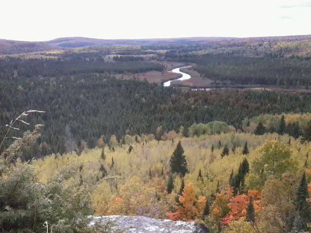
Some amazing views today! This pic is of the Poplar River from a cliff overlook west of Agnes Lake - one of my favs so far. We've finally hit some great fall colors and some vistas are ablaze in yellow, orange, and red.
No animals today, but we did find Larry at Agnes Lake where I hope he's having luck catching fish on his new tankera fly pole. Haven't seen Pilgrim so he's probably down the trail. Did meet Gray Ghost doing a NOBO with a buddy - he's an avid hiker with journals online.
Bryan brought my replacement dirty water bag for filter so I'm good there, too. Everything's looking good at the end of a long day on the trail.
Leave Comment
Posted: 09/21/2012
Posted: 09/21/2012
09/22/2012
Day 7 - Weighing Options
 I walked 42890 steps on the trail today.
I traveled about 17 miles today.
Wild day of options and changes today. At the end of the day, I've wound up in Duluth for a zero day - never expected that one!
We started at Mystery Mountain after a night of rain and hiked through cold, windy, rainy morning - not lots of fun but some wonderful views from hipoints over the continually more coloful sea of fall trees. The rain hounded us through the day as we covered miles and Bryan decided he'd cut his trek a day short. That meant we'd camp at Temperance River S.P. And he'd get a ride back up to Cascade River in the am. As we hiked on, I contemplated our options. As long as he's done, he could get a ride this evening and skip a forecast wet cold (28 degree) night in the tent. When we reached the S.P., there was only 1 campspot left and a line of 3 people behind us. So, we took the site, went outside and discussed things.
We'd need to arrange a ride in order for Bryan to get his car. As we were talking, Andrew who works at th park walked by. I said HI and we chatted a bit and let him know we were figuring out how to get upshore a ways. He was heading that way at 7pm and offered a ride! Now Bryan was set with a free ride and I had a site to myself. Not looking forward to another wet night, with a forecast of snow on Saturday, we decided to give up the campsite and both head to Duluth. I would figure out a ride back to Temperance on Sunday after the cold and wet blew through.
So, a long day of hiking topped off with a drive to town has me relaxing for a day. I've been told taking a day off each week is a good idea anyway.
What I learned from the day is to gather all your options, make a decision, but continue to look for improvements and further options. Otherwise, you may make a quick choice and miss out on a better solution that just took a bit more thinking.
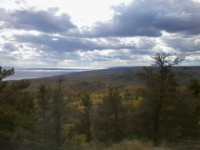
This pic is fromthe tiptop of Carlton Peak just north of Temperance River on the SHT. It is the highest spot around and you can see at least 20 miles.
Leave Comment
Posted: 09/22/2012
Posted: 09/22/2012
Day 8 - Zero Day
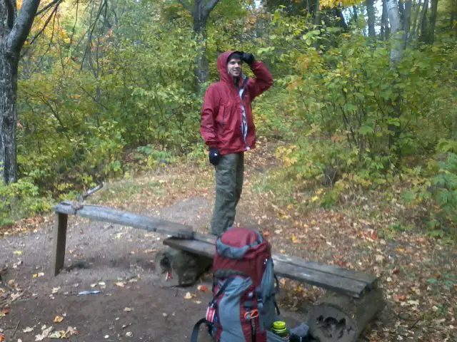 Zero day in Duluth was a great rest. I caught up on site comments and email, washed me and clothes, and rested the legs. I'm ready to get back on the trail tomorrow morning.
Bryan will drive me back and then head home. It was great spending a couple days with him and sharing skills, advice, and views on life. The weather wasn't great but he weathered it :-) in good spirits. Hopefully, we'll get to hike again.
Now, I'm looking forward to meeting new folks on the trail over the next week until I arrive right back here next Sunday - if all goes well.
There's still time for you to start your ScoutStrong PALA program while I'm hiking, or join me for a day or two - Check out my current location on the map.
Leave Comment
Posted: 09/22/2012
Posted: 09/22/2012
09/24/2012
Day 9 - Good Day, Bad Mistake
 I walked 52319 steps on the trail today.
I traveled about 25 miles today.
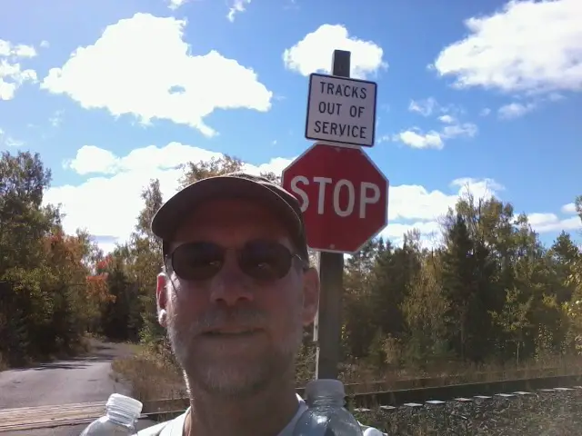
After a rest day and on a very nice trail, I'm making lots of miles today. Unfortunately, I left my camera battery in Duluth so I'll only have a few phone pics for the rest of the trip. I've been asking everyone I meet today if they have a Sony digital, but no luck so far.
What a simply beautiful fall day along the North Shore!
I reached Aspen Knob campsite and am all alone with a couple crazy rabbits running around the site. Talked to 11 backpackers today and 3 of them were Eagle scouts. Nice meal of scampi flavored noodles and herb/garlic tuna - and a Snickers for dessert! It's supposed to freeze tonight but I'm toasty in my quilt and down jacket so far.
My friend from Foley Mansfield may join me on trail for a day or two.
09/25/2012
Day 10 - Practically Perfect
 I walked 48240 steps on the trail today.
I traveled about 23 miles today.
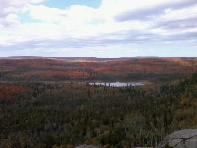
If you checked my travels today, you may have noticed the trail left the shore for some miles. I passed by beautiful Egge and Sonju lakes as well as a very impressive active beaver pond. There were a few serious UPs today, with Section 13 and Sawmill Dome being the best with great views. This pic is from Section 13.
I'm very fortunate to have this wonderful stretch of trail through such magnificent wilds, all so close to home. It is an easy trail to plan a 2 or 4 day trek on or just dayhikes too.
Ready for another cozy dry nite under my quilt!
Met a bunch of hikers today but none had a Sony battery :-)
Leave Comment
Posted: 09/25/2012
Posted: 09/25/2012
Good Morning on the Trail
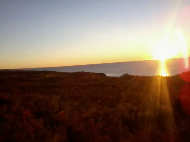 Gooooood morning, America!
I'm sitting here eating my poptart in the chilly 35 degrees watching the sun rise over Lake Superior. It's days like these that let you know life is good.
I expect to cover 25 or more miles today. Next stop is to wash up at Tettegouche S.P. Followed by lots of hiking.
If you're bored at work, see where I'm at - Check out my current location on the map.
Leave Comment
Posted: 09/25/2012
Posted: 09/25/2012
Older Posts Newer Posts
Find more Hiking Resources at www.HikingDude.com


Follow Me
Recent Comments