
Hiking Dude Blog
2025 - Aug Jul
2024 2023 2022 2021 2020 2019 2018 2017 2016 2015 2014 2013 2012 2011
07/20/2024
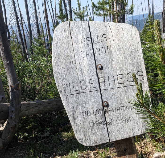
The Seven Devils mountains on the western edge of Idaho butt up to the nation's deepest canyon, Hells Canyon. The wilderness here is dry, rugged, remote, and difficult. It's also extremely beautiful. My family lived near here on the forest service ranger station in Riggins, Idaho, almost 60 years ago.
My brother decided it would be fun to drive from the midwest for hiking and fishing in the high alpine lakes cradled in the bowls between the Seven Devils summits with hospitable names such as He Devil, She Devil, Devil's Throne, the Ogre, and the Goblin. Silly me, I agreed.
About 2.5 years ago, I had to cancel a planned adventure, but this Seven Devils trek turned into the most discombobulated expedition for me so far. It was still an enjoyable trip, but nothing like we had planned.
After driving nearly 2 days, we reached the Windy Saddle trailhead into the Seven Devils at about 4pm. 'We' being my brother (Ed), his adult son (Kyle), and myself. We were to meet a college friend (Scott) and his adult son (Andrew) to start our hike. Scott met us there, but his son had been delayed and would reach the trailhead later and hike in to catch up with us. So, at 5pm under a still blazing sun with temps around 80f, we started in.
The plan was to hike, fish, and camp for 5 days. We would use the Seven Devils Loop (trail #124) to access two main groups of lakes and see what we could catch on flies. That plan lasted almost an hour.
Less than a quarter mile into our hike, Scott decided that his ankle was not going to be up for the ruggedness of this hike. He had injured it a few months ago and thought it was good to go, but it was too bothersome. So, after a short discussion, he turned back to the trailhead.
Another hour of hiking found us still under a mile from the trailhead. The thin air at ~7600 feet, arid air, and temperature were bothering my brother. We were making progress, but it was rough. After a few rests and starts, he decided it would be best to turn back also. That was fine with me since fishing on some Idaho rivers would be fun, too. But, Kyle had really wanted to do some hiking and, between the two of them, convinced me to continue with Kyle. So, now we were down to 2 with possibly a 3rd finding us later.
Now, Kyle and I had to reach a place to camp with water before it got dark around 9:45pm. That gave us 3 hours to go about 3 miles, so it shouldn't be a problem. As we hiked, a helicoptor flew around and landed a couple times off in the distance at a lookout tower. We didn't know what they were doing.
When we finished our first long uphill section, we had this great view out over the Hells Canyon to the west. A 1,200 foot downhill section on scree and shale would get us to the forest and our campsite by Sheep Creek.

As soon as we turned east and started down, we saw why the helicoptor was around. Smoke was rising from the rocky mountains ahead and above us. Should we continue forward or retreat from the fire? It was over a mile away, not very large, and with what seemed to be very little around to burn. So, we continued down to camp, watching the helicoptor fly circles over the smoke while it scooped water from a lake and dumped it on the fire. This went on for almost two hours.

Well, we reached our campsite on the west fork of Sheep Creek just below Devils Tooth around 8:30 and it was great. A beautiful, but noisy, waterfall and plenty of room. Tents up, dinner eaten, and we hit the hay with plans to continue up to the lakes to fish tomorrow.
Andrew did not show up as had been the plan. Kyle and his dad each had a Zoleo communication device. These wound up being great assets, allowing text messages to keep each other up to date. It turns out that Ed had texted Scott so he waited at the trailhead while Ed hiked out. Andrew got to the trailhead and hiked in to meet Ed and make sure he got out ok. Then, all of them headed down to Riggins to camp along the Salmon River.
We started our second day by hiking up more scree towards the first set of lakes. No problems with Kyle navigating and my navigation app deciding to die. As we reached a flat, open, almost desert area after a long climb, an airplane could be seen circling above us. Hiking on, we watched the plane drop pairs of smoke jumpers - 8 people in all. That was followed with 3 low-elevation passes right over us to drop supplies on a hill just ahead. It was all very interesting, but we wondered just how this fire was doing.

We reached Basin Lake with a great well-used camping area. We set up our tents and got day packs to hike up a few hundred feet in elevation to Sheep Lake, or until we ran into the fire. Well, the fire was closer.

At Gem Lake, we ran into a firefighter that had just landed and was hiking to the fire. He was chill and said we could just go on hiking. So, we did.
But, very soon after that, we ran into smoke rising on both sides of the trail. So, we scrambled up some rocks to see what was above and still stay away from the fire - which was not very large.
We stopped to watch another firefighter that was busy knocking down burning spots, and decided that it would be a better idea to head back down. The firefighter noticed us and helped us with that decision. :-) On the way down, we met another firefighter that said we'd be fine walking up around the fire, but we continued down.

We would not get to fish in Sheep or Gem lakes, and the wind was whipping around so we weren't even sure if we'd be able to stay where we were at Basin lake. So, we decided to change plans again. We packed up our camp and headed farther east to the next set of lakes. We hadn't planned on it, but now we would hike the entire loop around the Seven Devils and come out a day early.
Our final mishap happened about an hour later. A sharp left turn near Lily Pad lake is required to take the Seven Devils Loop. We wound up taking a trail towards Bernard Lakes which includes a 350 foot downhill. Once that was figured out, we retreated back uphill to the intersection where the mistake was made. At this point, it was getting late in the afternoon, our frustration level was pretty high, and we were hot and tired - a bad time to make any decisions, but we did. We decided to just head back.
So, after a long day of hiking, we camped right back at the same spot from the night before. It was definitely a challenging, interesting day. The next morning, we were up early to beat the heat and climbed the big hill out. We had some clouds, breeze, and plenty of water so it wasn't too bad.

The Zoleo texting meant Ed was waiting for us at the trailhead so it was simple to pile in and head down to do some fishing the next few days on the Clearwater, Selway, and Lochas rivers. It wasn't the trek we had planned, but it was a good time.

Hike On!
Posted: 07/20/2024
08/05/2024
Next week, we're off to explore three trails across the Atlantic. We'll start with 6 days on the King's Trail starting above the Arctic Circle in Sweden. Then, The West Highland Way in Scotland. Finally, we'll end with a jaunt around the Tour du Mont Blanc in France, Italy, and Switzerland.
If all goes well, we'll also get to summit the highest mountain in Sweden and in Scotland.
Unfortunately, the current weather looks like a few days of rain to start us off - yuch. But, better at the start than the end.
Posted: 08/05/2024
08/06/2024

Being in the flatlands, the biggest climb we have on which to practice for the Alps is the local ski hill. At 130 feet of elevation, we are going up and down 10 times most mornings. That's about 1300 feet, but the Tour du Mont Blanc has sustained climbs over twice that height - omg!
Fortunately, this family of turkeys gave us plenty of encouragement as we plodded up while they were having breakfast.
Hike On!
Posted: 08/06/2024
08/12/2024
We'll be spending a very loooooong day traveling from USA to Kiruna, Sweden. After what I expect will be a fitful night of sleep (due to timezones) at an AirBnB, we have a short bus ride to the start of our first of three trails.
As I told Mrs. Dude, once my foot hits the trail, all my stress will vanish and it will be fun! Until then, the hassle of arranging and getting tickets for planes, trains, busses, hotels, and whatnot to piece together three separate hikes takes some fortitude. Plus, the weather forecast looks miserable for the first week on trail - rain every day. So, we'll probably miss summitting Kebnekaise (Sweden's highest) mountain.
I am excited about some new gear for this adventure. I've been using pretty much the same equipment for the past 12 years that I first acquired or made for my first long hike on the Arizona Trail. I'm happy with most of it, but have been looking forward to a few changes...
- Shelter - I've been very happy with my Bearpaw Wilderness Designs shelter but, after sooo many years of use, the zipper is becoming obstinate. Also, since we're definitely going to be having plenty of moisture on this trip, it tends to sag, dropping condensation through the mesh net underneath. That's just the way silnylon works, but Mrs. Dude wants a change.
TarpTent has a shelter called the Stratospire Ultra made from something they call Ultra TNT laminate - think of DCF (or cuben fiber) but cheaper. Completely waterproof, no sag, and can set up in the rain while keeping the inside dry - so says the advertising. So, I got one and we're testing it out for about 30 days. Hopefully, they won't all be rainy days, right? :-)
PS: When ordering this shelter, THE Henry Shires called me back when I asked a question on tarptent.com. Not fanboying here, but it was cool to have the prez of the company contact a customer, wouldn't you agree? - Sleeping - My DIY quilts have been wonderful as far as I'm concerned. I've really wanted to make my own down quilt, but my wife just fell in love with ZenBivy's online presence. With their specs and prices, it was hard to justify making my own, so we both have new down quilts rated to 0F degrees. We'll see how well we can mix down and rain.
- Rain Gear - I've been a disposable poncho and garbage bag rain skirt guy for the past decade. It's worked fine on my long hikes, but did I say we're expecting at least a week of solid rain? So, I got a new poncho that's more substantial, AND a set of ultralight Frogg Toggs rain jacket and pants.
It's redundant, and any UL folks will cringe at the extra weight, but I'm just trying them out, ok? I'll throw the poncho over me and my pack if there's light rain and just use the rain suit if it looks like a heavy, sustained rain or cold weather.
So, when I get home, I'll let you know how the gear worked. While we're on the trails, I've got my tracking device and hope to blog when there's coverage. Check in once in a while over the next 5 weeks to see what's up.
Hike On!
Now, I just have my fingers crossed that this trip goes better than my Seven Devils 'hike' earlier this summer. :-)
Posted: 08/12/2024
08/14/2024
8/13-14: Left MSP at 7:45pm on IcelandAir to Reykjavik. Slept fitfully for most of the 6 hour flight. Had passport check in the most understaffed, poorly signed, chaotic airport experience since Tanzania and then barely caught our connection.
Barely is an understatement - we were the final two to reach the gate, get a personal recalled bus out to the plane on the tarmac, and had the flight attendant say 'Boarding Complete' as soon as we stepped aboard.
Our next connection at Stockholm was polar opposite. What a beautiful relaxing facility! Plenty of time, clean, lots of signage and displays, and few people.
Our Airbnb host met us at the airport in Kiruna and we enjoyed our quick tour through town to his home. We got a canister of gas for our camp stove so we're all set to hike tomorrow.
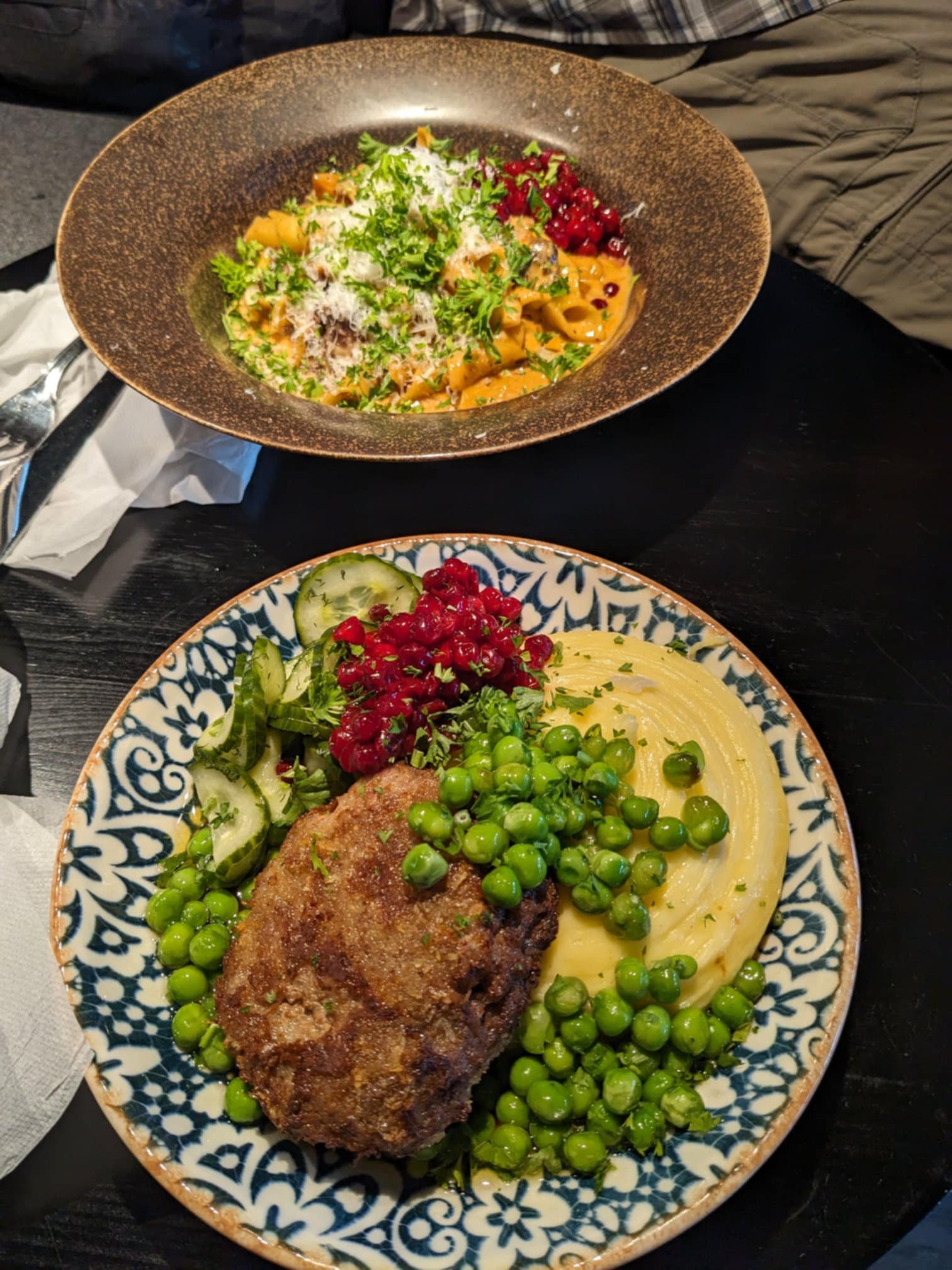
The highlight for me was a mile walk to a restaurant called Spill. We had a mini meatloaf made of elk and a bowl of pasta with smoked reindeer in a creamy sauce. Such good, strong flavors!
Showers back at the Airbnb and we could no longer keep our eyes open after about 18 hours of travel.
Hiking tomorrow!
Posted: 08/14/2024
08/18/2024
August 15 - Our Airbnb host gave us a ride to the Kiruna bus station and we took the 90 minute bus to Abisko on the skinniest of pages roads. We noticed that the terrain looked very much like Northern Minnesota in the iron range.
At the starting location, we took a detour to explore a demo Sami village - interesting sod houses and food storage. Then, we started hiking South on the Kungsleden (King's Trail) at 10:30.
As luck would have it, our first day of hiking south was also the final day for an event having 1,700 people hiking north. We got plenty of practice with the Swedish version of saying 'Hi' as we past others on the trail. It's 'Hej' which sounds just like 'Hi', but sometimes they say it twice.
We were planning to hike 9 miles so that we would clear the border of a national Park which had no camping. Once or on public land, you can set up your tent pretty much anywhere.
Just outside the national park boundary, a group of event support staff was serving swedish pancakes for their hikers but they had a ton left. So, we got to have a pancake with blueberries and whipped cream for a very unexpected snack. Since it was still early, we decided to hike farther.
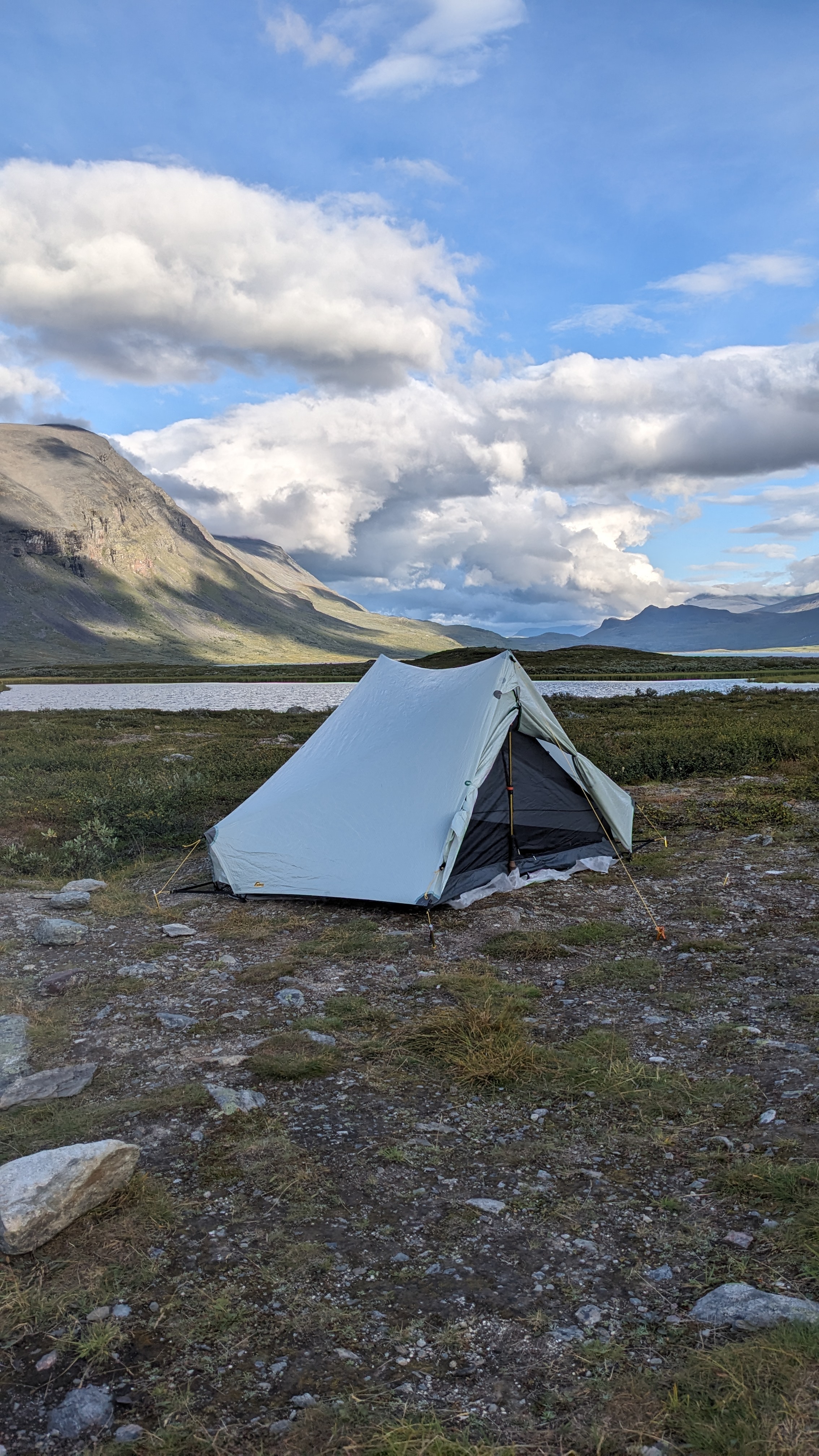
We are camped out on the barren tundra with no one around. We set up our new tent and got water and had shepherd's pie for dinner. At 9:00, we were all cleaned up and settled into our tent and it was still light out. Since we are in the land of the midnight sun above the Arctic circle, it never gets completely dark at night.
Some things that were interesting - only a few birds and no animals, miles of boardwalk on the trail, diversity of hikers we've met. South Carolina, Germany, Sweden, Poland.
Check out my current location on the map.
(My tracking app that was supposed to be dropping notes to this blog isn't working. So, we're actually at the end of our 4th day of hiking and have a little coverage. The tracking map link shows our progress)
Posted: 08/18/2024
08/19/2024
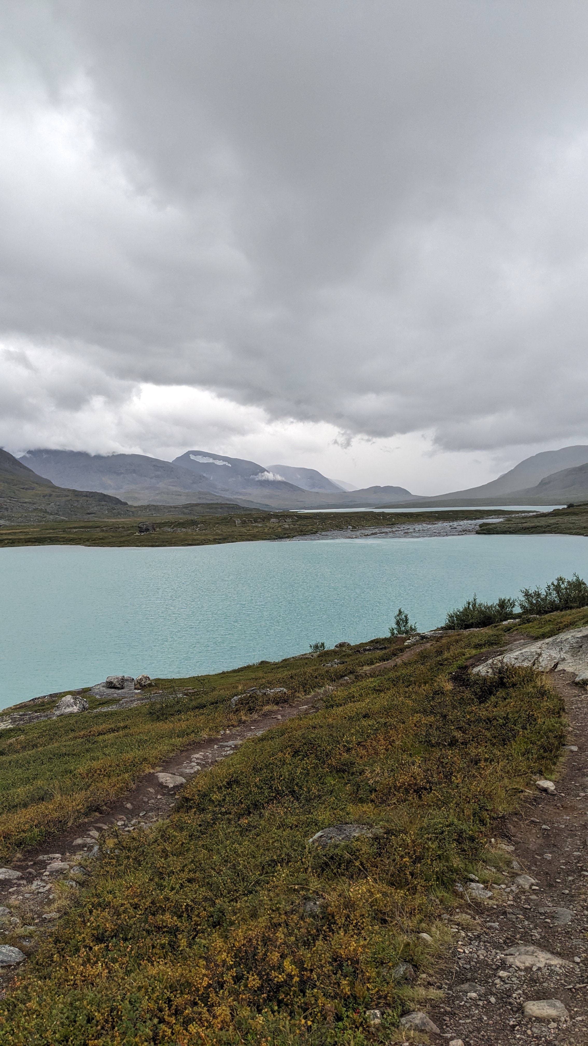
August 16 - Extremely windy all night and I slept very poorly. We woke to heavy rain so we stayed in the tent until it stopped around 10. Hiking from 10:30 to noon was fine but then the rain returned for about 3 hours making the day slower and dreary.
We stopped at our first mountain hut to warm up a bit. Pretty nice places, but quite expensive. I'll tell you about the helicopter 'rescue' later.
We saw many of the same people hiking that we met yesterday on trail. We also saw quite a few ptarmigan along the trail across the tundra. They seem about as smart as grouse. We also spied a few reindeer and hope to see more tomorrow.
Around 4:30, drizzling rain resumed and the sky looked ominous ahead, so we found a spot and stopped for the night. It is again chilly and very windy, but the sky has cleared and will hopefully usher in a sunny day tomorrow. Our camp spot is great and there is no one else across the open tundra.
The trail had many more boardwalks today. The rest is often rocky from so much use, but easy to follow. There are also many cells with raised wooden bridges and an occasional metal suspension bridge over rivers. We only covered about 10 miles today.
Posted: 08/19/2024

August 17 - We hiked over the highest pass on the trail today, so it's all downhill from here.
The first 3 days were hiking up a long valley and now we'll be hiking down another one until we turn east and climb up a small pass into a different valley. At least the Swedes didn't throw in a bunch of PUDs on this trail.
Another day of on and off rain. We took refuge for 90 minutes in a mountain station to have our lunch and warm up. We meet a guy from Denmark, 2 Swedes, and two sisters from Belgium who are hiking the entire trail. It is over 400km, we're only hiking about 100km.
Just as we were arriving at the mountain station, a helicopter landed and took a woman out of the mountains. The station host said there was no injury, just some crazy argument between two hiking partners and they decided they were done and wanted a ride out. It supposedly cost them over 10,000 euros! That's the story we were told anyway.
The many boardwalks gave way to a few miles of very rocky trail, especially over the pass. We did see a dozen reindeer in the morning on the hillside quite far away.
With rain threatening, we found ourselves approaching Salka Fjallstuga (Salka mountain station). Rather than pressing on and searching for a flat spot, we are talking advantage of a huge area of free camp sites and pit toilets. And, since we stopped it has been raining occasionally so we're dry in our tent.
We hiked about 12.5 miles today.
08/20/2024

August 18 - We've been hiking South for four days with the wind nearly constantly blowing strongly into our face. Today, we continued South to Singi Fjallstuga (Singi mountain station) where our route split off from the Kungsleden to take us east.
We climbed up about 500 meters to a low pass into the next valley, and of course the wind now blasted from the east!
In the morning, we had a mother and baby reindeer walk right across the trail. Later in the day, we saw 4 more up on the pass. So, we've seen our share of reindeer - no other animals though.
We saw many beautiful waterfalls and everyone on the trail is drinking water straight from the streams. We filtered the first day, but now have been taking our chances from small streams tumbling down off of high, empty mountain tops.
We met a great young swedish family and drilled them with tons of built up questions about animals, wild berries, the tundra, and much more we had been wondering about.
Our longest hike so far at 16 miles, we just kept walking and passing possible campsites until we reached the Kebnekaise mountain station area and stopped just outside their 'no camping' boundary. We were able to hike all day with no rain, but it started raining just as we began to set up our tent. We climbed in and again cooked our meal in our tent vestibule.
Posted: 08/20/2024
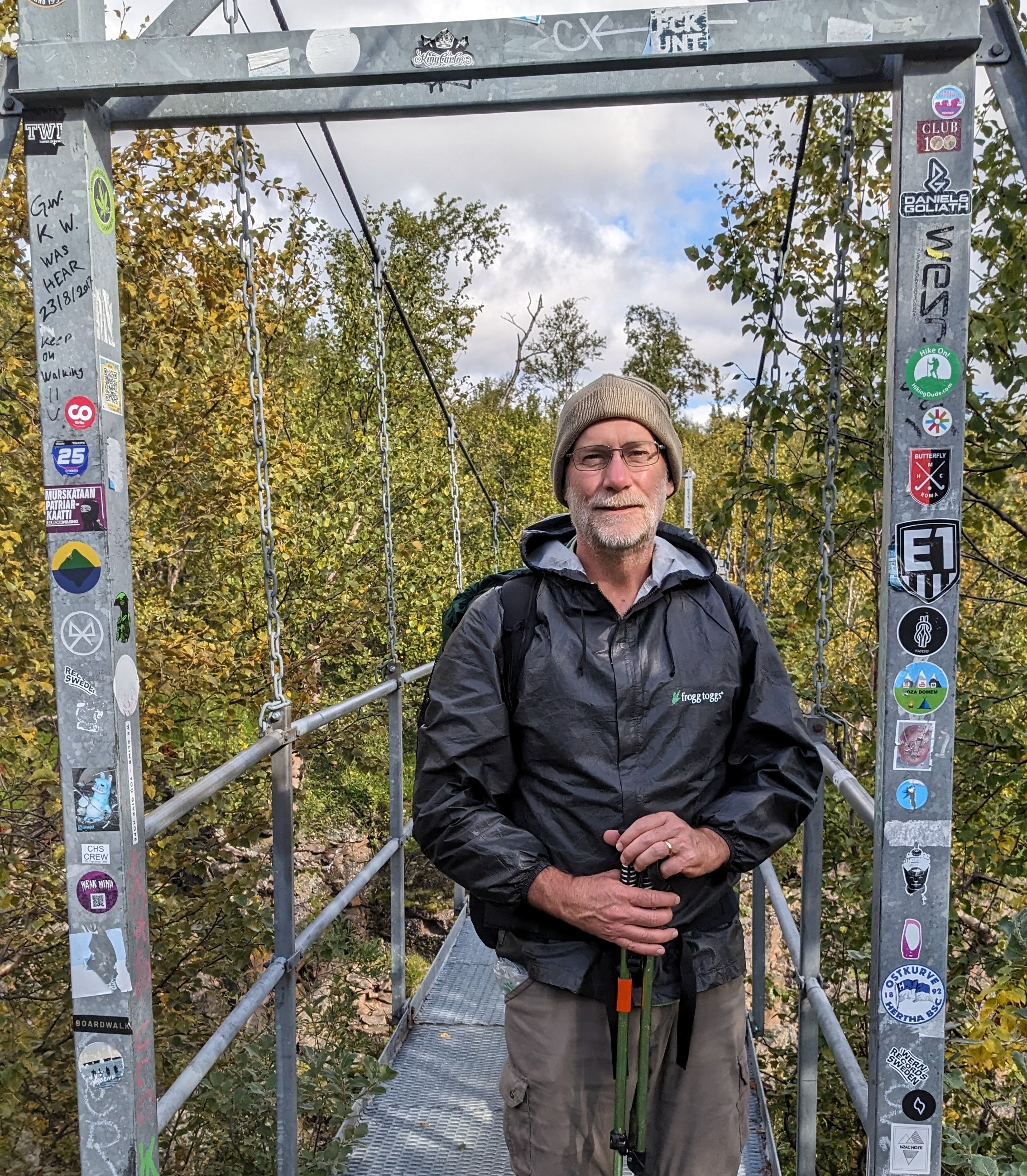
August 19 - Yet more rain when we woke up so we stayed in the tent until noon when the rain finally took a short break. We have 2 days to do the last 12 miles, so there's no hurry, the rain is supposed to stop, and there is plenty of light to hike later.
We packed up and walked 1/4 mile to the Kebnekaise mountain station which is actually a huge resort with 200 rooms, restaurant, and shop. We enjoyed a great lunch buffet with reindeer, chicken curry, rice, corn, quinoa, and juice. We really took advantage of the stop and their wifi.
We met a Danish couple and two French hikers while relaxing after lunch in a common room waiting for the rain to give up. Another hiker noticed the scouting emblem on my hat and asked about it. Turns out he was a scout in Hong Kong but has lived most of his life in Australia. He was in a group of 10 we had passed yesterday that are hiking hut to hut.
Around 3:30, we finally hiked from Kebnekaise mountain station down the last of the trail out of the mountains.
Because there was no rain this evening, we finally had the opportunity to choose a camping site that looked good to us and have time to set up the tent and relax. We found a flat sandy spot right beside a river. We are camped two miles away from our bus stop in the morning where we will board a bus to Kiruna. We are going to stay in a hostel for two nights and have a chance to wash clothes and check out the area before we fly to Stockholm and then on to Edinburgh.
This bridge leaving the mountain station had stickers pasted on it, so.... can you find mine?
Check out my current location on the map.
Posted: 08/20/2024
08/21/2024
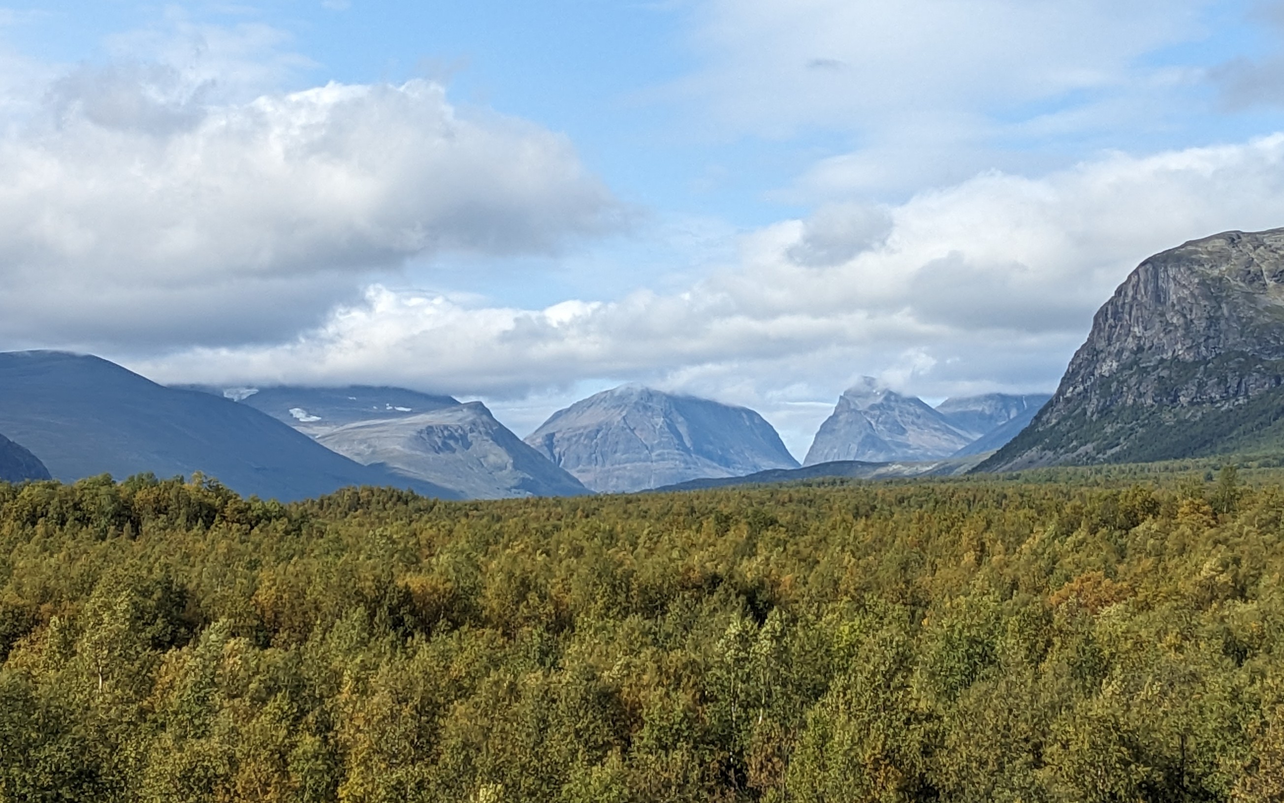
August 20 - Very short 2 mile hike to Nikkaloukta on wide, flat walk through scrubby birch forest with mushrooms of all sizes and colors.
We reached Nikkaloukta at 8am with 4 hours to wait for our bus ride back to Kiruna. Fortunately, the trail ends right at a restaurant that opens at 8am so we snacked on their buffet for 3 hours. Fruit, rolls, bread, granola, cheese, salami, berry jams, hard boiled eggs, juice, coffee, yogurt.
The last hour, we walked up s small hill to see a church and a police helicopter just happened to be taking off below us to head up into the mountains. Of course, there's no rain now so we could see the mountain range.
Bus ride was 90 uneventful minutes on a very comfortable bus with wifi. We walked to the 'Yellowhouse' hostel where we'll stay 2 nights. It's old, inexpensive, and just a comfortable place to rest.
We found a small restaurant called Pub Eden where we had a dinner of reindeer carpaccio (we had to look up what it was after we ordered it) and a sausage pizza. Both were very tasty.
Rest day tomorrow and then working our way over to Scotland.
Posted: 08/21/2024
Older Posts Newer Posts
Find more Hiking Resources at www.HikingDude.com


Follow Me
Recent Comments