
Hiking Dude Blog
2025 - Aug Jul
2024 2023 2022 2021 2020 2019 2018 2017 2016 2015 2014 2013 2012 2011
02/13/2019
I finished hiking for today. You can check out my current location on the map and I'll post about my day when I am in coverage.
Posted: 02/13/2019
02/25/2019
Over the next week, I'll be posting about my Trip to Africa to climb Mt. Kilimanjaro over 8 days and then experience the Tanzania for a week. My wife accompanied me, along with 20 other people, to climb the mountain so it was quite an operation!
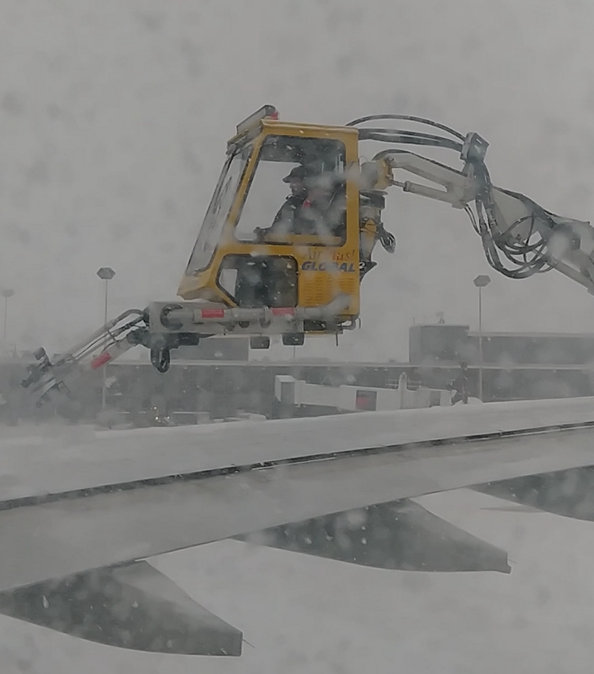

Travel to your destination is often the most expensive part of an adventure. The flight to Tanzania from Minnesota cost a lot of money and time. Our adventure started in the midst of a snowstorm, requiring de-icing of the plane. That was immediately followed by an engine problem resulting in a delay, followed by another round of de-icing. 3.5 hours after departure time, we finally pulled away from the gate. Once we were airborne, it wasn't too bad. Long flights are something of a time warp - an entire day is used up sitting, watching movies, and eating plastic food. 12 hours later, we arrived in the Netherlands.
After a quick sprint through the Amsterdam airport, another 8 hour flight got us to Kilimanjaro airport, 9 timezones in the future. The owner of our safari company and our lead climbing guide met us after fighting and clawing our way through the tangled mess of Tanzania immigration. Get your visa BEFORE your trip to avoid a LONG wait on arrival. Just like at Disney World, go as far to the left as you can in this mass of humanity that just arrived to press ahead as much as possible.
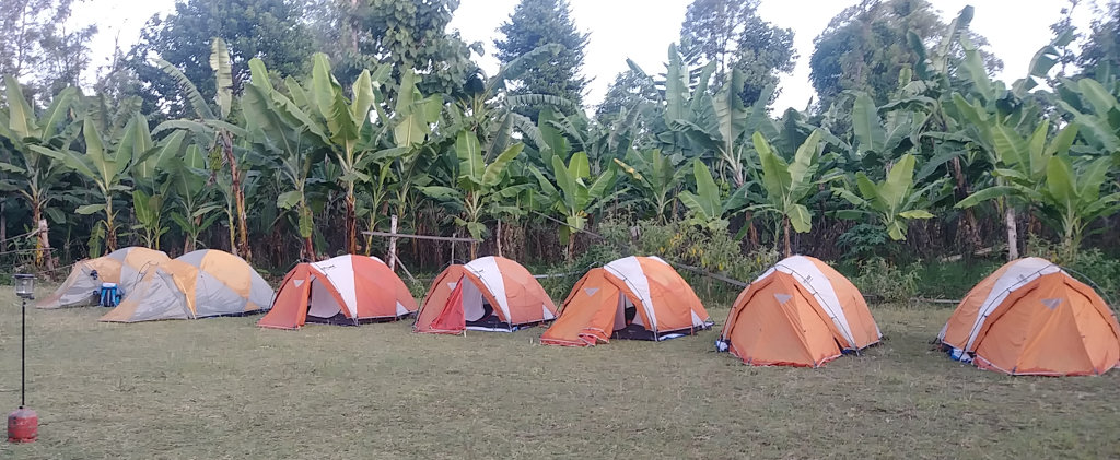

Reaching our first night's camp around 11pm, via a long, bumpy bus ride, we all just claimed tents and crashed until morning. It was nice being out in fresh, cool air with no bugs and unfamiliar stars across the sky. With the morning light, we could see that we really were in Africa - banana, acacia, and mango trees, intense sun, and a far-off glimpse of Kili.
This day was set aside to rest, explore the village, check gear, and meet our guides. I needed the day to start getting used to being pampered. Since I carry all my own gear and food on my long hikes, I knew there would be two challenges for me this time:
- Having porters carry all my gear, food, tent, everything I didn't need for a day hike
- Walking very, very slowly day after day due to elevation and size of our group
The company we're using is Tanzania Choice Safaris - a Tanzania-owned family company. Kakasii and Brenda Kimaro run the company and employ many local guides, cooks, and porters to handle a successful Kilimanjaro trek. On Facebook at TCS. It quickly became clear that TCS was a good choice and they did a wonderful job throughout the entire trek.
Now that we're settled in and two sets of lost luggage finally made it from Amsterdam, we'll start the actual hiking tomorrow.
Posted: 02/25/2019
02/26/2019
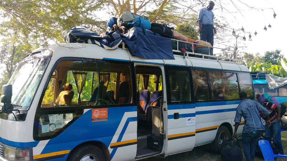

It seems to be taking FOREVER to start hiking! From our base in Uswaa village, all our gear was loaded on two buses for the long ride to the trailhead. Mind you, we did no work - the tents were taken down, packed, and loaded by our guide team. All we had to do was get our little day packs ready and sit on a bus. And, this was all after a huge breakfast cooked, served, and cleaned up by others!
Our ride up the mountain was often like a rickety, wooden roller coaster ride, and our bus even had a mechanical problem. Just a leaking radiator hose, but enough to be interesting. We leisurely climbed in our air-conditioned bus from the dry African plains through fertile forest land where hundreds of workers harvested carrots and potatoes all day in the heat. I should say that 'heat' is relative - many of them wore stocking hats and sweaters.
We eventually reached the Londorossi Gate to the Kilimanjaro National Park where we registered and our tour operator paid all the fees. And, the hiking and camping fees are big! It cost around $140/day for each person in our party. I don't know what that revenue is used for, but I saw no sign of trail maintenance on our trek.
After a very nice lunch, and watching all the porters get their loads officially weighed, we piled back in the buses for the last leg to our trailhead. Besides the 22 people in our big group, we are being supported by a lead guide, assistant guides, cooks, and porters. All this is a total of around 90 support people - or 110 people all together. It's an invasion!
Yes, we're finally hiking! Scrambling out of the bus, trying to avoid the porters throwing packs off the top, we all tumbled in a mass to the trailhead while adjusting hiking poles, fidgeting with pack straps, and smearing on sunscreen and/or bug repellent, depending on personal concerns. I saw no mosquitoes the entire trip, and this first day was all through rain forest so no sunscreen either.
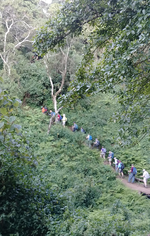

Have you ever seen a freight train start moving? The engine pulls, the couplings clank together, and the whole thing slowly lurches along, slowly gaining speed. Our group was similar, except we never got to the 'gaining speed' part. The day was a very casual hike on a very worn path through a beautiful forest of exotic trees. It's just as well since it was still quite warm and humid this low. We did gain 1400 feet over 5 miles, but it came from only a very few short, steep climbs. Monkeys occasionally appeared in the trees, but they were the only wildlife - what would you expect with hundreds of people walking past? Ours was not the only group using this trail.
We arrived at Mki Mkubwa camp at 9200 feet as the day wore down. This was a very busy camp and our tents were packed together. I found the tent my wife and I would share for this trek already set up on a nice, flat spot. This would be the norm through the week, our support crew doing an excellent job of racing ahead to the next campsite early to hold the best spots.
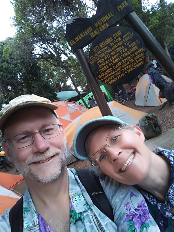

Soon after we arrived, we were each given a bowl of hot water to wash with, then gathered in the large dome tent which would be our meal tent for the next week. I dubbed it the Thunder Dome, but it didn't really catch on. The dinner routine developed quickly - coffee, tea, or cocoa at your leisure, followed by soup, then the main meal. All this prepared in the kitchen tent and served with flourish in the Thunder Dome. Folding chairs, tables with table cloths, real plates, cups, and utensils were all carried from camp to camp for us!
After dinner, our lead guide laid out the next day's plan to finish off this day. Brush teeth, use the carried in portable toilet, put in ear plugs, and off to bed. Bed was a very cozy sleeping bag on a soft mat, both rented from the outfitter for a few dollars, along with hiking poles, so we didn't have to transport them on the plane. This night, as would happen every night, I slept very well and hardly remembered having my head hit my rolled up down jacket pillow.
We hiked from 7800ft up to 9200ft over a distance of about 4 miles, all of it through rain forest.
Posted: 02/26/2019
02/27/2019

As it turns out, our group is very good at 'Pole Pole'. We have a guide leading the way and we are not supposed to get ahead of him - no one has yet. His job is to make sure we don't hike too fast. 'Pole Pole' is Swahili for 'Slowly' and that's how we're supposed to hike. This is by far the slowest hiking I have ever done. We aren't even at any elevation yet and we're going less than 1MPH. Oh yes, I would prefer to go faster but I was expecting a slow trek, so I'm fine with strolling along and enjoying the scenery.
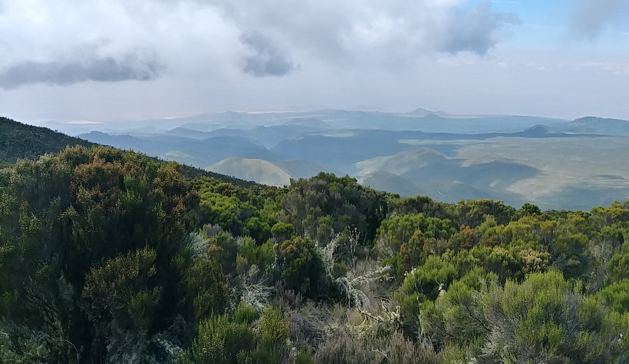
And, the scenery really changed today! We climbed up the Shira Ridge out of the jungle into tall scrub bushes and open sun. As the brush became smaller and our elevation became higher, we had great vistas out to the north and west where we could see the forest we had just left behind. All the big trees stopped growing at a certain elevation. You could see an obvious contour line where the trees stopped all along the hillside - very cool. And, we got our first glimpses up the high slopes of Kilimanjaro. Besides summit day, this was the hardest hike of the trek because it was warm and humid and a good gain of elevation. It was only a couple miles, though.
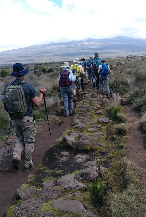

Reaching the upper end of the Shira Ridge, we traversed the Shira Plateau - a vast, relatively flat, plain reaching to the flanks of Mt. Kilimanjaro - to our campsite. So far, we've not actually been hiking on what most people think of as Kilimanjaro. The mountain has three volcanic cones: Kibo, the highest in the center at 19300 feet; Mawenzi, to the east at 17000 feet; and Shira to the west at only 13000 feet. Uhuru Peak is the top of Kibo and that is our destination but we've been walking up and along Shira the first 2 days. Tomorrow, we'll reach Kibo's slopes.
Across the plateau, as is true for the entire trek, the trail was obvious. Thousands of people a year tend to make a well-trodden path! But, for a half mile or so, the trail was constructed of large rocks arranged in a 3-foot wide path across the wilds. Some crew of workers put in a lot of time building it, but no one uses it. You can see in the photo that there are two well-worn dirt paths on either side but moss in the middle with the rocks. So, I guess another good idea that didn't pan out. Fortunately, it led us straight to Shira 1 Camp where we'll spend the night.
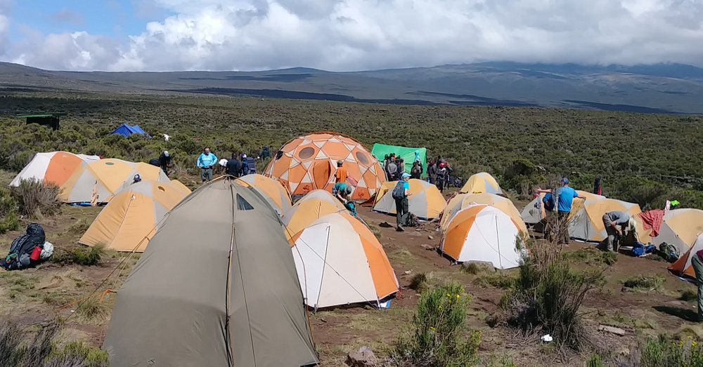

This second evening was absolutely the best camp of the trek. There was plenty of room and views all around, even up the slopes of Kibo. The big mountain was hiding above its blanket of clouds as it did every day from late morning until evening. As we waited patiently, the clouds gradually evaporated allowing glimpses of the peak before nightfall. It looked almost close enough to start climbing, but we'll not get that chance for four more days.
In this view of camp, you can see a portable toilet in the foreground and our large 'Thunder Dome' dinner tent dead center, behind which is the bright green kitchen tent. When we hike into camp, all of this is already set up every day! All we need to do is find tent #9, lay out our sleeping bags, change into camp shoes, and relax. Relaxing includes receiving a bowl of hot water to wash with, and then making coffee, tea, or cocoa in the Thunder Dome. It's a rough life! And, it's a strange feeling having others wait on me out here in the wild where I'm used to doing everything myself - I'm afraid I may get spoiled.
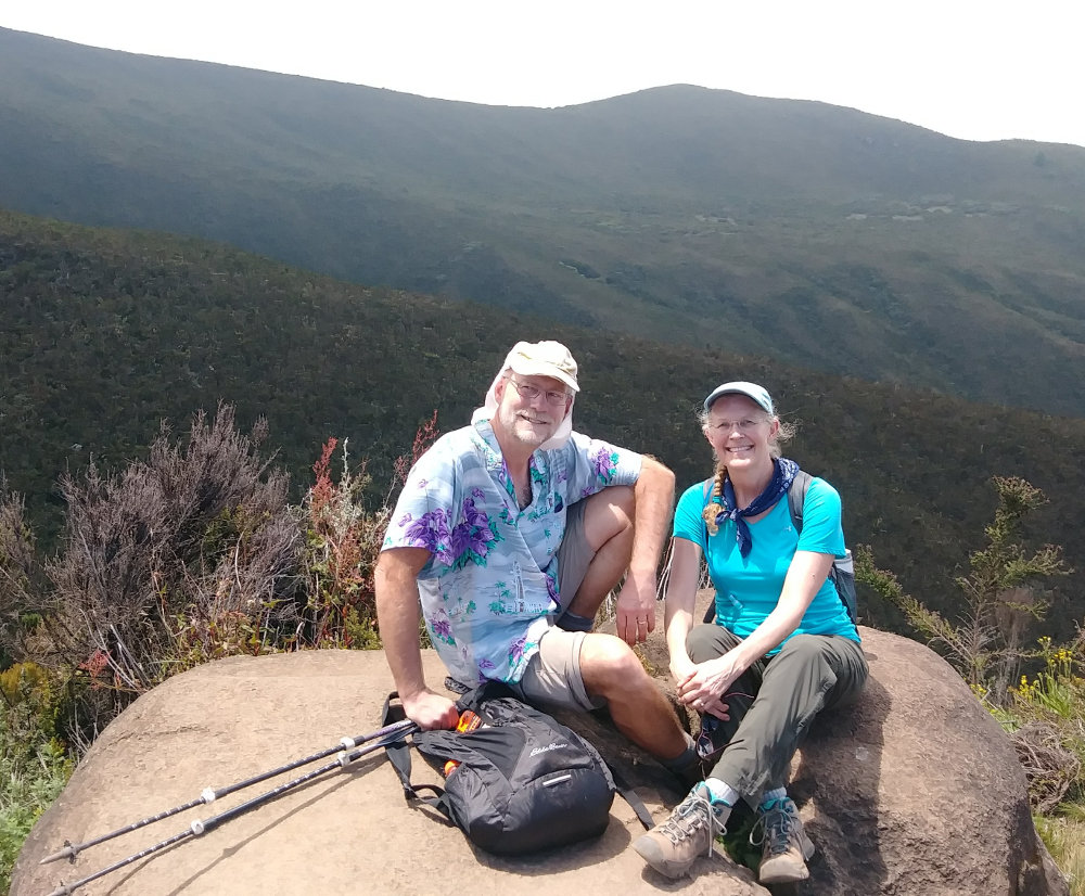

As you can see, my hiking attire on this trek isn't my usual drab, blend-in style. Since we're a big group, and there are multiple groups trekking, I figured something a little more vibrant might be interesting. It's totally not 'LNT', but there's no way to make a group of 100 people LNT, so I'm making it fun. I did notice on this and subsequent days that I tend to be more comfortable wearing a lot less than most others. The cooler temperatures felt nice to me while others put on gloves and fleece.
We hiked from 9200ft up to 11500ft over a distance of about 5 miles.
Posted: 02/27/2019
02/28/2019
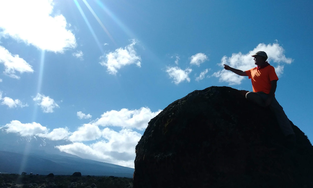
Somewhere out on the Shira Plains, we took a short snack break by this boulder - so I scrambled up and pointed the way to the summit! :-) Notice my attention-seeking shirt? I didn't want to get lost out here in the wilds of Africa!
From a crystal clear sunrise behind Kilimanjaro to the last rays of light bathing the summit, we had beautiful blue skies with the mountain showing off its crown of ice and snow. This was a wonderful day of walking with no hurry and plenty to see. After yesterday being the hardest hike, today was the nicest hike of the entire trek.
I woke before the sun today after a wonderful, warm night of sleep. Kili rose in the northeast with a bright star directly above it, but I couldn't get a good photo. So, I waited and watched in my down jacket and warm cap as the sun ever so slowly brightened the eastern sky behind the mountain. It was a peaceful half hour all to myself until the rest of the camp woke to the new day.
We've been given something of a schedule now. The support crew wakes and gets busy at 5am, starting on breakfast, making coffee and hot water for tea or cocoa. At around 6am or so, a couple guys come to each tent with a pot of hot, real coffee for whoever wants it. Since I don't drink coffee, I've spent this time out alone looking over the land, but others in our group love the wake up ritual. At about 6:45, we get hot water for washing, then breakfast is served around 7 or 7:15. Again, all we have to do is show up and eat - tough job! These guys making breakfast are the same ones that were up well after dark cleaning dinner dishes after making us a full meal the night before.
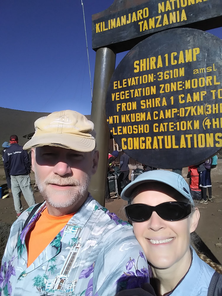

We're ready to start the day's hike once the sun warms us up. From down jacket to Hawaiian shirt by 8:30am, and it's time to start walking. Today, we gain 1300 feet, but it's a long, gradual gain throughout the day with a bit of a climb at the end.
Giving way to passing porters throughout the morning, our gang snaked its way across the plains. Nearly all brush has given way to grasses and occasional bushes. Distance is more difficult to measure and the miles slide past our feet. The highlight of the day is a sidetrip to Cathedral Point which you can see on the map track of our trip.
Reaching the far southeast edge of the Shira Plateau, a rocky ridge rose before us, but the main mountain was to our northeast. This ridge was actually part of the rim of the huge caldera we spent the past day hiking through. Of course, we had to climb up it to see what was on the other side. Actually, our guide told us to climb and we're good rule followers!
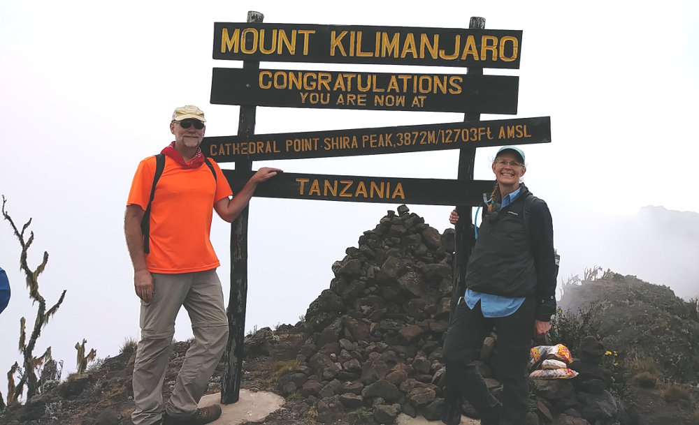

Scrambling up a couple hundred feet, we reached Cathedral Point with a sweeping view over the plateau back to our camp from this morning. On the other side of the ridge, the mountain fell away more than a thousand feet to jungle forest like we had left two days earlier. If King Kong had made an appearance, it would have fit perfectly. Misty clouds swept over the ridge, sometimes enveloping us, and then dissipating so we could see far below while we had a snack of hard-boiled eggs, mango juice, sweet rolls, and chapati (like a small tortilla).
Cathedral Point added distance to our hike, but it was one of the most interesting spots on our trek - definitely worth the extra time and effort to visit. Really, the day's hike before it was quite easy so a bit of rock scrambling was fun.

From Cathedral Point, we could see our destination for the day, but it was still a couple hours away, up the hillside. The trail took us past the end of the Shira evacuation route which was the end of the dirt road used in emergencies and included a helipad marked in rocks.
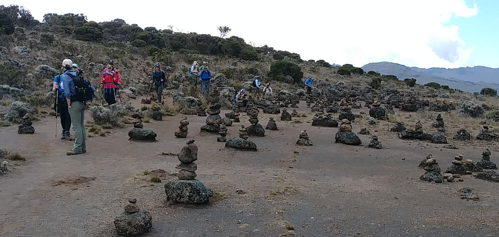
In this area, we also passed through a large rock-stacking scene. I had read that Kilimanjaro is a trash heap from the thousands of visitors, so I was expecting a mess. So far, there had been little trash, some graffiti scratched on rocks, and just a highly impacted pathway. It was much better than I had hoped for. This was the first 'Hey, Look At Me' place we'd encountered, and my Leave No Trace hackles raised a little.
Rock cairns are useful when placed to mark a trail, but some people enjoy stacking rocks for no reason except to to leave their mark. Some folks like seeing these piles, but they emphatically declare 'Kilroy Was Here' to anyone passing by and detract from the natural experience. Humans have this impulse to mark territory, and some just can't hold it in check. These stacked rocks appeared quite often along our trek up the rest of the mountain, not as markers but just scattered about around rest areas. I expect it may be due to hikers being bored with long rest breaks at these spots.
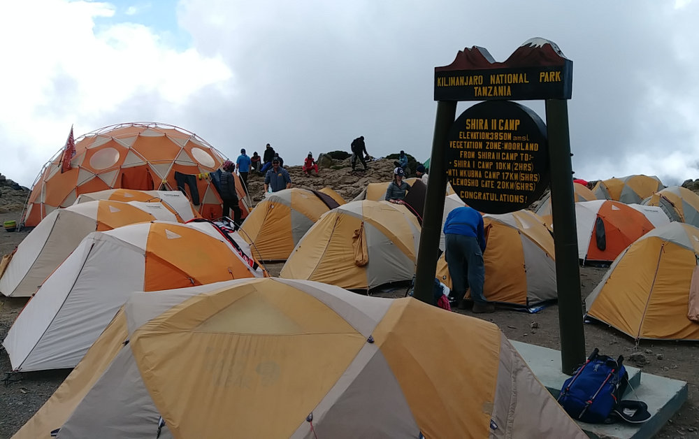

The last mile or so today was a steady climb to Shira II Camp actually on the shoulder of Mt. Kilimanjaro. There was less space here, but we still had comfortable, flat tent spots. As it turns out, one of the porters has a special job each day. He leaves early in the morning to run ahead to our next camp and stake out our territory, hopefully arriving before runners from other trek groups arrive. It seemed our runner was very good because all our sites were very good, as far as I could tell.
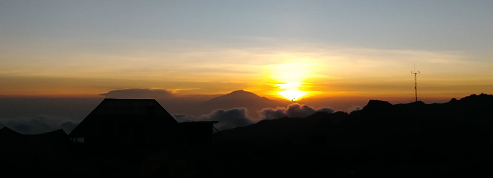
Now that we are higher up, the views are becoming far ranging. Besides having Kilimanjaro looming above our back, we can see across the plains far below and off to Mt. Meru to the west. With clouds staying away all day, we had a beautiful sunset almost directly behind Mt. Meru - and then the temperature dropped. Being up so high with thin, dry air, as soon as the sun set the chill set in. It was a brisk, fresh cold though, making for a great night's sleep.

We hiked from 11500ft up to 12800ft over a distance of about 6.25 miles.
Posted: 02/28/2019
03/01/2019
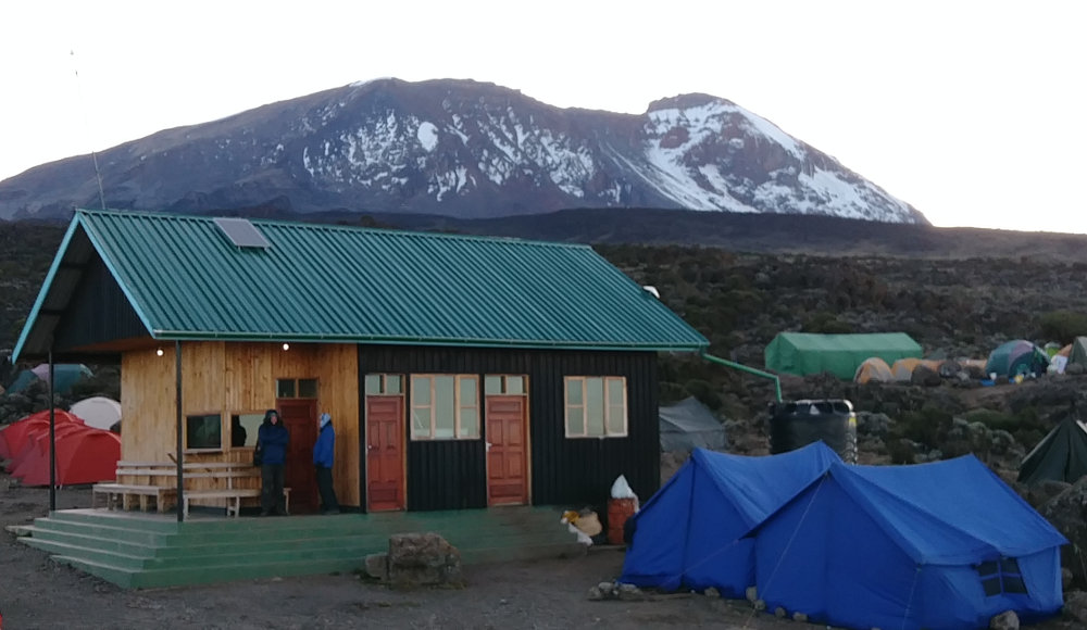

For sure, we're spoiled now. Three days of perfect weather, great views of the mountain, wonderful food, easy hiking, good sleep, it's all going wonderfully. We were even treated to the sun rising from behind Kibo in another clear sky day. Ok, hang on, you know it's going to change...
The usual morning coffee, hot water for washing, and over-indulgent breakfast prepared us to start our daily walk around 9am. Today, we headed up the hillside at our typical Pole Pole pace, making way for porters as they sped past with our gear, tents, food, and toilets. In this wide open, vegetation free, expanse of mountain desert, the support crew has many paths past us so they pay us little mind. We do our best to share a friendly 'Jambo' and step out of the way.
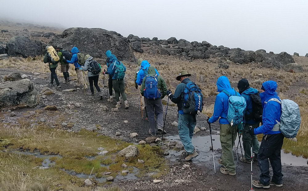

Up we go, heading for the highest point any of us have ever been. I've hiked a bit over 14,000 feet, but we'll top out above 15,000 today. Along the way, clouds form below us and begin blowing UP the hillside towards us. These are the same clouds we've seen every day since arriving, only now we are above and then IN them. The mist is chilly and most everyone puts on warmer layers and raingear. We are so high that the air is cold enough to freeze the moisture and we are pelted with hail. This only lasts off and on for an hour or so.
There is not much scenery with the encompassing clouds and desolate landscape, but it is still a great day. It doesn't take much imagination to feel you are visiting a different world. We walk on, mostly over a long, gradual rise to our lunch stop destination.
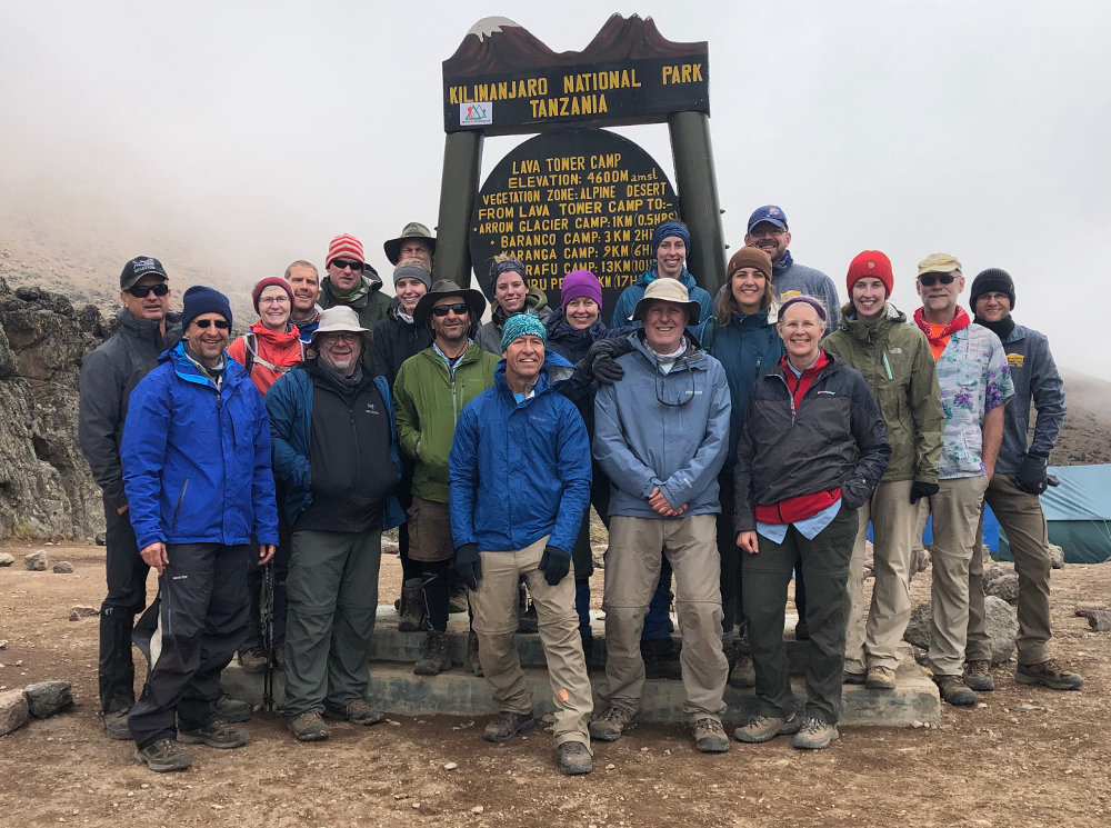

Lava Tower is a well-known stopping point. On this day, it marks the highpoint of our climb and from here we will drop down, losing all the elevation we gained today to this point. Today is designed to be an acclimatization hike. We hike up to get our bodies used to the thinner air, and then descend to sleep for the night. Actually, no one complains of any altitude problems, so we're doing just fine so far.
As I mentioned, some of us tend to enjoy cooler temperatures over warmer. In the photo, you can see one person in short sleeves - Yes, I was comfortable and felt just fine. :-) But, I did have my raincoat on earlier during the hail - because my wife gave me 'that look' letting me know I was being weird. This turns out to be the only bad weather day we have the entire trek and it wasn't really even enough to cause concern - the wind on summit day was awesome, but no really 'bad weather'.
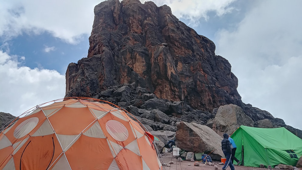

Here at Lava Tower, our crew had gone ahead to set up the kitchen, toilets, and Thunder Dome. I was just expecting a simple snack as we had the previous day at Cathedral Point, but this was over the top. I can't say enough times how pleased our group is with Tanzania Choice Safaris as our outfitter. The tower itself is an especially hard pack of volcano lava that has not eroded with the rest of the mountain, causing an impressive butte. People can arrange climbs of the tower as part of their adventure on Kili.
After our wonderful lunch, we had to force ourselves back into the clouds from our comfortable dining tent to continue the hike to camp. This half of the hike was nearly all downhill, so it was mostly a matter of watching our footing on the rocky trail. There were a couple ups and downs along the way, but not too bad. We descended through a forest of Dendrosenecio Kilimanjari trees - more commonly called Senecio trees. Our guide for the day, Augustine, took time to explain how to tell the age of the trees, but I'm not sure any of us actually understood it all - something about each hip was 25 years, and some trees were over 100 years old.
Each day, we had a different guide leading us, and a second as the caboose. This was something to look forward to each day as it gave us opportunity to meet a few Tanzanians and learn from them. They all spoke English and were very friendly and helpful. Our lead guide, Festo Mtui, would visit us somewhere on the trail each day, sometimes joining us for an hour or so, sometimes longer. Keep in mind, this one man was managing a team of 80+ workers and keeping 22 clients safe, happy, and comfortable.
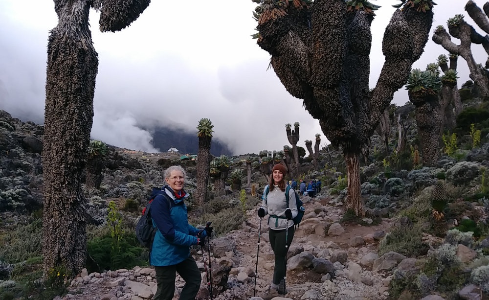

Our day came to a close at Baranco Camp, at about the same elevation we started this morning. In this photo, you can see the Senecio trees and camp in the distance. When we reached camp, the support crew was all assembled and sang a wonderful, energetic, welcoming song as a nice treat.
We hiked from 12800ft up to 15000ft and back down to 13100ft over a distance of about 6.25 miles.

Posted: 03/01/2019
03/02/2019
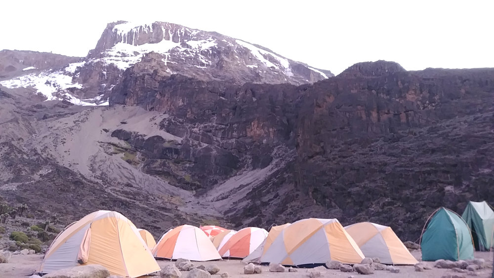

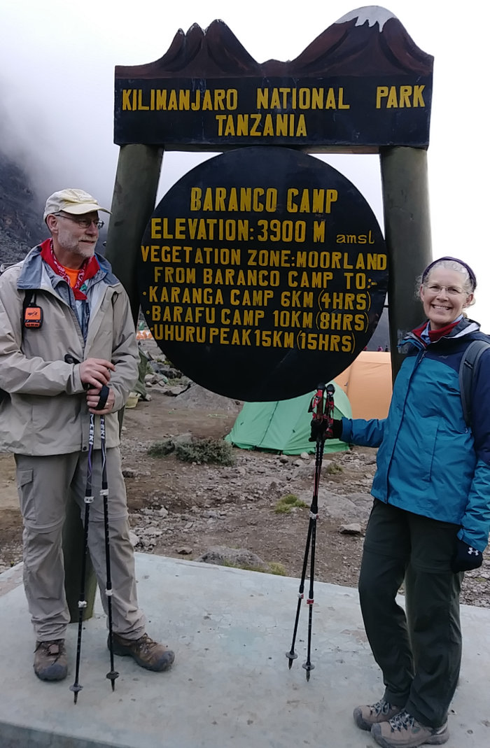
Shira I Camp was at ~11,500 feet, Shira II at ~12,800 feet, Baranco at ~13,100 feet, and today's destination is also ~13,100 feet. In the past three days, we've only gained 1600 feet on the mountain, and we have 6200 feet to the summit. Looking at the numbers, it may seem like a waste of a few days. But, spending these days hiking over 13,000 feet is giving us plenty of time to acclimate to the lighter air. I haven't really felt any physical challenges, altitude symptoms, or even sweating. We've been going very slowly (Pole Pole) and enjoying the time out here in the fresh air and crisp weather. The statistics show that this longer, slower Lemosho route has a higher success rate than shorter, steeper routes that cut out days and demand more of your body. We'll see.
Our view of the summit from Baranco camp this morning was gorgeous. We could certainly just scoot right up there today if we wanted, but we still have one more camp before our summit attempt. And, to get to that camp, we have to scale the notorious Baranco Wall!
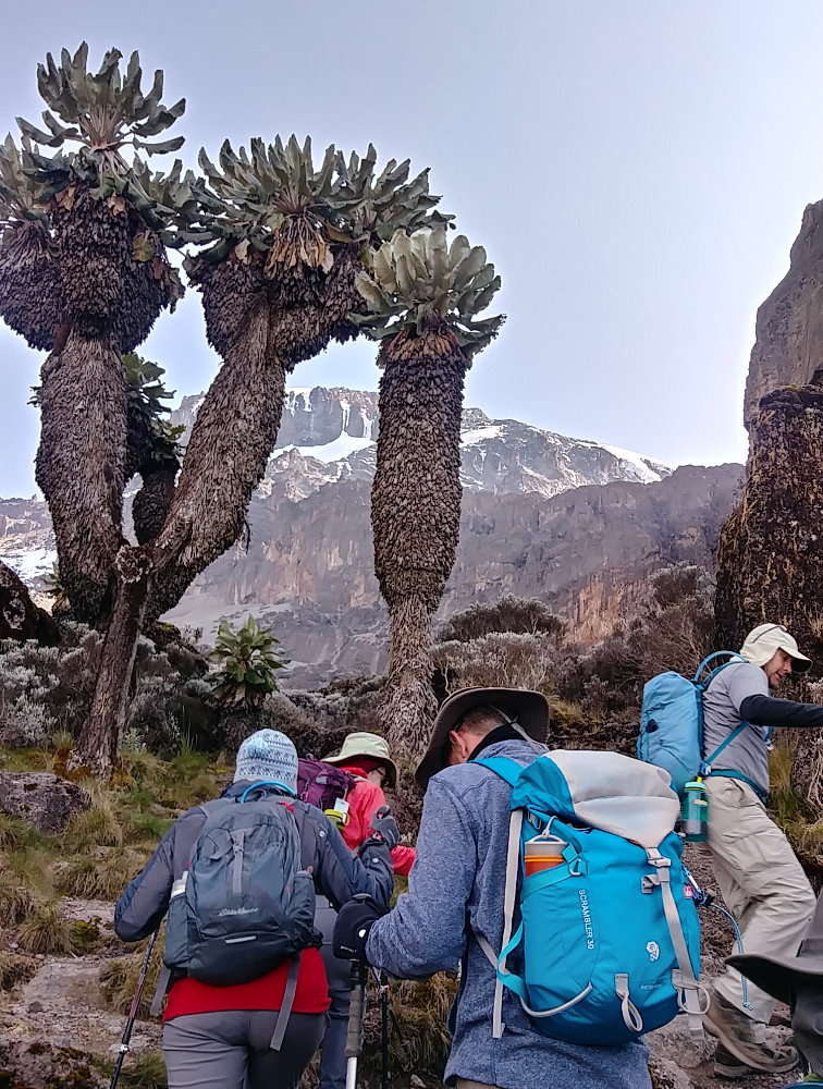

OK, on pretty much any long trail or popular adventure there is at least one part that gets hyped up as being a real challenge. On Kilimanjaro, from what I've read, it's the summit attempt and the Baranco Wall. I've read how it is practically vertical, very narrow trail, hundred foot falls to certain death, palm-sweating terror, clinging to rock faces, and so on. I guess it's all relative. I thought it was one of the most fun parts of the entire trek. We got to scramble up rocks, there wasn't much room, and if you jumped off the trail you would probably die. But, it was safe, took about two hours, and had exactly one spot where you needed to hug the rock wall. That is evidently called the Kissing Rock but you'll have to google images of it because I didn't stop to take a photo.
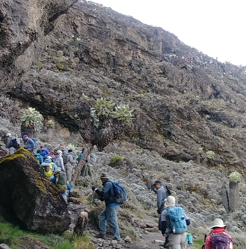

The Baranco Wall was a fun way to start the morning. Right out of camp, we crossed a small stream and then spent the next couple hours climbing up and making way for porters. Since there was not much room, we gave way to porters often and they hopped on up like mountain goats. You can see there are people far up the cliff ahead of us, but the trail is easy to follow.
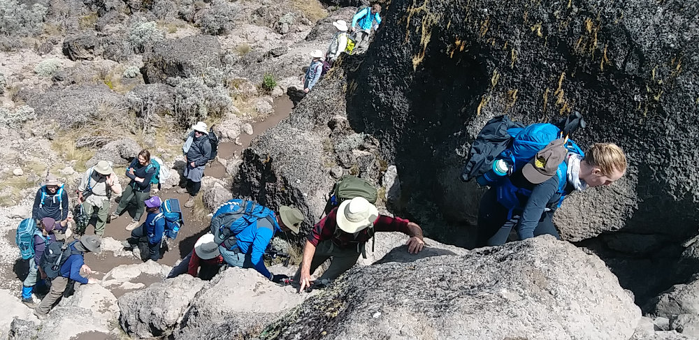

In a few spots, we did need to put away the trekking poles and use hands and feet. It was a nice change, but could be challenging for some. Speaking of trekking poles, they are something to consider. Almost all of us had them, mostly renting from the outfitter rather than transporting across the ocean. But, they were not really needed for the vast majority of the trek. I used mine most days, but only really appreciated them on the summit day and descent. One person in our group just kept them in their pack the entire trip.
At the top of the Baranco Wall, we had a nice rest break on smooth, solid rock with the sun shining brightly. It was a great respite, but our guide didn't let us lounge around for long. We still had a few miles ahead of us and we were getting pretty good at Pole Pole, maybe a bit slower than the guides wanted.
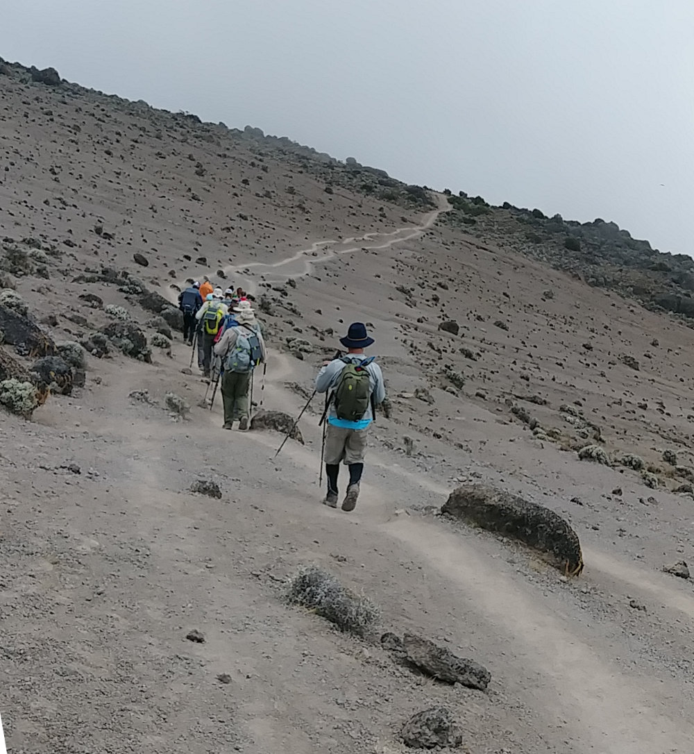

After the wall, we were above almost all vegetation. It was much like a moonscape with dust and rocks all around. The trail was obvious and porters could fly past after being crowded on the narrow wall trail.
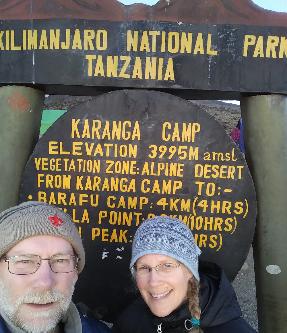
Cool weather, skittering clouds, and easy trail made the rest of the day's hike fairly uneventful. The last half mile had us drop steeply into the Karanga Valley and then just as steeply climb up the other side to our campsite at Karanga Camp. The Karanga Valley is a deep ravine that drops hikers a few hundred feet in elevation and provides moisture and protection for more plant life. Senecio trees, mosses, and and brush filled the hillsides for our last bit of 'forest' until after the summit.
Up the valley towards the mountain, I noticed a second trail where porters were busy bringing water from the creek up to the camp - almost a half mile each way. It made me appreciate the water at camp a bit more this night.
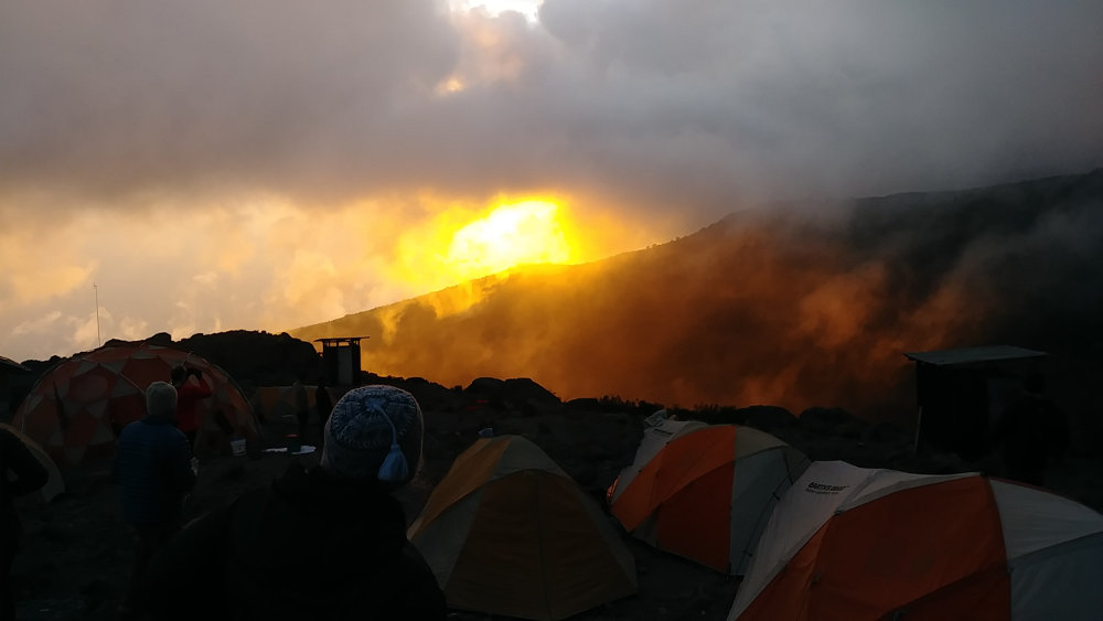

We're still right at the preferred elevation of the clouds. They played tag with us all afternoon and provided for a colorful sunset. They also kept the air moist and chill so warm layers were put on as soon as we stopped hiking for the day to relax in camp. It was a short day of hiking, but the alternative would be to hike all the way to the next camp and then do the summit attempt tonight - some crews had that itinerary but it just sounds like no fun to me.
We hiked from 13,100 feet to 13,100 feet, with a few deep valley and high ridge crossings, over a distance of about 3.5 miles. We have now come from the western slopes all the way around to the east and have just a couple miles to our last camp where we finally start going vertical.

Posted: 03/02/2019
03/03/2019
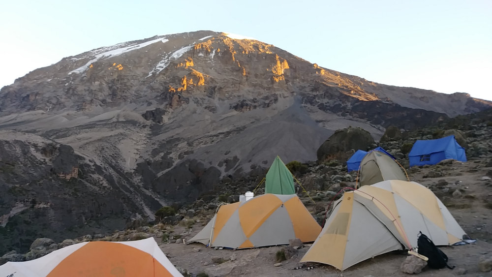

We are SOOOO Close! Looking up at the summit this morning felt like we really should be on our way up today! But, just one more short hike to get in position to push to the summit.
We've now been over 13,000 feet for 2.5 days and I've noticed no altitude issues at all. If I walk a short distance up the hillside at a normal pace, then I get winded, but no headache, sleeplessness, nausea, dizziness, or fatigue. I've checked my heart rate a couple times each day and it's normal. So, the Diamox we are taking is helping and/or we are treating our bodies well by slowly gaining altitude and taking it easy.
As usual, the clouds are all gone this morning and we have another beautiful, blue sky day ahead of us. I'll bet money that the clouds will build by 11am though.
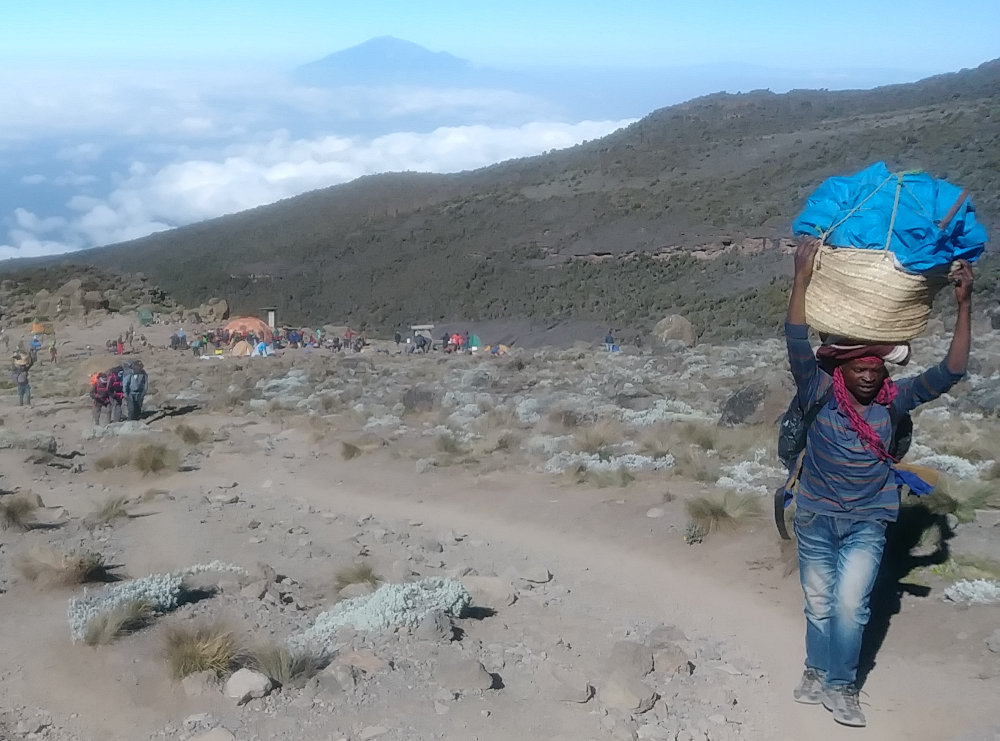

This will be the last day that our porters need to carry gear up the mountain. This young man is leaving Karanga Camp carrying his own 10 pounds of gear, plus 30 pounds of our stuff. The porters do amazing work on Kilimanjaro and watching them is the hardest part of the trek for me. Our outfitter seems to treat all the workers appropriately, holding to the rules in place and not abusing the porters. It's very hard work, but I've heard from many sources that it is the best work available in the region. Some of the key rules are:
- Porters get paid at least $8.50/day
- Porters carry no more than 15kg of gear plus 5kg of personal gear
- Porters get paid, plus tips, immediately at the end of the trek
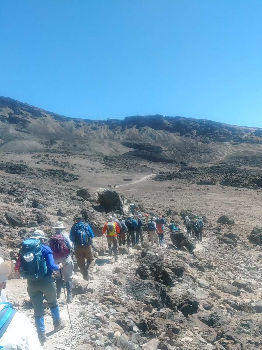

A couple hundred feet up the hillside from Karanga Camp, there was absolutely no vegetation left. From here on, rocks, gravel, sand, and dust are our friends! The sun is bright, the sky clear above us, and the trail a gradual climb along a well-worn path as we gain 2,200 feet - about 1000 feet per mile. This is a fairly steep grade, but we Pole Pole up and up, taking plenty of short rest breaks to enjoy the barren landscape and gaze over the accumulating clouds far below us. As long as they stay down there, we'll be just fine.
We have the mountain peak high above our left and the cloud covered plains far below our right all morning as we kick up dust. This photo shows our long, final ascent to Barafu Camp at 15,300 feet. We'll be camping up on that ridgeline where the trail seems to disappear.
From Karanga Camp to Barafu Camp, we crossed no streams or water source of any kind. That means all the water we use up at 15,300 foot high Barafu Camp, and on our summit hike, is carried all the way from the stream in the Karanga Valley which is about 3 miles and 2,500 feet in elevation away! A 5 gallon bucket of water weighs about 20kg. At this camp, we don't get bowls of hot water for washing - instead, we use a couple of wet wipes on our face and hands. All the water for drinking, cooking, and toilets is carried up.
Trying to make a tiny bit less work for others, I filled all my water bottles at Karanga and carried the water up myself so I would have it ready for the summit attempt in the morning. At least someone else didn't have to carry that small amount so far.
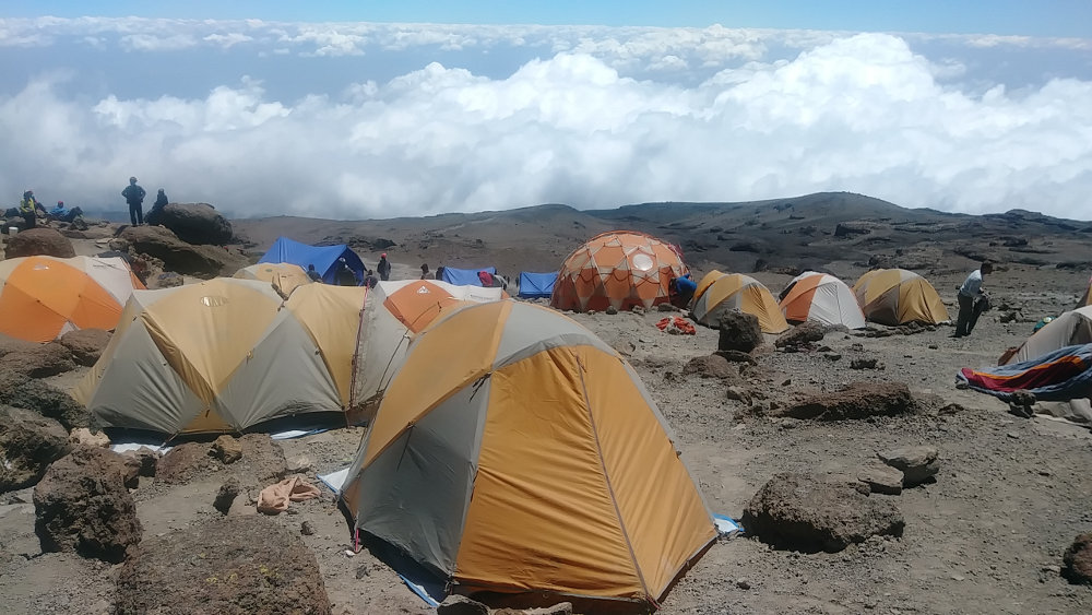

We reached our temporary home very early in the afternoon. The idea is that we'll clean up, eat, and then get what rest we can before we start our climb around 2am. It is pretty impressive how our crew can find flat tent spots on a rocky mountainside for all of us - well, for our tent at least. We've had wonderful spots at every camp. Here, you can see our tents packed between rocks with the cloud cover boiling below us. It's a beautiful, dry, breezy afternoon to rest and wait. Of course, over the other shoulder is the imposing summit silently waiting for our attempt to join the hundreds of thousands of others that have scampered to the top.
We hiked from 13,100ft up to 15,300ft over a distance of about 2.25 miles.
Posted: 03/03/2019
03/04/2019
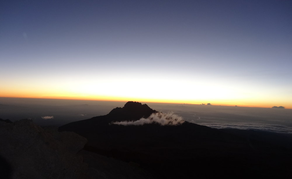

The excitement of 'Summit Day' came early for us. As we rested in the late afternoon at Barafu Camp, our cooks were hard at work. We enjoyed an early dinner in the Thunder Dome dining tent and then had the tough job of resting until our 2am planned departure for the summit.
The breeze that typically died off in the evening every day so far decided to take a different tact this day. As the sun sank lower, the wind picked up. And picked up. And picked up. The stakes holding the vestibule on our tent tore out of the ground, so I got out and piled rocks on them. They tore out again, so I got bigger rocks. Other tents were being buffeted as well. Inside the tent, all was fine and we could tune out the noise and fall asleep.
I'm not sure of the time, but I woke and it was dark night. Our tent was rattling and the vestibule was flapping yet again. I went out to fix it, and heard a commotion above the roar of the wind. Where our dining tent had been, there was just empty dirt. The entire tent had torn loose and blown somewhere out into the wild down the mountain! The kitchen tent was partially flattened and other tents were being rocked around, but held in place. Porters scrambled around to check stakes on some tents and pile more rocks on them. I had taken care of ours, so I headed back to bed.
Around 1am, I woke up and we got ready to go. I put on some layers and went out to see how I felt. I quickly went back in the tent and put on every layer I had - long undershirt, shirt, fleece, down jacket, and rain coat - long underwear, pants, rain pants - mittens, face mask, and stocking hat. I figured we would be doing a lot of standing around on the climb and that wind was doing a good job of pulling heat away. Eight hours after it started up, the windstorm was still building and it was difficult to even hear someone right next to you. Even with all this, the staff had hot drinks for us before we headed up the mountain - amazing!
There's not much to say or show about slowly hiking up a mountain in the dark. For the next 4 hours, we just trudged along following the person ahead of us. The sky was clear so we could see a trail of twinkling lights up the mountain as all the other climbers started earlier than we did. And, the stars were bright above. Eventually, the eastern sky lightened, we turned off our headlamps, and the sun finally rose. That didn't stop the wind, raise the temperature, or make the mountain less steep, but just being able to see around made the climb nicer.
About sunrise, I noticed that the vision in my right eye was blurring. The strong wind was blowing from the north, our right side, and I figured that must be causing problems. Dust and sand were flying and pinging off my face, but I didn't feel any irritation in my eye, just blurred vision. That's a bit scary when you don't know what's causing it. As it turns out, at least 7 people in our group experienced the same blurred vision - only in their right eye. A little research later indicated that blurred vision at high altitudes is a thing, somewhat common (After we descended later in the day, the vision problems went away).

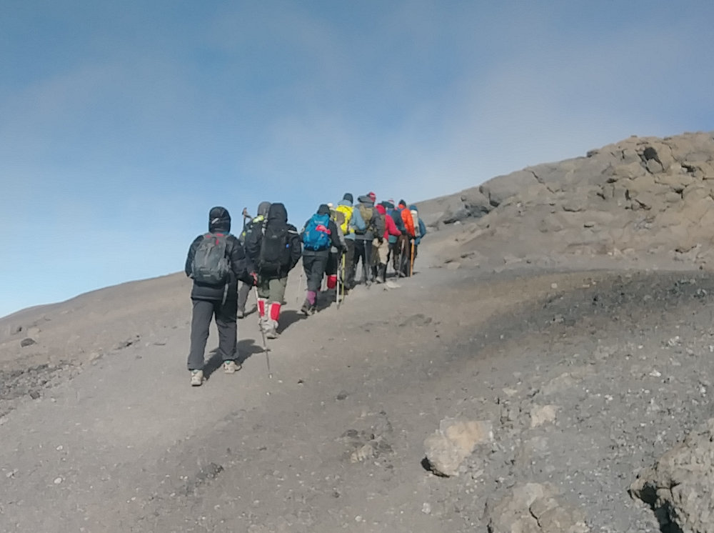
The vision excitement was the only big deal I had happen on the climb. It was just a steady walk all the way up with little talking, a few short breaks, and plenty of dust. The temperature didn't seem all that cold, but it was enough to have frost on my faceshield, and ice slush in my water bottles. Quite a few people had their camelback hoses freeze up. Some people ran out of water (I shared mine).
Once it got light enough to see, I did notice there were some climbers coming down already - much too early to have made it to the summit. They were just 1s and 2s, and escorted by guides. I counted 11 separate groups, but I expect there were more I missed. They may have turned back due to the wind, exhaustion, or altitude illness, but they did not make the summit. None of them were from our group.
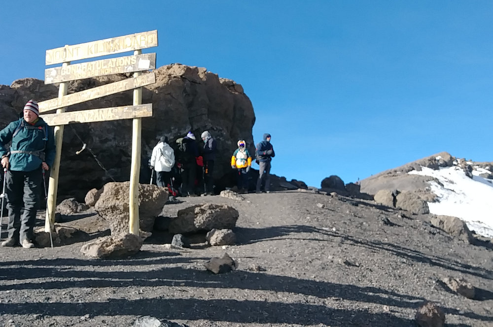
Around 8am, we finally finished the steep part of the climb and arrived at Stella Point. This is on the mountain rim, but not the absolute highest point. By this time, our large group had split into a few smaller groups going different speeds. We were in the first group and just kept on hiking after a short stop at the sign. The weather was pretty much the same except that clouds were now skittering across the landscape, hiding most of the summit view.

From here, the trail across the relatively flat mountain rim was soft and comfortable. The air was cold and thin, but everything was going just fine. Another 40 minutes or so of very easy hiking and we arrived at Uhuru Peak, the official summit. We made it! The clouds soared past, sometimes blanketing us in a whiteout and sometimes evaporating to show off the summit views.
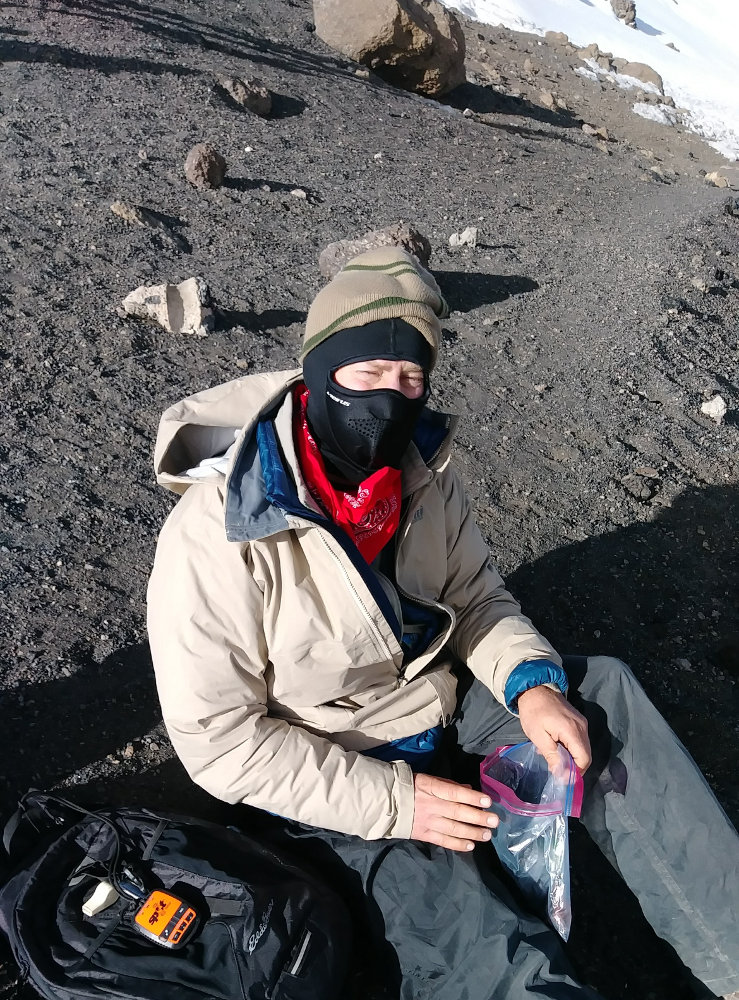

Here's me taking a snack break at the top just to show what I wore. The faceshield really worked great, warming the air a bit before breathing it in. I was never cold, nor sweating. By unzipping all the layers, I stayed just right the entire hike. The raincoat was a great windbreak and the down jacket insulated well. I carried my Spot Tracker on my day pack.
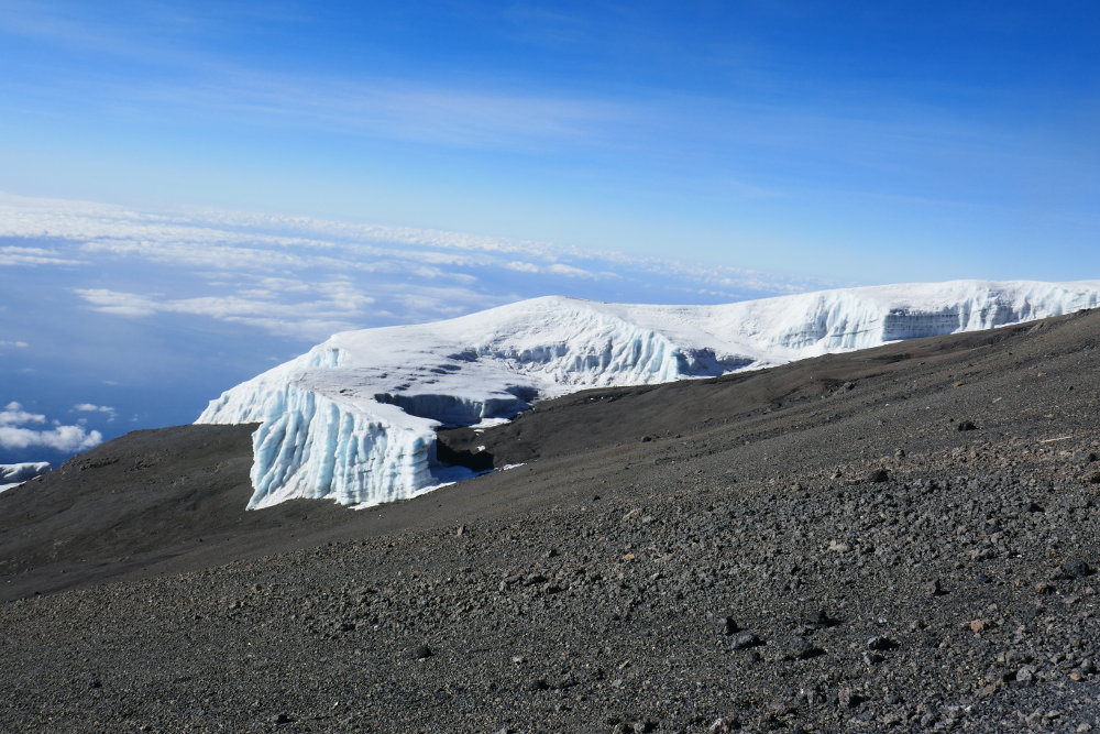

The Kilimanjaro glaciers are one of those brilliant natural wonders that are disappearing. Some say they will be gone in a few years, others say a few decades. There is only 18% of the ice that was there 100 years ago, so book your trip soon if you want to see them!
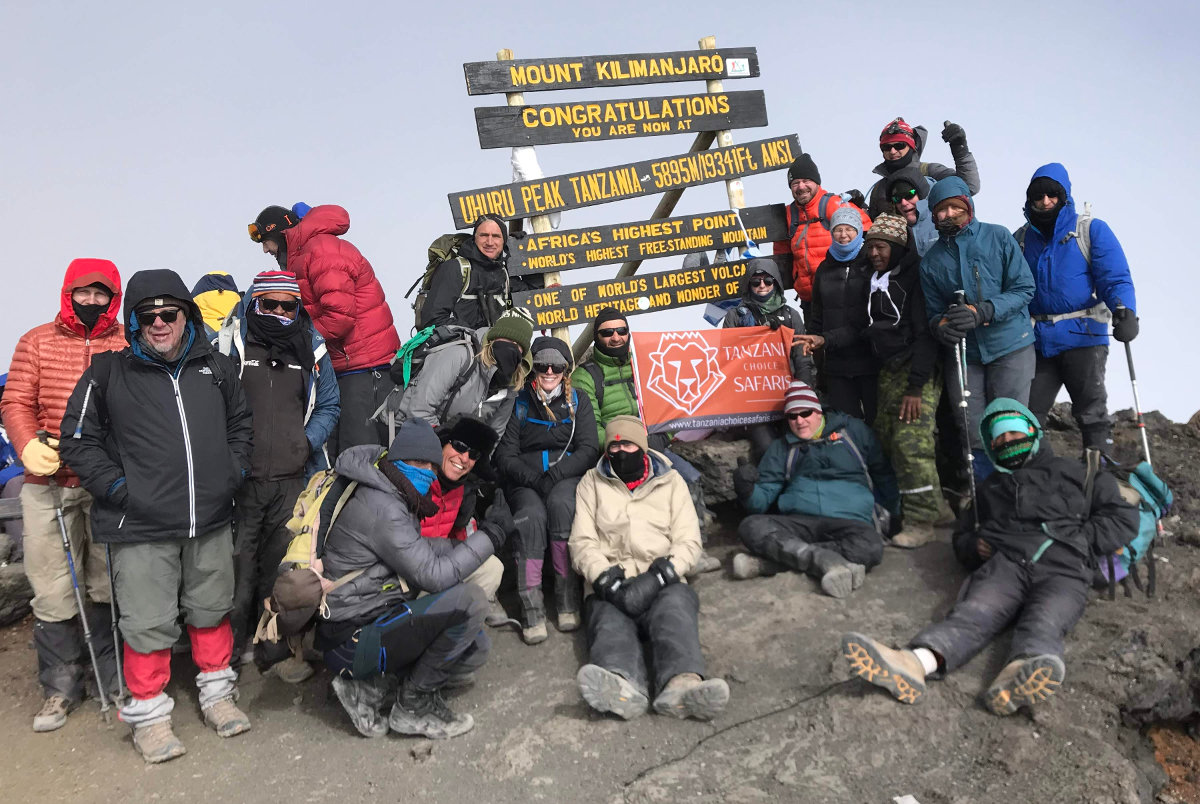

The majority of our group (16 I think) were at the sign at the same time. Another 5 were climbing slower and we were told to head down before they made it up. One person stopped at Stella Point. So, our entire group of 22 made it to the top of the mountain. I believe that is mostly because we took a long, slow route up the hill with a great support team that made sure we were doing well the entire trek.
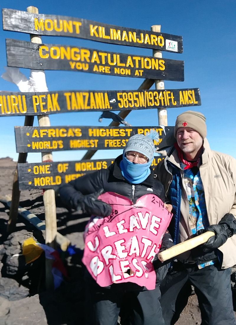

We summited on Valentine's Day, so my wife had a surprise card along that said 'You Leave Me Breathless'. The wind was STILL blowing so hard, it was a challenge to show it off.

After only a very short time at the summit, we had to head back down. This was my one disappointment looking back on the trip - I would have liked to enjoy the summit longer.
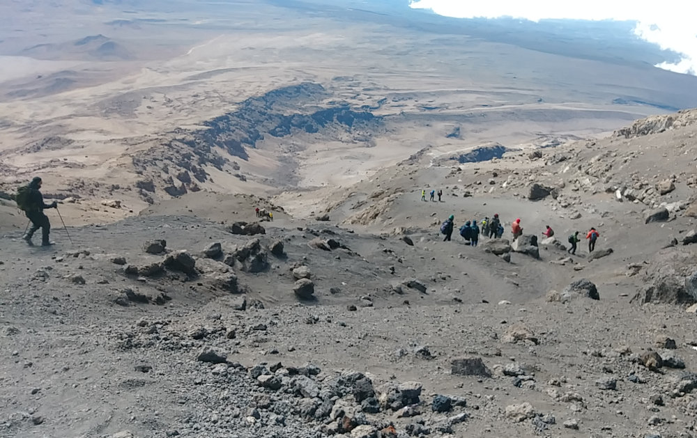
The descent had caused me the most worry when planning for this hike. I was concerned how my knees would do pounding down a steep hillside for 6 or 7 miles. As it turned out, the soft scree and sand acted like a cushion for each step and my legs did just fine. It was a relatively fast hike down since gravity was helping so much and the trail was fine. We reached our camp at about noon, but could only stop for a short rest and to pack up our gear. This was because camp was moving down the mountain to make room here for the next wave of climbers coming up.
While we were gone for the past 10 hours, the wind had been blowing dust everywhere and there was a layer over everything inside our tent - because the vestibule had come loose yet again. Being the worst of our problems, that was really nothing. We packed up, gathered about 10 or 12 of us, and headed down, down, down being led by George our guide to Millennium Camp at 12,500 feet. It was an uneventful hike, but I really enjoyed dropping through all the environments as we got lower. Grasses, then bushes and brush, small trees, and finally forest covered the land as the elevation dropped.
Hopefully, this video will give you an idea of what the wind was like on the mountain. This is not our camp - it is one a bit higher up that we walked past on our way down. We found out later that some groups that were to summit the day after us had to abort their attempt because their tents and equipment got destroyed by the wind.
We hiked from 15,300ft up to 19,341ft and down to 12,500ft over a distance of about 9.25 miles.
Posted: 03/04/2019
03/05/2019
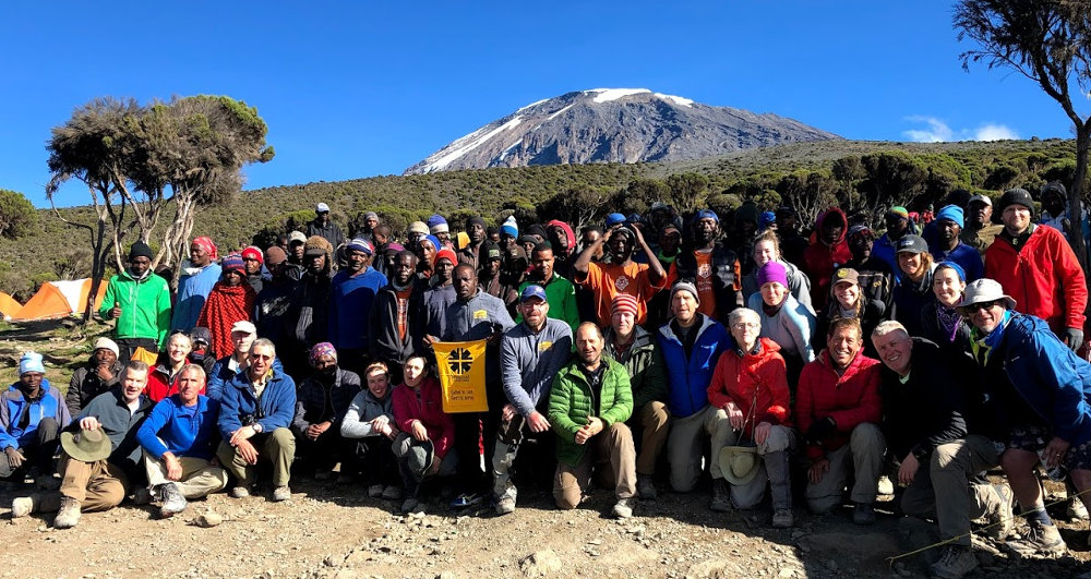

Our last meal on the mountain was a wonderful breakfast in the Thunder Dome. Yes, it had been recovered after being blown away last night. A few rips in the top, but still able to stand. After breakfast, we had the traditional Thank You ceremony with the support team. This is where the clients present monetary tips to the various support roles - porters, cooks, toilets, guides, and lead guide. It's customary to present the money and announce the amounts in front of all so there is no chance someone might pocket some that should be distributed. A couple fun songs and we were ready to scurry down the hill to a bus, lodge, and showers!
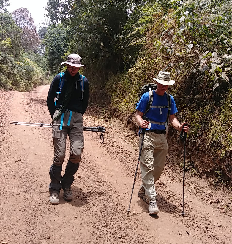

Surprisingly, today's long walk downhill caused more slips and injuries than the rest of the trek. The trail was fairly steep through a beautiful rain forest with lots of terraced steps that meant hard pounding of feet. That trail opened into a gravel road for another couple miles. The sand on this steep road was very slippery and I heard that most of us slipped at least a few times on the way down. I slid four times myself, with no injury but just more stress, and I saw one person not in our group actually fall ahead of me.
One highlight of this hike was that there were many monkeys causing a ruckus in the trees overhead a couple times. The other highlight was reaching the exit at Mweka Gate and having a cold beer while waiting for the rest of our gang. When we were all down, it started to rain as we loaded the buses, and there was even a few claps of thunder up the mountain. We drove to Meru Meru Lodge for showers, drinks, and a celebration dinner, followed by sleep in a luxurious bed.
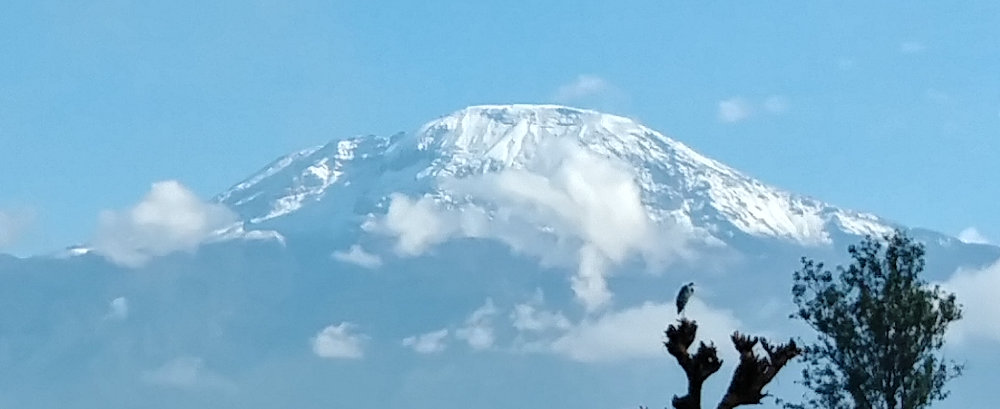

Even though the wind was a challenge on the mountain, we were very, very fortunate with weather on our trek. The wind destroyed some camps, and when we go off the mountain, it rained. Higher up, it snowed! This is the view of Kilimanjaro from our lodge the next morning when we woke to clear skies. Compare that to the photo of our mountain family above and you can see that our entire summit day would have been through fresh snow today.
We hiked from 12,500ft down to 5,400ft over a distance of about 7.5 miles.
Posted: 03/05/2019
Older Posts Newer Posts
Find more Hiking Resources at www.HikingDude.com


Follow Me
Recent Comments