
Hiking Dude Blog
2025 - Aug Jul
2024 2023 2022 2021 2020 2019 2018 2017 2016 2015 2014 2013 2012 2011
09/21/2018
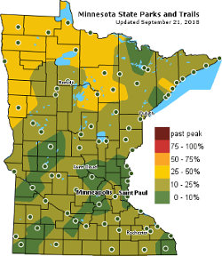
 Do you know your Beta-Carotene, Anthocyanins, Flavonols, and Chlorophyll? Well, those big words are the basis for the eternally entertaining display of fall colors on deciduous trees. The tree in our front yard is a beautiful maple and always gives off a great display for the neighborhood. This is the BEST time to hike through the woods, enjoying the rainbow of colors, lower humidity, and lack of insects.
Mrs. Dude and I are looking forward to a few days of hiking and camping 'up north' to take in the wonderful fall tree colors that usually grace Minnesota. It can be a gamble to plan just when the best time to go might be. The best colors fall within a 3 week window, but can be early or late depending on weather all summer, and especially on September weather.
With all the technology and historic data available these days, it is getting much easier to target the best dates for specific areas. For Minnesota, the DNR has a good Fall Color Finder map that gets updated daily. They have an image that shows typical peak color times, but do not predict the best times for this year.
I found a Fall Foliage Prediction Map that shows the entire country and the expected best times for color wherever you want to go. So, it looks like Oct. 6-8 will be peak color along the Minnesota north shore - Perfect!
Unfortunately, forecasts call for rain now - but it's still far away and I have my fingers crossed.
Hike On and enjoy your local colors!
Posted: 09/21/2018
10/28/2018
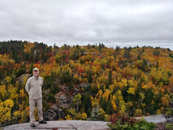

The fall colors have been great the past month, but the windstorm last night took down most of the lingering leafs. The brown oaks still have a long time left, and all that darn buckthorn is still green - grrrr. We spent a day hiking on the Superior Hiking Trail a few days ago, finding some great patches of maple, birch, and poplar at their prime.
We hiked up Britton Peak, Carlton Peak, and Section 13 covering just about 10 miles. The timing was perfect, but the weather was contrary - it was misty and rainy much of the day. The best kaleidoscope of color was on top of Section 13 by Finland. When anyone now asks me for favorite fall color spot, that is it! It is a steep, but short, hike in from the nearest trailhead up to lookout views over hillsides of deciduous trees, rock outcroppings, and a beaver pond far below.
One reason I wanted to put in a few more miles on the SHT was because it counts as part of the North Country national scenic trail.
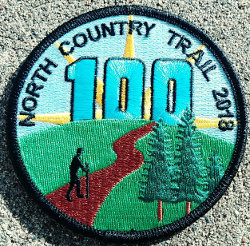

So, why is that important? Well, the NCT Association is running their #Hike100NCT program again this year. If you hike 100 miles on the NCT, they will send you a patch and certificate, and everyone loves patches! Since I had done 93 miles on my SHT hike in July, the 10 miles we hiked this time put me over the threshold. I received my patch after sending in my information. It is very easy to do. Just go to the Hike 100 page, sign up, and submit your hike completion form online.
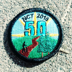

You still have two months of hiking, until December 31, to complete the challenge. It does not have to be 100 different miles - you could just walk back and forth on the same mile 50 times if you want. If you think 100 miles would be just too far, the NCTA has added a 50 Mile Challenge this year - smaller patch for smaller miles. And, if you do 100 miles, they will send you both patches!
Since the NCT is 4600 miles, folks from North Dakota to New York are pretty close to it.
If you are really into patches and hiking, you might also check your local state Department of Natural Resources (or similar) website to see if they have a hiking patch program. Minnesota does at this page. Another hiking patch program is at 52 Hike Challenge. And, there are dozens of other hiking challenge programs - just google it.
Hike On
Posted: 10/28/2018
02/05/2019
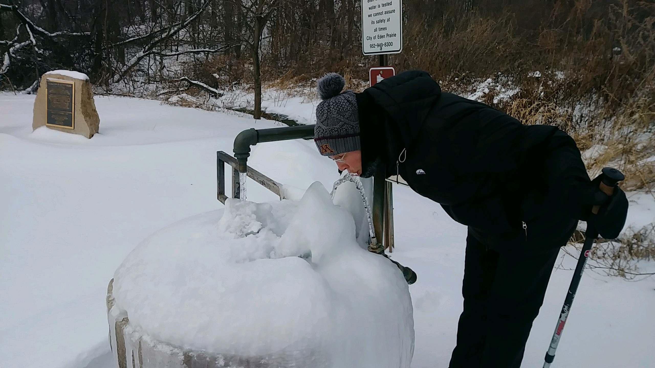 Many days of 5, 6, and 7 mile practice hikes have filled the past couple months. Not really much to share except cold, cold, cold - and ice, ice, ice.
But, today we leave for Africa and a trek up Mt. Kilimanjaro to the Roof of Africa at 19,300 feet.
I'll have my spot tracker along so you can at least see our progress over the 8 day trek but I also hope to post a few times.
This will be a much different adventure than I'm used to - porters carrying my gear, cooks making my food, even someone setting up my tent! It's weird thinking about it but I guess it is required to legally go up the mountain.
Jambo! Hike On!
Many days of 5, 6, and 7 mile practice hikes have filled the past couple months. Not really much to share except cold, cold, cold - and ice, ice, ice.
But, today we leave for Africa and a trek up Mt. Kilimanjaro to the Roof of Africa at 19,300 feet.
I'll have my spot tracker along so you can at least see our progress over the 8 day trek but I also hope to post a few times.
This will be a much different adventure than I'm used to - porters carrying my gear, cooks making my food, even someone setting up my tent! It's weird thinking about it but I guess it is required to legally go up the mountain.
Jambo! Hike On!02/08/2019
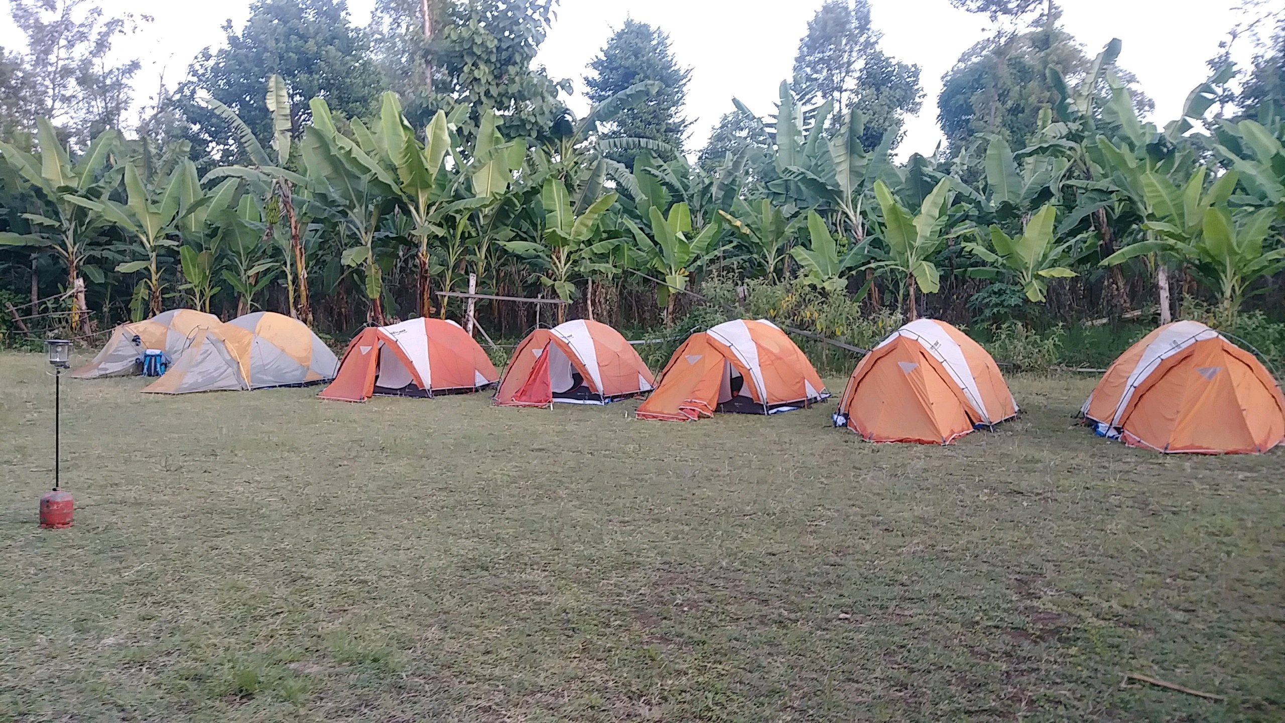 We left our base camp to start our hike this morning. 3 hour rider to the trailhead and then walk up up up.
Posted: 02/08/2019
02/11/2019
I finished hiking for today. You can check out my current location on the map and I'll post about my day when I am in coverage.
Posted: 02/11/2019
02/12/2019

I finished hiking for today. You can check out my current location on the map and I'll post about my day when I am in coverage.
Posted: 02/12/2019
02/13/2019

I finished hiking for today. You can check out my current location on the map and I'll post about my day when I am in coverage.
Posted: 02/13/2019
02/25/2019
Over the next week, I'll be posting about my Trip to Africa to climb Mt. Kilimanjaro over 8 days and then experience the Tanzania for a week. My wife accompanied me, along with 20 other people, to climb the mountain so it was quite an operation!
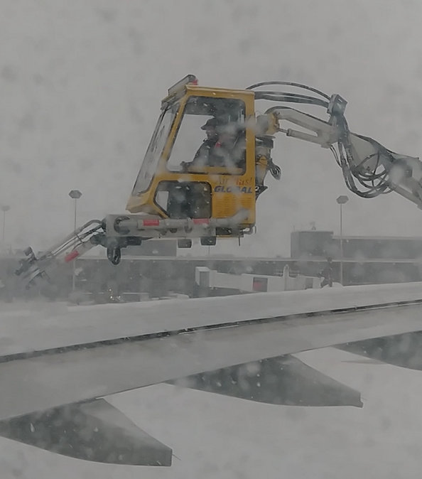

Travel to your destination is often the most expensive part of an adventure. The flight to Tanzania from Minnesota cost a lot of money and time. Our adventure started in the midst of a snowstorm, requiring de-icing of the plane. That was immediately followed by an engine problem resulting in a delay, followed by another round of de-icing. 3.5 hours after departure time, we finally pulled away from the gate. Once we were airborne, it wasn't too bad. Long flights are something of a time warp - an entire day is used up sitting, watching movies, and eating plastic food. 12 hours later, we arrived in the Netherlands.
After a quick sprint through the Amsterdam airport, another 8 hour flight got us to Kilimanjaro airport, 9 timezones in the future. The owner of our safari company and our lead climbing guide met us after fighting and clawing our way through the tangled mess of Tanzania immigration. Get your visa BEFORE your trip to avoid a LONG wait on arrival. Just like at Disney World, go as far to the left as you can in this mass of humanity that just arrived to press ahead as much as possible.
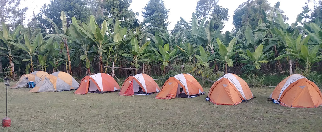

Reaching our first night's camp around 11pm, via a long, bumpy bus ride, we all just claimed tents and crashed until morning. It was nice being out in fresh, cool air with no bugs and unfamiliar stars across the sky. With the morning light, we could see that we really were in Africa - banana, acacia, and mango trees, intense sun, and a far-off glimpse of Kili.
This day was set aside to rest, explore the village, check gear, and meet our guides. I needed the day to start getting used to being pampered. Since I carry all my own gear and food on my long hikes, I knew there would be two challenges for me this time:
- Having porters carry all my gear, food, tent, everything I didn't need for a day hike
- Walking very, very slowly day after day due to elevation and size of our group
The company we're using is Tanzania Choice Safaris - a Tanzania-owned family company. Kakasii and Brenda Kimaro run the company and employ many local guides, cooks, and porters to handle a successful Kilimanjaro trek. On Facebook at TCS. It quickly became clear that TCS was a good choice and they did a wonderful job throughout the entire trek.
Now that we're settled in and two sets of lost luggage finally made it from Amsterdam, we'll start the actual hiking tomorrow.
Posted: 02/25/2019
02/26/2019
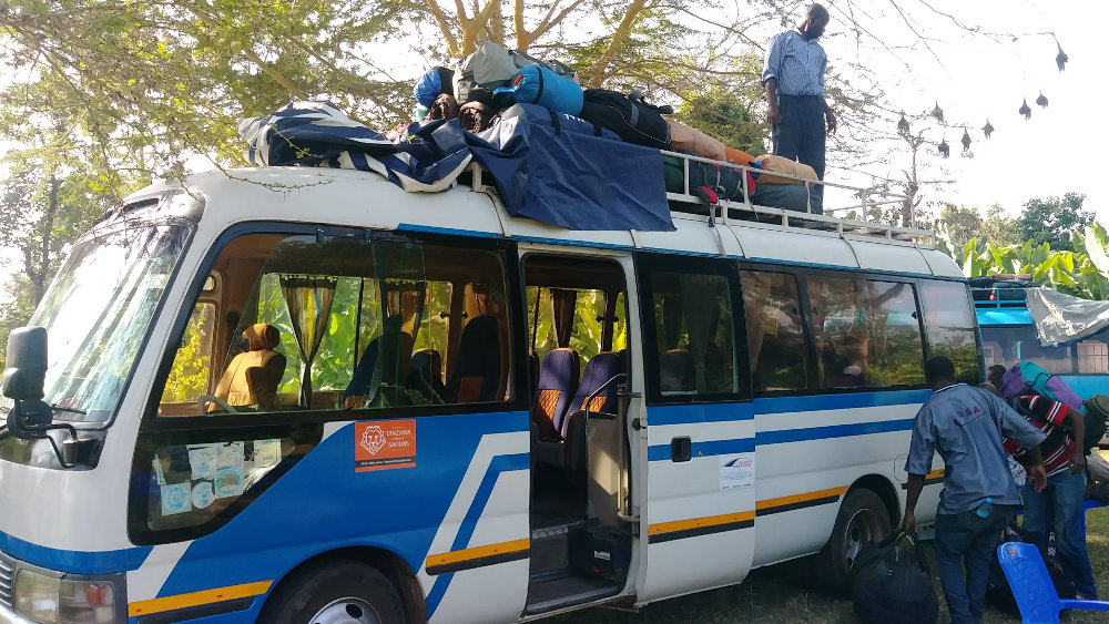

It seems to be taking FOREVER to start hiking! From our base in Uswaa village, all our gear was loaded on two buses for the long ride to the trailhead. Mind you, we did no work - the tents were taken down, packed, and loaded by our guide team. All we had to do was get our little day packs ready and sit on a bus. And, this was all after a huge breakfast cooked, served, and cleaned up by others!
Our ride up the mountain was often like a rickety, wooden roller coaster ride, and our bus even had a mechanical problem. Just a leaking radiator hose, but enough to be interesting. We leisurely climbed in our air-conditioned bus from the dry African plains through fertile forest land where hundreds of workers harvested carrots and potatoes all day in the heat. I should say that 'heat' is relative - many of them wore stocking hats and sweaters.
We eventually reached the Londorossi Gate to the Kilimanjaro National Park where we registered and our tour operator paid all the fees. And, the hiking and camping fees are big! It cost around $140/day for each person in our party. I don't know what that revenue is used for, but I saw no sign of trail maintenance on our trek.
After a very nice lunch, and watching all the porters get their loads officially weighed, we piled back in the buses for the last leg to our trailhead. Besides the 22 people in our big group, we are being supported by a lead guide, assistant guides, cooks, and porters. All this is a total of around 90 support people - or 110 people all together. It's an invasion!
Yes, we're finally hiking! Scrambling out of the bus, trying to avoid the porters throwing packs off the top, we all tumbled in a mass to the trailhead while adjusting hiking poles, fidgeting with pack straps, and smearing on sunscreen and/or bug repellent, depending on personal concerns. I saw no mosquitoes the entire trip, and this first day was all through rain forest so no sunscreen either.
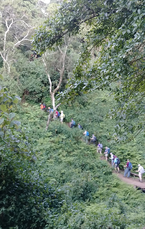

Have you ever seen a freight train start moving? The engine pulls, the couplings clank together, and the whole thing slowly lurches along, slowly gaining speed. Our group was similar, except we never got to the 'gaining speed' part. The day was a very casual hike on a very worn path through a beautiful forest of exotic trees. It's just as well since it was still quite warm and humid this low. We did gain 1400 feet over 5 miles, but it came from only a very few short, steep climbs. Monkeys occasionally appeared in the trees, but they were the only wildlife - what would you expect with hundreds of people walking past? Ours was not the only group using this trail.
We arrived at Mki Mkubwa camp at 9200 feet as the day wore down. This was a very busy camp and our tents were packed together. I found the tent my wife and I would share for this trek already set up on a nice, flat spot. This would be the norm through the week, our support crew doing an excellent job of racing ahead to the next campsite early to hold the best spots.
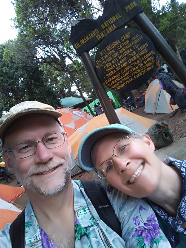

Soon after we arrived, we were each given a bowl of hot water to wash with, then gathered in the large dome tent which would be our meal tent for the next week. I dubbed it the Thunder Dome, but it didn't really catch on. The dinner routine developed quickly - coffee, tea, or cocoa at your leisure, followed by soup, then the main meal. All this prepared in the kitchen tent and served with flourish in the Thunder Dome. Folding chairs, tables with table cloths, real plates, cups, and utensils were all carried from camp to camp for us!
After dinner, our lead guide laid out the next day's plan to finish off this day. Brush teeth, use the carried in portable toilet, put in ear plugs, and off to bed. Bed was a very cozy sleeping bag on a soft mat, both rented from the outfitter for a few dollars, along with hiking poles, so we didn't have to transport them on the plane. This night, as would happen every night, I slept very well and hardly remembered having my head hit my rolled up down jacket pillow.
We hiked from 7800ft up to 9200ft over a distance of about 4 miles, all of it through rain forest.
Posted: 02/26/2019
02/27/2019
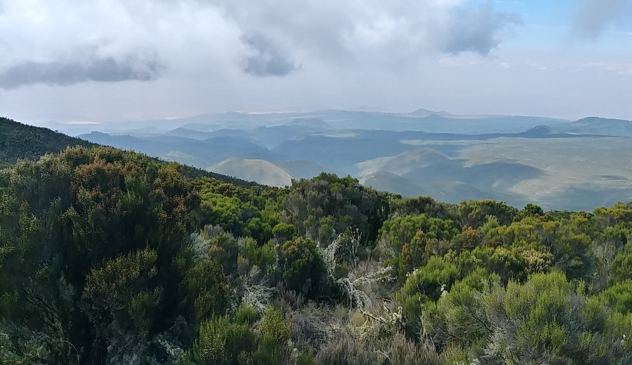

As it turns out, our group is very good at 'Pole Pole'. We have a guide leading the way and we are not supposed to get ahead of him - no one has yet. His job is to make sure we don't hike too fast. 'Pole Pole' is Swahili for 'Slowly' and that's how we're supposed to hike. This is by far the slowest hiking I have ever done. We aren't even at any elevation yet and we're going less than 1MPH. Oh yes, I would prefer to go faster but I was expecting a slow trek, so I'm fine with strolling along and enjoying the scenery.
And, the scenery really changed today! We climbed up the Shira Ridge out of the jungle into tall scrub bushes and open sun. As the brush became smaller and our elevation became higher, we had great vistas out to the north and west where we could see the forest we had just left behind. All the big trees stopped growing at a certain elevation. You could see an obvious contour line where the trees stopped all along the hillside - very cool. And, we got our first glimpses up the high slopes of Kilimanjaro. Besides summit day, this was the hardest hike of the trek because it was warm and humid and a good gain of elevation. It was only a couple miles, though.
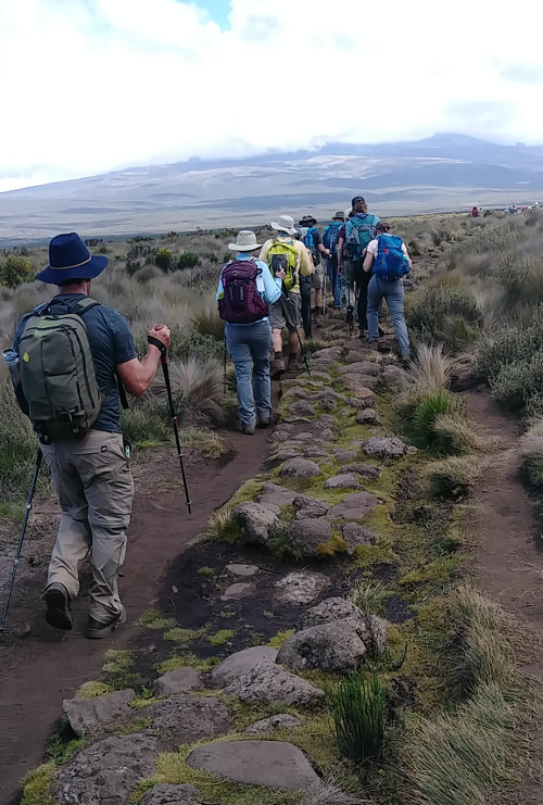

Reaching the upper end of the Shira Ridge, we traversed the Shira Plateau - a vast, relatively flat, plain reaching to the flanks of Mt. Kilimanjaro - to our campsite. So far, we've not actually been hiking on what most people think of as Kilimanjaro. The mountain has three volcanic cones: Kibo, the highest in the center at 19300 feet; Mawenzi, to the east at 17000 feet; and Shira to the west at only 13000 feet. Uhuru Peak is the top of Kibo and that is our destination but we've been walking up and along Shira the first 2 days. Tomorrow, we'll reach Kibo's slopes.
Across the plateau, as is true for the entire trek, the trail was obvious. Thousands of people a year tend to make a well-trodden path! But, for a half mile or so, the trail was constructed of large rocks arranged in a 3-foot wide path across the wilds. Some crew of workers put in a lot of time building it, but no one uses it. You can see in the photo that there are two well-worn dirt paths on either side but moss in the middle with the rocks. So, I guess another good idea that didn't pan out. Fortunately, it led us straight to Shira 1 Camp where we'll spend the night.
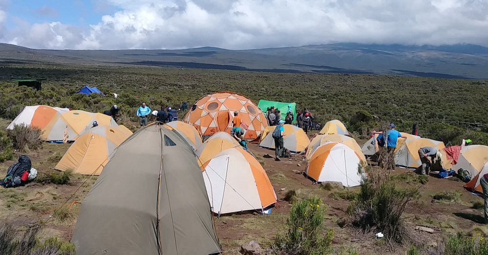

This second evening was absolutely the best camp of the trek. There was plenty of room and views all around, even up the slopes of Kibo. The big mountain was hiding above its blanket of clouds as it did every day from late morning until evening. As we waited patiently, the clouds gradually evaporated allowing glimpses of the peak before nightfall. It looked almost close enough to start climbing, but we'll not get that chance for four more days.
In this view of camp, you can see a portable toilet in the foreground and our large 'Thunder Dome' dinner tent dead center, behind which is the bright green kitchen tent. When we hike into camp, all of this is already set up every day! All we need to do is find tent #9, lay out our sleeping bags, change into camp shoes, and relax. Relaxing includes receiving a bowl of hot water to wash with, and then making coffee, tea, or cocoa in the Thunder Dome. It's a rough life! And, it's a strange feeling having others wait on me out here in the wild where I'm used to doing everything myself - I'm afraid I may get spoiled.
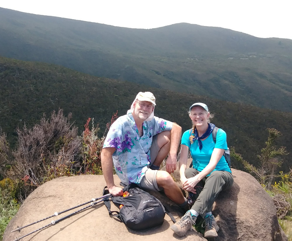

As you can see, my hiking attire on this trek isn't my usual drab, blend-in style. Since we're a big group, and there are multiple groups trekking, I figured something a little more vibrant might be interesting. It's totally not 'LNT', but there's no way to make a group of 100 people LNT, so I'm making it fun. I did notice on this and subsequent days that I tend to be more comfortable wearing a lot less than most others. The cooler temperatures felt nice to me while others put on gloves and fleece.
We hiked from 9200ft up to 11500ft over a distance of about 5 miles.
Posted: 02/27/2019
Older Posts Newer Posts
Find more Hiking Resources at www.HikingDude.com


Follow Me
Recent Comments