
Hiking Dude Blog
2025 - Aug Jul
2024 2023 2022 2021 2020 2019 2018 2017 2016 2015 2014 2013 2012 2011
07/20/2018
Something Interesting
Leave Comment
Posted: 07/20/2018
Posted: 07/20/2018
Something Interesting
Leave Comment
Posted: 07/20/2018
Posted: 07/20/2018
Done Hiking Today

I finished hiking for today. You can check out my current location on the map and I'll post about my day when I am in coverage.
07/21/2018
Something Interesting
Leave Comment
Posted: 07/21/2018
Posted: 07/21/2018
Done Hiking Today

I finished hiking for today. You can check out my current location on the map and I'll post about my day when I am in coverage.
Leave Comment
Posted: 07/21/2018
Posted: 07/21/2018
07/24/2018
SHT Wrap
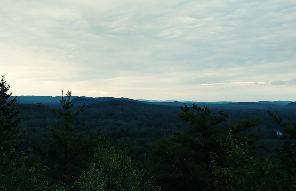

I thought I was prepared. Really, I thought I had all the bases covered.
- In case of blisters, I had needle and moleskin.
- In case of sore muscles, I had acetaminaphin.
- In case of inflamed joints, I had ibuprofen.
- In case of injured knees, I had elastic wraps.
- In case of hypothermia, I had a rain poncho and warm quilt.
- In case of cuts, scratches, and scrapes, I had bandaids and antibiotic ointment.
- In case I got severely injured, I had my SPOT emergency device.
- In case I got lost, I had compass, maps, and SHT app.
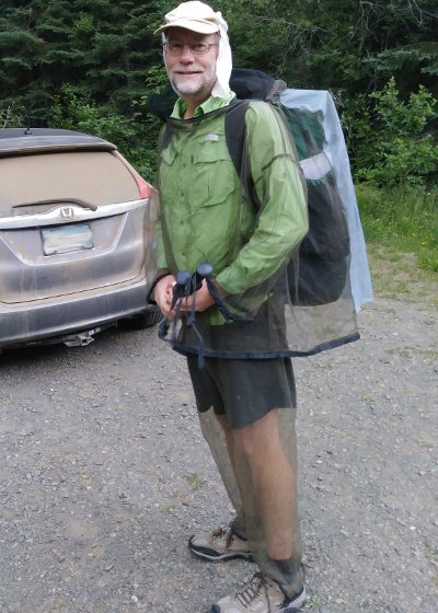
- To prevent insect bites, I had a full mesh body suit.
The one thing I did not prepare for was to catch a stupid common cold! Seriously, catching a cold out on the trail? Well, that's what stopped my fast hike of the trail.
Here's a quick overview of my 92 miles in 2 days and 9 hours SoBo (SouthBound) hike.
Day 1: 270 Overlook to South Little Brule River
miles: 35
challenges: rain and overgrown trail
highlights: meeting an old friend, making new ones
Mrs. Dude dropped me off at the Border Route Trail trailhead on Otter Lake Road at 5:50am. It was too buggy for her to walk up to the northern terminus, so she drove off as I hiked north a bit over a mile to the official SHT Ending/Starting point. Very nice views there, with a trail registry. It was cool to see that a few other SoBo hikers had started over the past couple days. I had high hopes to find them along the trail over the next week. I hope they are all having great treks and progressing towards their goals right now.
The trail was dry and in good shape, even at the far northern end. No more than an hour after starting south, it started sprinkling. It felt good at first, but after an hour or so, my shoes and socks were soaked and I finally decided to toss on the rain poncho since the sprinkles were turning to real rain.
Soon after that, I crossed paths with my first two fellow hikers. To my surprise, I knew one of them! He is the owner of Campfire Dragon and a Leave No Trace educator. These guys were just finishing up a ~55 mile trip from Grand Marais to the north end.
The rain eventually let up, leaving soaked foliage along the trail. That meant mile after mile of shoes not drying out since every step replaced any lost water in my shoes. Much of the trail was overgrown, but that was expected up here. I needed no navigation because it was well blazed and a dent in the weeds could always be noticable.
A short break for water and a bit of food at South Carlson Pond campsite halfway through the day, and I was back to hiking.
I stopped for water again from the Brule River just north of Devil's Kettle Falls which was a mistake. Better planning and I could have just filled up from the clean spigot at the Magney State Park parking lot, saving 10 minutes of filtering.
I ended the day at 6:45pm at the South Little Brule River campsite. I had hoped to make it another 5.3 miles to the Kadunce River site, but the wetness had been a drain and I was spent with only about 2 hours of light left. I had passed the Northwest and North Little Brule River sites because there was no one in them and the South site was farther down the trail. I think it would be better to stop at one of the first two since they looke like much flatter and spacious sites.
Fortunately, there was a family already in camp so I got to chat with them for an hour or so. The dad had lots of questions about my gear and hiking, so it was fun, even though a bit more rain fell in the evening.
Day 2: SLB River to Trout Creek
miles: 36
challenges: wet feet, Cascade River signage
highlights: Woods Creek section
Rain from the night left the trail wet again in the morning. So, wet shoes and socks left over from yesterday went right back on and stayed wet until the shoes eventually dried out in the afternoon - the socks stayed wet.
I was awake before my alarm went off, feeling like I had not slept much through the night. A quick packing up and I was on the trail by 5:15 with just enough light to not trip and fall. Yesterday, I had passed the highest point in the trail and just a mile down the trail I would pass the lowest point, doing the LakeWalk. It's a slow, plodding 1.5 miles on a smooth gravel beach that is beautiful but tiring. Here's a tip: walk on the largest stones - they offer a bit more support than the pebbles.
Filtered water from Cliff Creek around 9am.
Ran into a group of girls from Camp Manitowash at the Woods Creek trailhead, taking a break.
Filtered water at East Devil Track camp.
Spent way too long at Grand Marais overlook at midday.
I think a wonderful Fall dayhike would be from the Woods Creek trailhead to the Pincushion Mt. overlook. The trail is mostly clear and there are waterfalls, cliffs, many tree varieties, and a great view over Lake Superior. It's about 8 miles long.
I filtered water at South Bally Creek Pond camp. Another short time loss since it is quite a way offtrail - getting water at North Bally would save time.
Hit my most frustrating event on the trek at the Cascade River. The SHT runs down both the east and west sides of the river. The main trail is on west side so I followed signs over the bridge to a blue blaze on a big tree with a trail leading down the hill. It quickly peetered out into down trees from wind. I followed tracks made by others searching for the trail until they all disappeared. After 15 minutes, I gave up, crossed back over the bridge and took the Spur Trail down to Trout Creek camp. I still don't know where the 'main trail' is to be found there but I expect it requires a more significant roadwalk west from the bridge.
Trout Creek is a nice site. Tons of flat space under huge trees and easy water access. Having arrived at 8:30, I set up camp, got water from the river, and went to bed. And, that's when I noticed the left side of my throat was scratchy and my left nostril was dripping a bit.
Day 3: Trout Creek to Oberg Mountain
miles: 23
challenges: sickness
highlights: Lake Agnes, Poplar River, dry feet
Another fairly restless night, but no rain. I woke at 4:45 and was concerned with my worsening cold symptoms. Nothing I could do about it, and I was still good enough to hike. I took quite awhile to pack up, filter water, eat a little, and contemplate if I had a shot at the record. The first two nights, I stayed at the same sites as the current record, the trail was dry, weather was looking good, and my legs were doing much better than I had hoped for. So, with finally dry shoes and a new pair of soft, dry socks, I got on trail around 5:45. Never did see sign of my neighbors at this site, but I hope they enjoyed their adventure.
The morning flew past. I made great time on nice trail to Agnes Lake where I filtered water. The entire time, my nose dripped - about every 20 to 30 seconds, so I was losing more fluid in addition to sweating. And, I would have a horrendous sneeze/cough every 15 minutes or so - probably why I saw no moose or bear. But, it was still just a runny nose and sore throat - no congestion or difficulty breathing yet.
At a road crossing just before Lake Agnes, I met two guys by a pickup. I stopped to chat and found out they were waiting for a Boy Scout troop following me down the trail. They were supporting them with food, water, whatever was needed. The troop was at Indian Creek camp, but I told them there was no sign of life when I hiked past at about 7am so they might be waiting awhile. Turns out that this was Troop 228 from Philadelphi, PA that had sign the Northern Terminus registry on 07/16 so they had taken 6 days to get this far.
After Lake Agnes, I got yet another Poplar River overlook photo. I have 3 now. It's a beautiful view. But, at about this time, I noticed my head was starting to ache quite a bit and my runny nose was getting thicker. Not good. I had kept hoping it might just pass. When I started to have a little difficulty breathing and hacked up my first blob of mucus, I conceded that it must be a cold and would only get worse.
According to Mayo Clilnic, symptoms of a common cold usually appear one to three days after exposure to a cold-causing virus. Signs and symptoms, which can vary from person to person, might include:
- Runny or stuffy nose - dripping like a leaking faucet
Sore throat - scratchy and sore from the nose drainage
Congestion - developed through the day while hiking
Sneezing - about every 15 minutes
Slight body aches or a mild headache - but it could just be from the hard hiking
Low-grade fever - not sure yet
Cough - not yet
Generally feeling unwell (malaise) - yep
I knew it would take at least a couple days to get over the worst of this cold. Normally, on a long hike, taking 2 or 3 'zero days' of no hiking to rest and repair will get you back on trail. But, since I had only 9 days to complete this, losing even a day meant I would not finish. So, I had the choice of finishing a full day of hiking at Temperance River S.P. or cutting it short at the next trailhead. Making it to Temperance would have put me on record track for 3 days, but would have meant a late night of driving for my wife. I took the spur trail to the top of Oberg Mountain to make the call and then waited until she picked me up at about 6pm.
A night in Duluth, drive home on Monday, and now it's Tuesday morning. The cold is running its course and I gained a fever and coughing and have no energy, so there's no way I could have kept up the hiking. I knew completing this fast hike was a stretch, but I sure did not expect the common cold to be my downfall. I wish I could pinpoint where I picked up the virus - it was probably at a gas station or food place on the drive to the trail since that was my only interaction with people for the 3-day incubation time.
Hike On!
07/26/2018
SHT Tips 4 U

My recent Superior Hiking Trail hike was short in days, but long in miles. Along the way, I had some thoughts that I figured I should share. Some of them might just make your SHT experience a bit better.
- Rest Up - It's a long drive to the northern terminus and an even longer drive back if you have someone dropping you off. A good way to get an early start after a good rest is to stay overnight in Grand Marais.
GM is a great little town with a nice waterfront to explore for an afternoon or evening. Many fun food spots to try and a new brewery, plus some tourist shops and plenty of activity around the harbor.
My wife drove me to my SHT SoBo start and we stayed at the Mangy Moose right in town. Danielle was a wonderful host, made us feel very welcome, and highlighted places to check out on a city map the motel provided. They have about 10 roooms, all with unigue decor - we stayed in the Bear Den. Nice and convenient lodging to prepare for a big day of hiking. - Wet Yer Whistle - 'I drank too much water' said no hiker ever! All of us, whether on trail or not, would benefit from drinking more water. On trail, not drinking enough water is a prime reason for loss of stamina and slower progress.
Fortunately, the SHT has water galore along its entire length. Sure, there are some ridges and hillsides that are dry, but many creeks and rivers are crossed with plenty of good water sources. Taking advantage of more water stops means you need to carry less water weight, are drinking more water, and have more opportunity to take short rests from hiking. Using your maps and guidebook will help ensure you carry enough water to the next source, but not pounds more than you really need.
Drinking inadequate water is one of my big failing points. I can hike a long way without water and I often do. While cruising along, by the time I realize I'm thirsty, I'm often dehydrated enough that my progress has suffered and I'm slowing down. Drinking a half liter makes a HUGE difference, and I gain momentum back quickly but only for a short time. I already have a deficit that will take time and concentrated rehydrating to overcome.
Drink more, more often - that's a good thing to remember. - Beware the Boards - Many hikers mention the tough tread of the SHT, usually listing rocks, roots, mud, and overgrowth. Surprisingly, with just a little rain, or even morning dew, the many boardwalks over perma-wet areas can be treacherous. I slipped three different times, all from my first step onto a boardwalk being at a bit of an angle and hitting my heel first, losing traction, and doing a slow-motion splits with my front leg just refusing to stop. It felt ridiculous and I bet it looked even sillier. Unfortunately, on one slip, I landed on a hiking pole and broke it. No injuries, though.
Step directly, flatly, and slowly onto boardwalks to ensure you have traction. I was just hiking too fast and not paying attention as I should. - Fashion Fun - No one really cares what your outfit looks like on trail. Function is much more important that fashion, but one comment I heard more than any other (by far) on this hike was about my bug suit. To be honest, people have been commenting about it for years, on the Ice Age Trail, last summer on the Pacific Northwest Trail, and recently on the SHT. The comment is nearly always the same - 'Wow! What cool pants!' or 'Hey, now that's smart!'
The mesh pants and mesh jacket do a great job of keeping mosquitoes at bay, but they also beat out repellents in other ways:- - Protect legs from scratchy, prickly, itchy plants
- - Keep ticks from getting on me
- - Protect face from spider webs
- - Protect from those darn flies
- - Go on and off as needed, no reapplying every few hours
It does add a small amount of warmth, especially if there's no breeeze, but it's much less than fabric and a good trade-off, I think. - Earn a Patch - The SHT is considered part of the North Country Trail and the NCT Association is running two free patch programs in 2018. If you hike at least 50 miles, you get a patch. If you hike at least 100 miles, you get the 50 and 100 mile patches. You can hike the same mile back and forth 50 times if you want. See NCT HIKE 100 to sign up and learn more.
I earned my 50 mile already and will get the 100 when my wife and I go on a short SHT trip in the fall.
Hike On!
09/21/2018
Fall Colors
 Do you know your Beta-Carotene, Anthocyanins, Flavonols, and Chlorophyll? Well, those big words are the basis for the eternally entertaining display of fall colors on deciduous trees. The tree in our front yard is a beautiful maple and always gives off a great display for the neighborhood. This is the BEST time to hike through the woods, enjoying the rainbow of colors, lower humidity, and lack of insects.
Mrs. Dude and I are looking forward to a few days of hiking and camping 'up north' to take in the wonderful fall tree colors that usually grace Minnesota. It can be a gamble to plan just when the best time to go might be. The best colors fall within a 3 week window, but can be early or late depending on weather all summer, and especially on September weather.
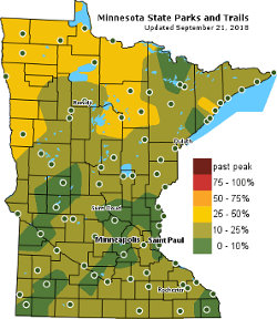
With all the technology and historic data available these days, it is getting much easier to target the best dates for specific areas. For Minnesota, the DNR has a good Fall Color Finder map that gets updated daily. They have an image that shows typical peak color times, but do not predict the best times for this year.
I found a Fall Foliage Prediction Map that shows the entire country and the expected best times for color wherever you want to go. So, it looks like Oct. 6-8 will be peak color along the Minnesota north shore - Perfect!
Unfortunately, forecasts call for rain now - but it's still far away and I have my fingers crossed.
Hike On and enjoy your local colors!
Leave Comment
Posted: 09/21/2018
Posted: 09/21/2018
10/28/2018
Hike Challenges
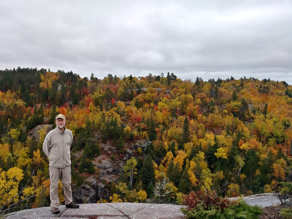

The fall colors have been great the past month, but the windstorm last night took down most of the lingering leafs. The brown oaks still have a long time left, and all that darn buckthorn is still green - grrrr. We spent a day hiking on the Superior Hiking Trail a few days ago, finding some great patches of maple, birch, and poplar at their prime.
We hiked up Britton Peak, Carlton Peak, and Section 13 covering just about 10 miles. The timing was perfect, but the weather was contrary - it was misty and rainy much of the day. The best kaleidoscope of color was on top of Section 13 by Finland. When anyone now asks me for favorite fall color spot, that is it! It is a steep, but short, hike in from the nearest trailhead up to lookout views over hillsides of deciduous trees, rock outcroppings, and a beaver pond far below.
One reason I wanted to put in a few more miles on the SHT was because it counts as part of the North Country national scenic trail.
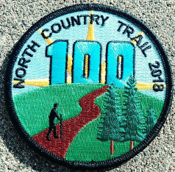

So, why is that important? Well, the NCT Association is running their #Hike100NCT program again this year. If you hike 100 miles on the NCT, they will send you a patch and certificate, and everyone loves patches! Since I had done 93 miles on my SHT hike in July, the 10 miles we hiked this time put me over the threshold. I received my patch after sending in my information. It is very easy to do. Just go to the Hike 100 page, sign up, and submit your hike completion form online.
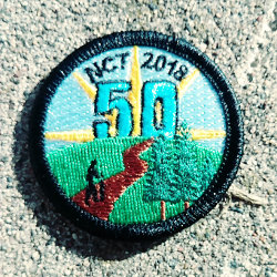

You still have two months of hiking, until December 31, to complete the challenge. It does not have to be 100 different miles - you could just walk back and forth on the same mile 50 times if you want. If you think 100 miles would be just too far, the NCTA has added a 50 Mile Challenge this year - smaller patch for smaller miles. And, if you do 100 miles, they will send you both patches!
Since the NCT is 4600 miles, folks from North Dakota to New York are pretty close to it.
If you are really into patches and hiking, you might also check your local state Department of Natural Resources (or similar) website to see if they have a hiking patch program. Minnesota does at this page. Another hiking patch program is at 52 Hike Challenge. And, there are dozens of other hiking challenge programs - just google it.
Hike On
Leave Comment
Posted: 10/28/2018
Posted: 10/28/2018
02/05/2019
Off to Africa
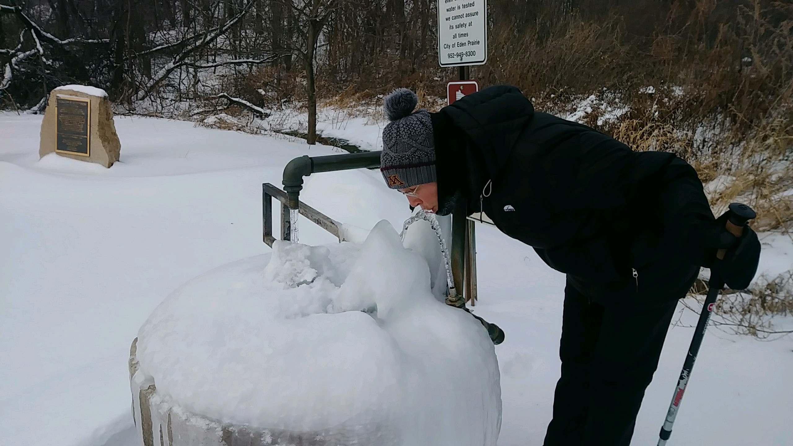 Many days of 5, 6, and 7 mile practice hikes have filled the past couple months. Not really much to share except cold, cold, cold - and ice, ice, ice.
But, today we leave for Africa and a trek up Mt. Kilimanjaro to the Roof of Africa at 19,300 feet.
I'll have my spot tracker along so you can at least see our progress over the 8 day trek but I also hope to post a few times.
This will be a much different adventure than I'm used to - porters carrying my gear, cooks making my food, even someone setting up my tent! It's weird thinking about it but I guess it is required to legally go up the mountain.
Jambo! Hike On!
Many days of 5, 6, and 7 mile practice hikes have filled the past couple months. Not really much to share except cold, cold, cold - and ice, ice, ice.
But, today we leave for Africa and a trek up Mt. Kilimanjaro to the Roof of Africa at 19,300 feet.
I'll have my spot tracker along so you can at least see our progress over the 8 day trek but I also hope to post a few times.
This will be a much different adventure than I'm used to - porters carrying my gear, cooks making my food, even someone setting up my tent! It's weird thinking about it but I guess it is required to legally go up the mountain.
Jambo! Hike On!Older Posts Newer Posts
Find more Hiking Resources at www.HikingDude.com


Follow Me
Recent Comments