


Hiking Dude Blog
2025 - Aug Jul
2024 2023 2022 2021 2020 2019 2018 2017 2016 2015 2014 2013 2012 2011
07/14/2017
Done Hiking Today
I finished hiking for today. You can check out my current location on the map and I'll post about my day when I am in coverage.
Leave Comment
Posted: 07/14/2017
Posted: 07/14/2017
07/15/2017
Done Hiking Today
I finished hiking for today. You can check out my current location on the map and I'll post about my day when I am in coverage.
Leave Comment
Posted: 07/15/2017
Posted: 07/15/2017
07/17/2017
Done Hiking Today
I finished hiking for today. You can check out my current location on the map and I'll post about my day when I am in coverage.
Leave Comment
Posted: 07/17/2017
Posted: 07/17/2017
07/18/2017
Done Hiking Today
I finished hiking for today. You can check out my current location on the map and I'll post about my day when I am in coverage.
Leave Comment
Posted: 07/18/2017
Posted: 07/18/2017
07/19/2017
Day 2: Hike the Divide
 I do believe our first day may wind up being our toughest day of hiking.
We got up early and found the backcountry permit office. We were 5th in line. The campsite we wanted was marked as full so w wound up getting one much farther along.
Got in line forthe shuttle and waited almost an hour. First bus got us part way then second bus hauled us on. But, the driver chose to not stop at our trailhead so we got a nice tour Up to Logan Pass. Caught another shuttle back down and finally got hiking around 11am.
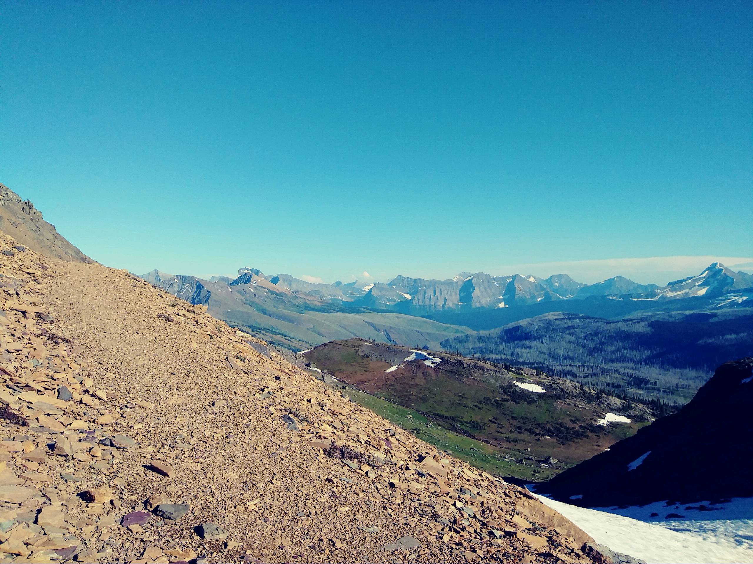
The trailhead sign had Goat Haunt listed which was the direction we needed, so off we went - up up up. After a few miles we figured out that we were on the CDT which was a few miles longer than the trail we wanted but went the same way. Oh well.
TheTrail was rugged, steep, and high but the views were awesome! By the end of the day, I could barely move ahead. All my 'going up' muscles were done.
Tomorrow, we'll actually hook into the PNT and heI walked 41070 steps on the trail today.
I do believe our first day may wind up being our toughest day of hiking.
We got up early and found the backcountry permit office. We were 5th in line. The campsite we wanted was marked as full so w wound up getting one much farther along.
Got in line forthe shuttle and waited almost an hour. First bus got us part way then second bus hauled us on. But, the driver chose to not stop at our trailhead so we got a nice tour Up to Logan Pass. Caught another shuttle back down and finally got hiking around 11am.
The trailhead sign had Goat Haunt listed which was the direction we needed, so off we went - up up up. After a few miles we figured out that we were on the CDT which was a few miles longer than the trail we wanted but went the same way. Oh well.
TheTrail was rugged, steep, and high but the views were awesome! By the end of the day, I could barely move ahead. All my 'going up' muscles were done.
Tomorrow, we'll actually hook into the PNT and heI walked 41070 steps on the trail today.I traveled about 17 miles today.
ad West.
Leave Comment
Posted: 07/19/2017
Posted: 07/19/2017
Day 3: Canada Almost
 I walked 40650 steps on the trail today.
I traveled about 17 miles today.
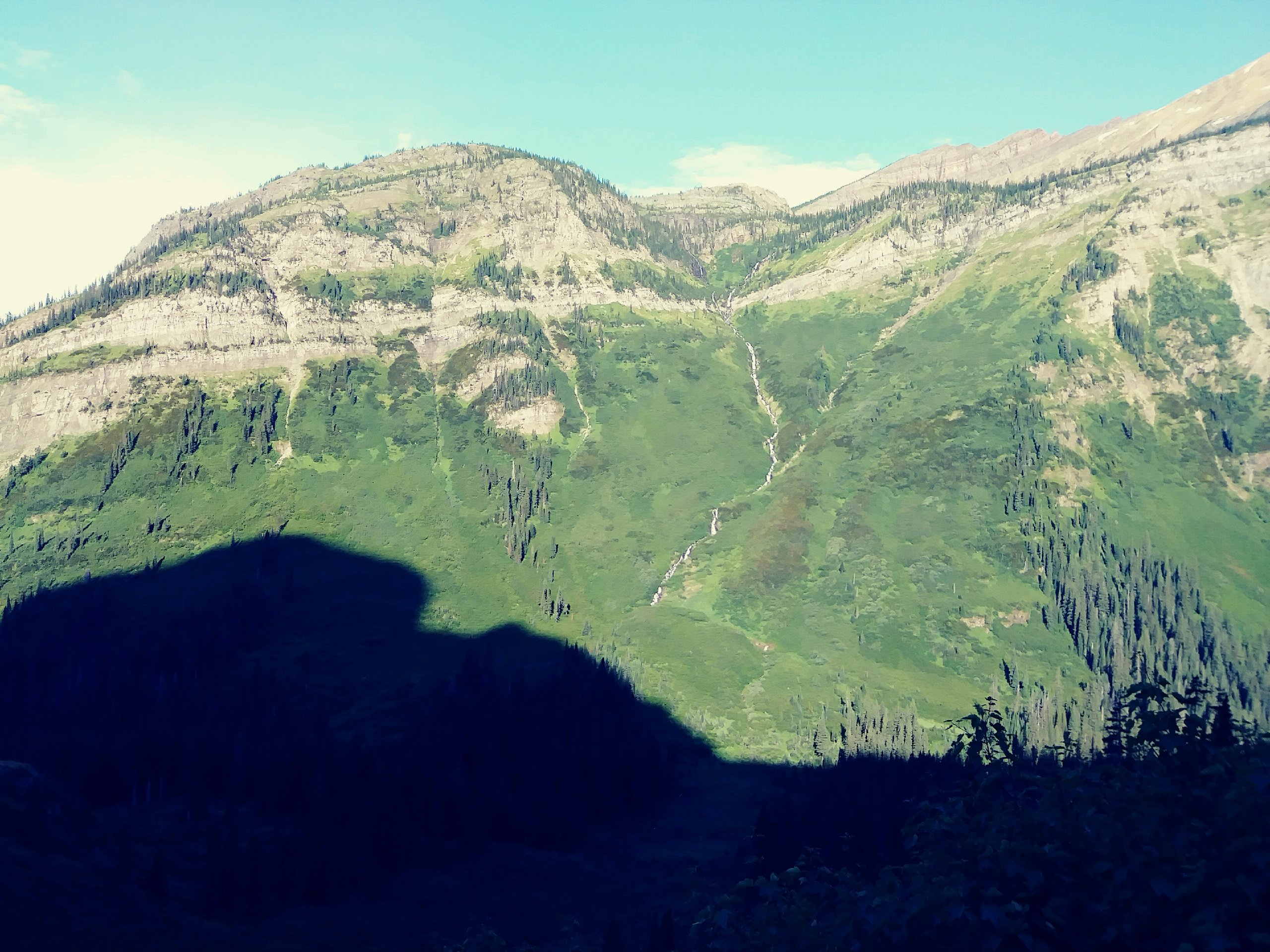
The night at Fifty Mountain campsite was comfortable and quiet. We rose, packed, and got hiking to blue skies and sun painted peaks. The high peaks to our east provided shade as we headed north, dropping into the Watertown valley to intersect with the actual PNT. The trail was terribly overgrown and seemed like a perfect place to meet a bear. No luck. Goat Haunt ranger station and the Canadian customs was funny. While we were looking at the big Lake Watertown, a Canadian customs guy asked where we were coming from - I pointed back South and said 'back there'. He asked where we were going - I pointed West and said 'over there'. He then asked if we had been in, or were going to, Canada - I said 'no'. Then, he said 'well, then I don't even need to talk with you.' Fine with me, he started the conversation. While our morning was all downhill, the afternoon was a continuous climb, but not to steep. We made it to the top of Brown's Pass and spent the night at the buggiest site in Glacier, at least from all the warnings we got from dayhikers, rangers, and trail crews. It wasn't that bad and it topped off a serious 1000ft climb at the end of the day. Still no interesting wildlife but the mountains are wonderful. We've met some nice folks but no other long distance hikers yet. Tomorrow is all downhill and out of Glacier.
Day 4: Civilization, Sort Of
 I walked 62353 steps on the trail today.
I traveled about 23 miles today.
Brown's Pass, today's starting point, is on the Continental Divide so it's all downhill to the Pacific now. And our day started out extremely downhill - a very steep descent to Bowman Lake. On the way down, we saw a moose grazing about 50 yards from the trail, oblivious to us due to wind direction and noise from the waterfalls. We stopped for lunch at the Bowman Lake campsite which I would vote in as the prettiest site in Glacier. About a half hour after lunch, as we were getting water cartoon a small stream, a young lady climbed up the short distance from the Lake shore. She and her two companions were having difficulty paddling their canoe West against the very strong wind that we were thankful for forkeeping the bugs away. She asked us to let the rangers at the west end of the lake know of their predicament. We got to the campground and told the camp host since no rangers were around. From Bowman Lake to Polebridge is a 6 mile dusty, busy roadwalk. We had fortunately gotten water from the camp host. The only interesting thing about the road was that we finally saw a bear! A pickup passed us and w then saw it stopped in the road after coming around a bend. They were easygoing the bear so we did too. It was only 20 yards from the road casually eating trees. So we walked on the other side of the pickup as they slowly drove by as a barrier for us, just in case. We finally reached Polebridge, ate outside at the saloon (which was pretty good), then hiked out of town since the publicized 'Merc' store didn't really have any backpacking food that we could find. This first bit of civilization was enhanced by our chance meeting of an older fellow and a couple at the saloon and chasing with them for quite awhile. We also saw our canoeing friend in front of the Merc - it turns out they persevered against the wind and made it on their own. We also met another PNT hiker named Alexander in Polebridge. He's staying here
Leave Comment
Posted: 07/19/2017
Posted: 07/19/2017
Done Hiking Today
I finished hiking for today. You can check out my current location on the map and I'll post about my day when I am in coverage.
Day 5: A Little Rest
 I walked 34840 steps on the trail today.
I traveled about 15 miles today.
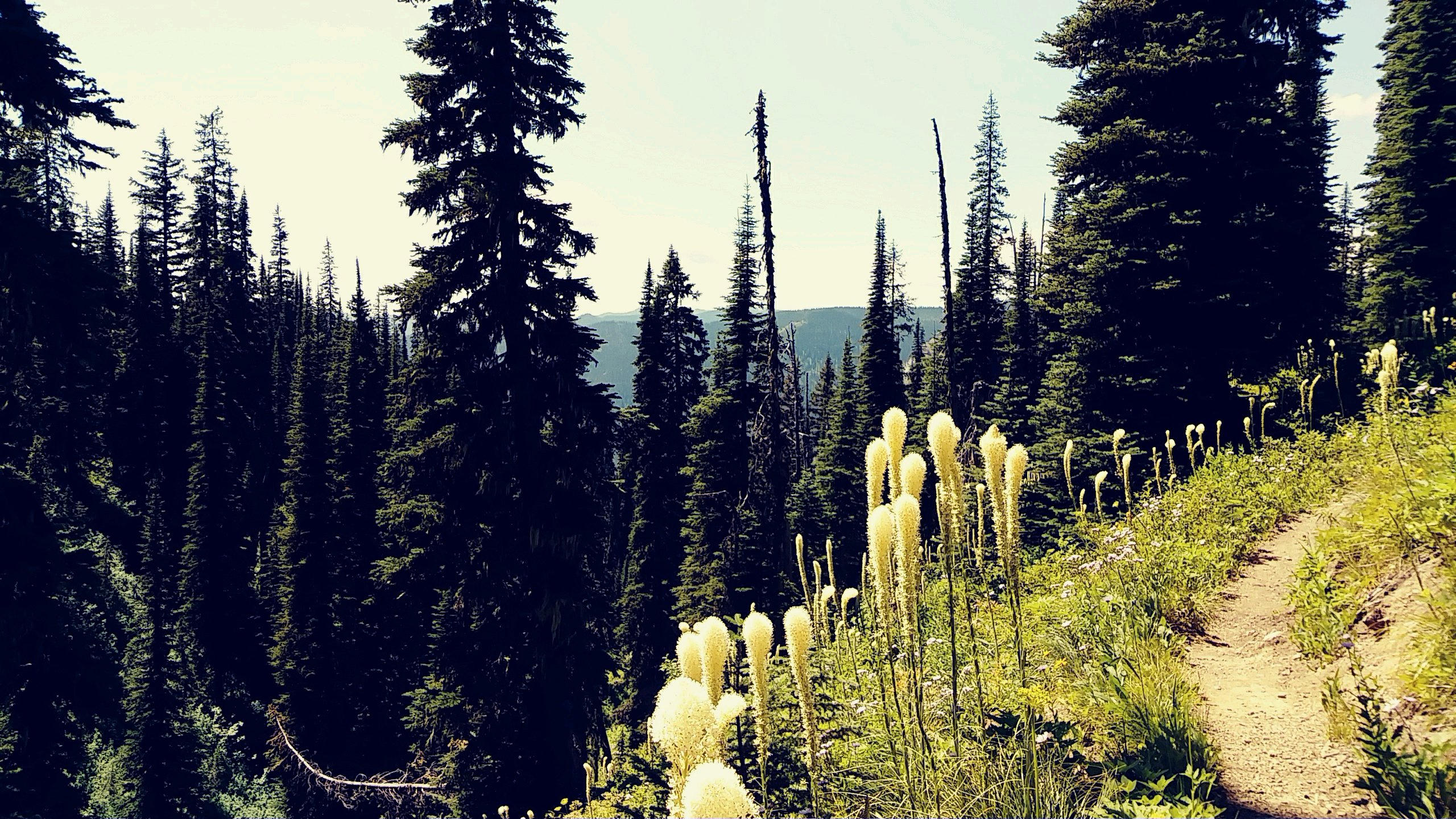
With sore legs and feet from the long dusty roadwalk yesterday, we planned to have a short day today and rest a bit. Another reason our day was short is because there is supposedly a 14mile stretch with no water just ahead and we didn't really want to do 30 miles, or carry enough water for the distance plus an overnight. Bear grass is in full bloom and the pollen is thick. We brush past it much of the day and are covered at times, but it is beautiful. So, here we are spending a very relaxing afternoon and evening at Red Meadow Lake campground. The lake is wonderful and I spent a long time swatting flies and throwing them in for the trout to eat. A pit toilet, easy water, and towering mountain view make this a great spot to rest. The trail here today was uneventful. A very long steady climb up old logging roads followed by a short stretch of recently maintained Trail 26 was the day. Whoever maintains this section did a ton of work this summer digging tread and even pounding rocks. We met a few mountain bikers at the campground who are riding an approximate continental divide route. Then at the end of the day, Alex from Australia rode in. He started in Banff and is heading south along the same route. It was nice to talk with him a bit. We met no one on the trail today - but it is Monday I guess.
Leave Comment
Posted: 07/19/2017
Posted: 07/19/2017
Day 6: We Walked
 I walked 63358 steps on the trail today.
I traveled about 26 miles today.
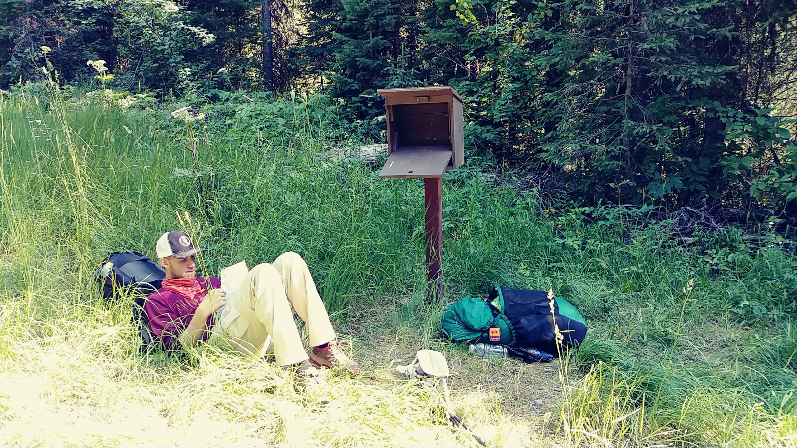
38 degrees when we got up at 5:30 this morning and there was fog rolling off the little lake. We were on the trail by 6:05 with full water and rested bodies, and it's a good thing! This12 mile section had no water at all and, even though it looks like a nice ridge walk on the map, was up and down STEEP peaks and saddles all morning. The first fresh spring on the trail at 6000 feet after dropping into the Blue Sky Creek drainage was beautiful to see. Mt. Locke was a killer climb. From the spring on, the trail was relatively easy all day so we added some extra miles of roadwalk on at the end. We saw our first PNT trail registry out here and signed it - a map page someone no longer needed in a box. Saw that 'Parks' signed it today before us so maybe we'll find him on trail. Other than that, all entries were days or weeks old. So, today we walked. And had great views of the mountains!
Leave Comment
Posted: 07/19/2017
Posted: 07/19/2017
Older Posts Newer Posts
Find more Hiking Resources at www.HikingDude.com
Follow Me
Recent Comments