
Hiking Dude Blog
2025 - Aug Jul
2024 2023 2022 2021 2020 2019 2018 2017 2016 2015 2014 2013 2012 2011
06/17/2017
Cirque de Gavarnie
 High in the Pyrenees today, we hiked from a small village up to a beautiful bowl formed by the peaks. Many waterfalls feed by melting snow poured down the cliffs to gather into a clear, fresh, cold river.
We hiked to the base of the largest waterfall where the torrent created a cloud of spray and a powerful windstorm that drenched anyone to close. If was another gorgeous day and the start was a nice way to chill off halfway through.
After hiking back down, we watched a professional bicycle race along the winding mountain road - complete with chase cars, motorcycles, cheering fans, and a helicopter overhead.
To see where we hiked, Check out my current location on the map.
High in the Pyrenees today, we hiked from a small village up to a beautiful bowl formed by the peaks. Many waterfalls feed by melting snow poured down the cliffs to gather into a clear, fresh, cold river.
We hiked to the base of the largest waterfall where the torrent created a cloud of spray and a powerful windstorm that drenched anyone to close. If was another gorgeous day and the start was a nice way to chill off halfway through.
After hiking back down, we watched a professional bicycle race along the winding mountain road - complete with chase cars, motorcycles, cheering fans, and a helicopter overhead.
To see where we hiked, Check out my current location on the map.Leave Comment
Posted: 06/17/2017
Posted: 06/17/2017
06/18/2017
Lac Bleu Loop
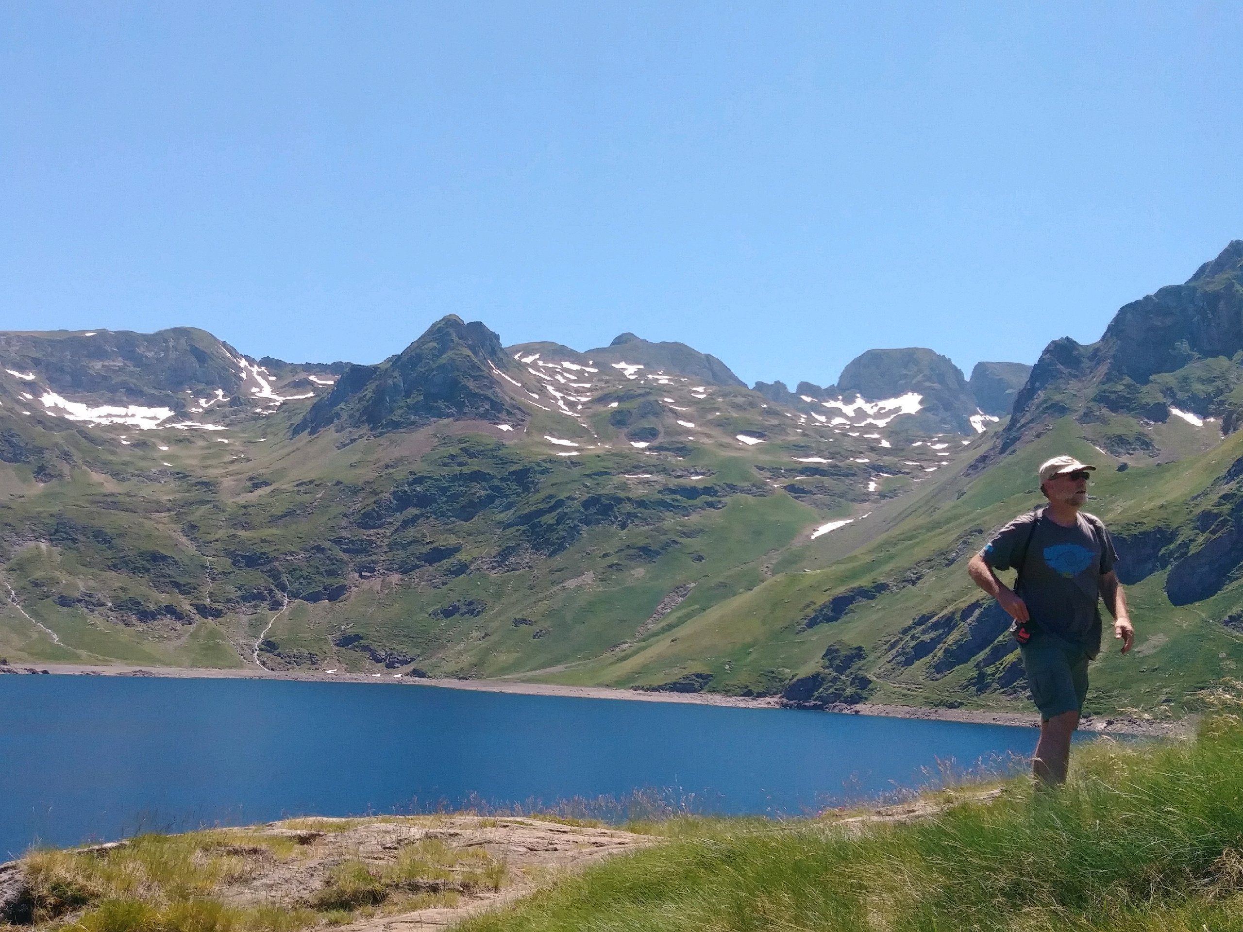 As a follow up to yesterday's hike, we did a 15km (9.5miles) loop today. I've discovered all trail in the Pyrenees is either very UP or very DOWN - no flat or gradual.
Starting a bit before noon, the trail was continual switchbacks through beautiful forest, high meadow, and rock nearly the entire way. We reached Lac Bleu and had a half hour rest to eat a bit, thinking we were at the top of the loop.
As we continued, our route down kept climbing up another 300 feet or so after already climbing about 2400 feet. And this was even steeper than before.
The views all along the hike were excellent with new scenes of waterfalls, peaks, and foliage coming one after another. This picture is Lac Bleu which certainly deserves its name - it is a spectacular high alpine lake. It matches the clear skies we had for yet another day in the mountains.
Having finally reached our high point, the very steep descent was easier on fatigued muscles but still took 3 hours compared to the 3.75 going up.
Along the descent, we saw and heard sheep, cows, goats, and horses grazing in high meadows - all with bells on! I've not seen horse bells before.
Check out my current location on the map. and you can see the loop we made.
 Leave Comment
Posted: 06/18/2017
Posted: 06/18/2017
06/20/2017
Grande Randonnee 78
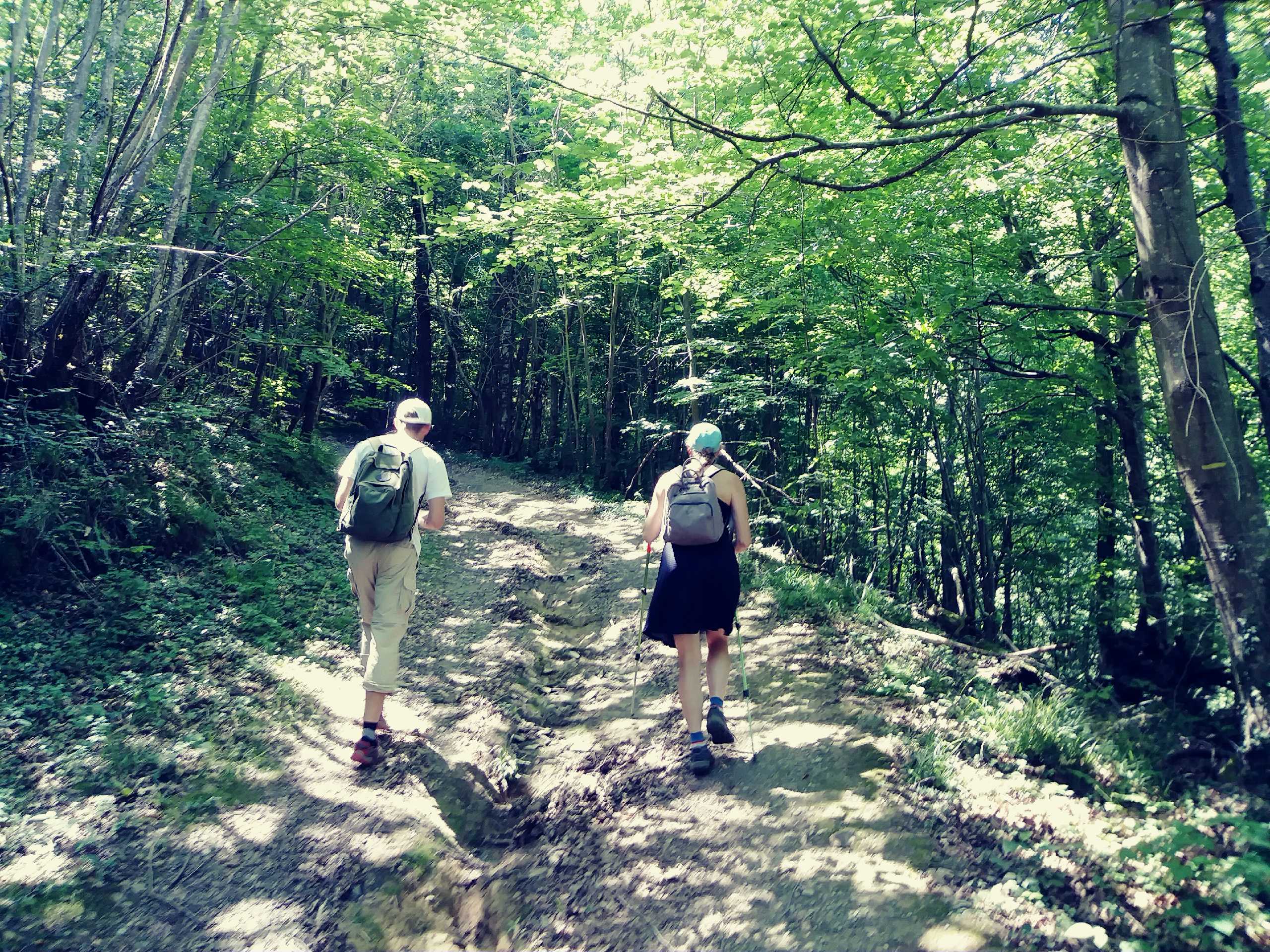 If you search for - GR trails in France - you will find there are well over 35,000 miles of long distance trails criss crossing the country and connecting to similar trails all across Europe. We got to hike just a couple miles on the GR78 both in a small village and through a forest.
We were not planning to hike today, but we arrived at the Gouffre d Esparros three hours before the next opening and decided to take a walk. The gouffre is a underground cavern entered from the top rather than the side like a cave. It was beautiful with tons of Crystal formations and flows of mineral deposits. No pictures were allowed so you'll just have to believe me. It was a nice treat to escape the heat that has settled into the area along with high humidity.
Our hike was short and hot. I felt more sweaty than on our very long Lax Bleu trek. The most interesting part was the colorful blazes used to mark the trail and then reading about the trail system after.
It looks like more extreme heat and humidity the next couple days, so short walks will probably be the norm. Check out my current location on the map. and you can at least see where the cave is located.
If you search for - GR trails in France - you will find there are well over 35,000 miles of long distance trails criss crossing the country and connecting to similar trails all across Europe. We got to hike just a couple miles on the GR78 both in a small village and through a forest.
We were not planning to hike today, but we arrived at the Gouffre d Esparros three hours before the next opening and decided to take a walk. The gouffre is a underground cavern entered from the top rather than the side like a cave. It was beautiful with tons of Crystal formations and flows of mineral deposits. No pictures were allowed so you'll just have to believe me. It was a nice treat to escape the heat that has settled into the area along with high humidity.
Our hike was short and hot. I felt more sweaty than on our very long Lax Bleu trek. The most interesting part was the colorful blazes used to mark the trail and then reading about the trail system after.
It looks like more extreme heat and humidity the next couple days, so short walks will probably be the norm. Check out my current location on the map. and you can at least see where the cave is located.Leave Comment
Posted: 06/20/2017
Posted: 06/20/2017
06/21/2017
Hikes and Chateaus
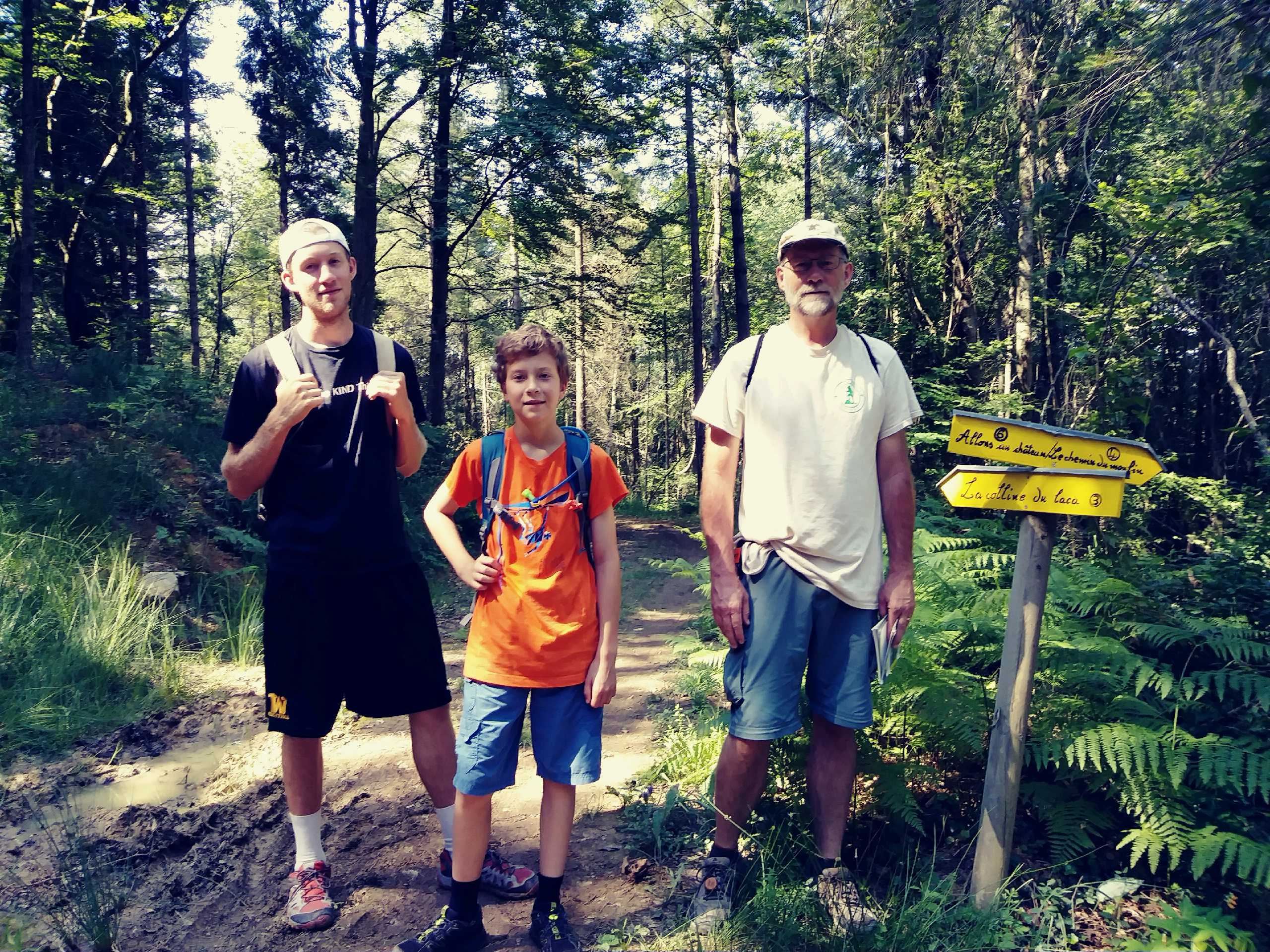 Enjoyed another short morning hike before the intense afternoon heat. This time, we did a nice 5 mile loop through forest around a hill near Capvern led Bains.
After lunch at the boulangerie in Capvern, we headed to the Chateau Dr Mauvezin and spent a couple hours exploring the entire castle from bottom to top. Three groups of school children touring the chateau added some excitement.
The day was wrapped up with a very special dinner in the midi-Pyrenees town of Arreau at a wonderful restaurant serving palettes (like crepes).
Enjoyed another short morning hike before the intense afternoon heat. This time, we did a nice 5 mile loop through forest around a hill near Capvern led Bains.
After lunch at the boulangerie in Capvern, we headed to the Chateau Dr Mauvezin and spent a couple hours exploring the entire castle from bottom to top. Three groups of school children touring the chateau added some excitement.
The day was wrapped up with a very special dinner in the midi-Pyrenees town of Arreau at a wonderful restaurant serving palettes (like crepes).Leave Comment
Posted: 06/21/2017
Posted: 06/21/2017
06/22/2017
Ultimate Beach Hiking
 We discovered that the world championship for Beach Ultimate is being held this week in Royan so we drove up here (Check out my current location on the map.) to check it out. USA will probably win all divisions, but it is fun to see the many different country teams playing.
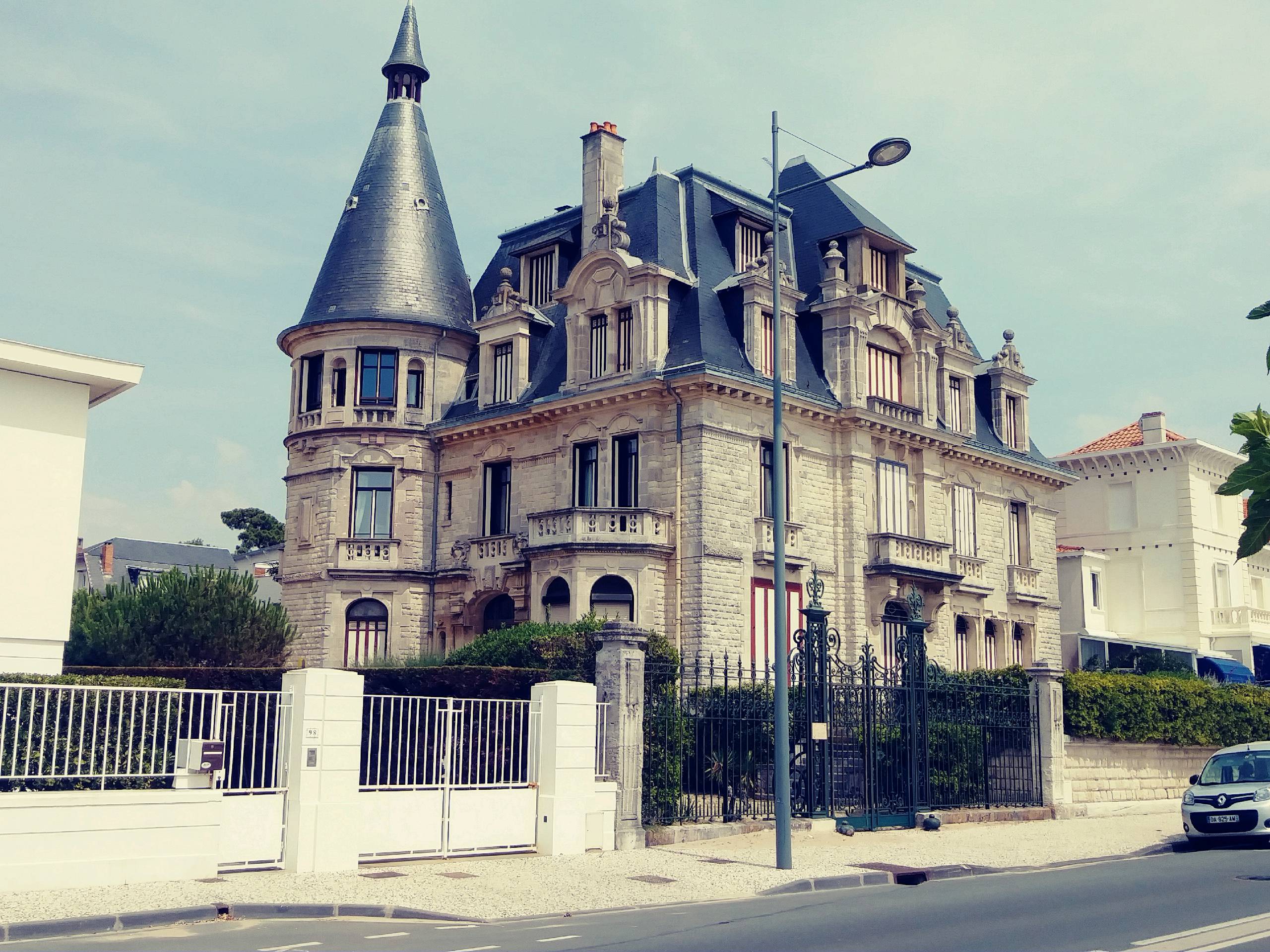
Hiking for today consisted of walking up and down the very beautiful beachfront 4 times for a total of about 6 miles. Much easier hiking than the steep Pyrenees mountain trails. The scenery included some wonderful old houses like this one which we decided must have some interesting ghosts living in the attic at least.
Leave Comment
Posted: 06/22/2017
Posted: 06/22/2017
06/23/2017
Sand Sand Sand
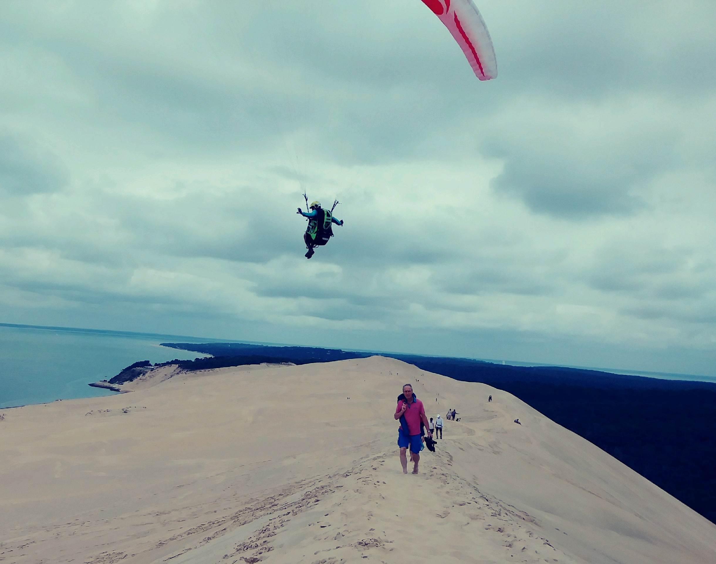 The Dune du Pilat is the tallest sand dune in Europe and I climbed to the top and hiked along its ridgeline today. Well, along with a couple hundred other people, but it was still very cool.
The Dune is over 100 meters high and contains roughly 60,000,000 cubic meters of sand - and it is moving eastward a couple meters every year. The continual wind is slowly blowing it into the forest which is dieing under the sand.
The wind off the ocean makes for refreshing coolness on a hot day and great lift for parasail pilots.
The hike was very strenuous in the soft sand but a ton of fun. Check out my current location on the map.
Tomorrow, we are back into the mountains foran overnight trek so I may not have coverage to post.
The Dune du Pilat is the tallest sand dune in Europe and I climbed to the top and hiked along its ridgeline today. Well, along with a couple hundred other people, but it was still very cool.
The Dune is over 100 meters high and contains roughly 60,000,000 cubic meters of sand - and it is moving eastward a couple meters every year. The continual wind is slowly blowing it into the forest which is dieing under the sand.
The wind off the ocean makes for refreshing coolness on a hot day and great lift for parasail pilots.
The hike was very strenuous in the soft sand but a ton of fun. Check out my current location on the map.
Tomorrow, we are back into the mountains foran overnight trek so I may not have coverage to post.Leave Comment
Posted: 06/23/2017
Posted: 06/23/2017
06/24/2017
Done Hiking Today

I finished hiking for today. You can check out my current location on the map and I'll post about my day when I am in coverage.
Leave Comment
Posted: 06/24/2017
Posted: 06/24/2017
06/25/2017
Back to the Mountains
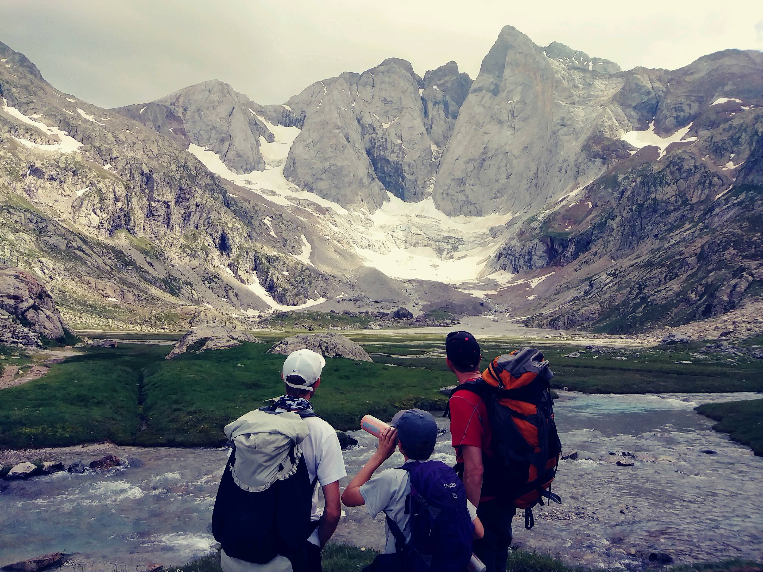 An 8.6km hike up into the Pyrenees along magnificent waterfalls, cliffs, and alpine meadows brought us to our home for the night.
We started at the Pont d'Espange and gained about 700 meters to 2200 meters elevation where there is a wonderful refuge. It is like a hostel with right crowded dorm rooms and shared toilets, but very clean and nice. The place is packed!
Our stay included dinner of lentil soup, lasagna, bread, cheese, and a brownie. In the morning, we'll also have breakfast.
The hike up started in clouds but we soon broke through to beautiful blue skies between towering mountains. I even saw my first real wildlife of the trip - 3 huge marmots!
The trail is actually a small stretch of the famous GR10 - look it up. We met a couple at dinner that did the same hike as us today but are continuing on a loop into Spain, going hut to hut and hiking about 12 miles a day. They are from Belgium. That sounds like a lot of fun, not needing to carry all your food. Maybe some day.
An 8.6km hike up into the Pyrenees along magnificent waterfalls, cliffs, and alpine meadows brought us to our home for the night.
We started at the Pont d'Espange and gained about 700 meters to 2200 meters elevation where there is a wonderful refuge. It is like a hostel with right crowded dorm rooms and shared toilets, but very clean and nice. The place is packed!
Our stay included dinner of lentil soup, lasagna, bread, cheese, and a brownie. In the morning, we'll also have breakfast.
The hike up started in clouds but we soon broke through to beautiful blue skies between towering mountains. I even saw my first real wildlife of the trip - 3 huge marmots!
The trail is actually a small stretch of the famous GR10 - look it up. We met a couple at dinner that did the same hike as us today but are continuing on a loop into Spain, going hut to hut and hiking about 12 miles a day. They are from Belgium. That sounds like a lot of fun, not needing to carry all your food. Maybe some day.Leave Comment
Posted: 06/25/2017
Posted: 06/25/2017
Border Crossing
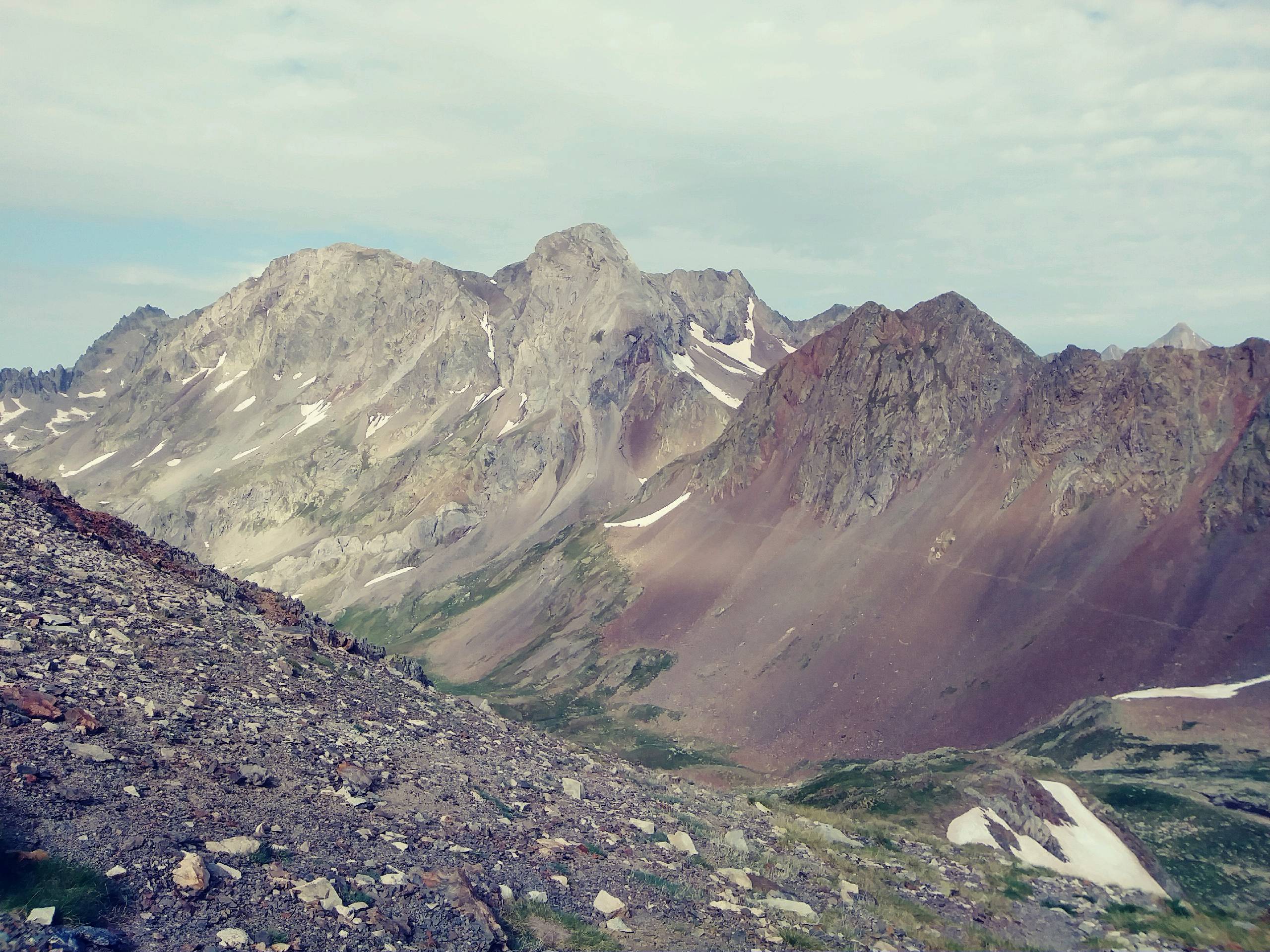 Up early with a hour to kill before breakfast, I walked up a trail for a half hour then back down to the refuge building. Fueled up on some oatmeal, dried fruit, and bread with marmalade (Lots of bread here) before our hike of the day.
Of course we hiked uphill but this time it was a very steep trail that took us to the Spanish border. This picture is the pass border at 2600 meters (8500 feet) with a wild view down into Spain. Up here there was just barren rock and a constant buffeting wind. Still, it was a shirt and shorts hike with yet another day of excellent weather. We only got a couple drops when a cloud rolled by.
From the border pass, we descended the 3600 feet to the trailhead over the same path we had climbed the day before. Much easier going down, but near the bottom where it is very popular and crowded, we came upon two separate injuries. One was a young girl that had collapsed and the other was an older man who feel and hit his arm and head. We stopped and offered help both times but it was declined. The man walked out ok but an ambulance arrived to take the girl out.
It has been great saying Bon Jour dozens of times as we negotiate past other hikers. People on the trail were friendly, as usual. Tomorrow starts our journey towards home.
Up early with a hour to kill before breakfast, I walked up a trail for a half hour then back down to the refuge building. Fueled up on some oatmeal, dried fruit, and bread with marmalade (Lots of bread here) before our hike of the day.
Of course we hiked uphill but this time it was a very steep trail that took us to the Spanish border. This picture is the pass border at 2600 meters (8500 feet) with a wild view down into Spain. Up here there was just barren rock and a constant buffeting wind. Still, it was a shirt and shorts hike with yet another day of excellent weather. We only got a couple drops when a cloud rolled by.
From the border pass, we descended the 3600 feet to the trailhead over the same path we had climbed the day before. Much easier going down, but near the bottom where it is very popular and crowded, we came upon two separate injuries. One was a young girl that had collapsed and the other was an older man who feel and hit his arm and head. We stopped and offered help both times but it was declined. The man walked out ok but an ambulance arrived to take the girl out.
It has been great saying Bon Jour dozens of times as we negotiate past other hikers. People on the trail were friendly, as usual. Tomorrow starts our journey towards home.Leave Comment
Posted: 06/25/2017
Posted: 06/25/2017
06/26/2017
Tourist Hikes
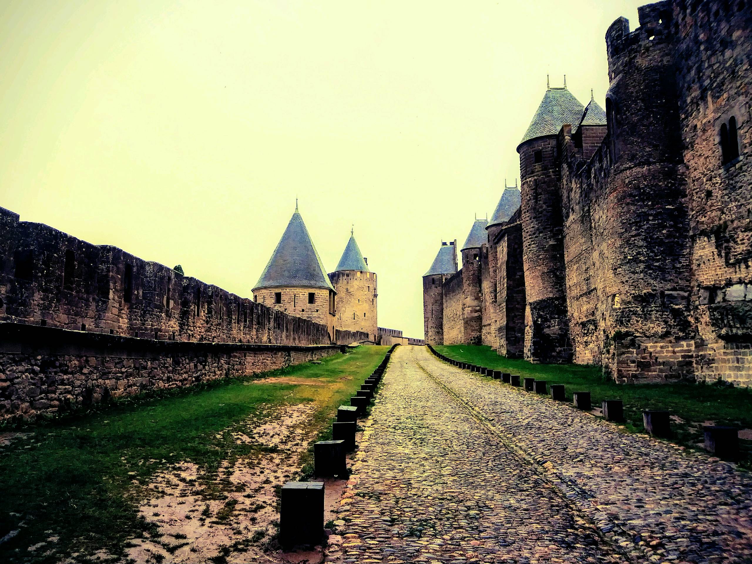 Leaving the Pyrenees behind, we're on our way to Geneva to return home. We made two stops for short touristy hikes today.
In Carcassonne, we explored the old fortified city positioned on a hill overlooking the region. The ancient rock walls, roads, turrets, towers, and buildings were very interesting. The town itself was really just a mall - tons of little places to eat, buy souvenir junk, or clothes. We did stop in the old church as a quartet of men was singing and the space resonated with their voices. The rain (our first on the trip) didn't help the experience of walking around. I almost lost an eye a few times from short people carrying big umbrellas. :-)
It was easy to imagine how this place protected its people aftergreat efforts to build.
In Nimes, we paid to explore the Arena which was built by the Romans for their grizzly sport. The brickwork from 1900 years ago was impressive and the audio tour narrative was verbous and informative. Unfortunately, in my view anyway, this structure has been kept in use over the centuries so it has been patched, repaired, and improved so much that the original is difficult to enjoy. The metal and cement seating, barricades, and stages hide the beauty of the old structure.
Also, nearly every surface has graffiti scratched, carved, or written on it. And, the litter in corners and under seating from recent event attendees is distracting. This was my least favorite site of this trip, actually the ONLY place I didn't completely enjoy.
Our last short walk of the day was on the narrow shoulder of a busy road from our budget hotel to the Ristorante Elefante 2 - which turned out to be a very nice, inexpensive, and quiet place with great pizza and pasta. Our waitress was friendly and a reminder of how diverse the regions of France really are. The general population here looks and sounds quite different than the folks in the Pyrenees region.
So, one more day and we'll be winging back over the Atlantic.
Leaving the Pyrenees behind, we're on our way to Geneva to return home. We made two stops for short touristy hikes today.
In Carcassonne, we explored the old fortified city positioned on a hill overlooking the region. The ancient rock walls, roads, turrets, towers, and buildings were very interesting. The town itself was really just a mall - tons of little places to eat, buy souvenir junk, or clothes. We did stop in the old church as a quartet of men was singing and the space resonated with their voices. The rain (our first on the trip) didn't help the experience of walking around. I almost lost an eye a few times from short people carrying big umbrellas. :-)
It was easy to imagine how this place protected its people aftergreat efforts to build.
In Nimes, we paid to explore the Arena which was built by the Romans for their grizzly sport. The brickwork from 1900 years ago was impressive and the audio tour narrative was verbous and informative. Unfortunately, in my view anyway, this structure has been kept in use over the centuries so it has been patched, repaired, and improved so much that the original is difficult to enjoy. The metal and cement seating, barricades, and stages hide the beauty of the old structure.
Also, nearly every surface has graffiti scratched, carved, or written on it. And, the litter in corners and under seating from recent event attendees is distracting. This was my least favorite site of this trip, actually the ONLY place I didn't completely enjoy.
Our last short walk of the day was on the narrow shoulder of a busy road from our budget hotel to the Ristorante Elefante 2 - which turned out to be a very nice, inexpensive, and quiet place with great pizza and pasta. Our waitress was friendly and a reminder of how diverse the regions of France really are. The general population here looks and sounds quite different than the folks in the Pyrenees region.
So, one more day and we'll be winging back over the Atlantic.Leave Comment
Posted: 06/26/2017
Posted: 06/26/2017
Older Posts Newer Posts
Find more Hiking Resources at www.HikingDude.com


Follow Me
Recent Comments