
Hiking Dude Blog
2025 - Aug Jul
2024 2023 2022 2021 2020 2019 2018 2017 2016 2015 2014 2013 2012 2011
09/06/2024

September 5 - Our first day on the Fisherman's Trail was wonderful! Blue sky, breeze, and dry air all day. Practically perfect weather.
We spent most of the seven hours that we hiked high on a plateau overlooking the ocean with a couple drops down to the sea to walk on the beach. There were also a couple miles in sparse forest away from the shore.
The trail itself had very little elevation but was tough much of the day. Deep, dry sand, like powdered sugar, made many miles very slow going, especially on the incline. Still, it was sooooo much better than mud in the rain! We traveled 12 miles to the next town South of Porto Covo, called Vila Nova de Milfontes.
We met other hikers from Germany, Australia, and Scotland, but we're the only ones camping so far. We didn't meet anyone at our campground tonight, but it's mostly car campers.
We started after 8am and stopped at a cafe place for a nice toasted ham and cheese sandwich around 10am. We took a short snack break later, but other than that just walked until we reached our destination.
Since the sun is bright and it's pretty warm, we're hoping to start a bit earlier tomorrow. But, that brings up other challenges.
After setting up our tent and taking showers, we wandered around the town looking for groceries and then dinner. Like other hot places, it seems many places shut down in the afternoon here. We did find some snacks for tomorrow, but we had to wait until 7pm for a restaurant to open. So, late dinners make early departures come quickly. We'll see how it goes.
Also, Kelly started feeling similar symptoms to my cold this afternoon. That might mean a miserable few days for her. We'll see.
Check out my current location on the map.
Posted: 09/06/2024
09/05/2024

September 4 - Lisbon is hot! At least compared to our last few weeks. We figured out the metro and got ourselves from the airport to a store for cooking gas and then on to the bus station to catch our 2 hour ride to the North end of the Fisherman's Trail in Porto Covo.
A very short walk to a campground in town, more like a semi-permanent trailer park, and our home for the night is set up. We're kind of in a little back alley behind some camper trailers but it's quiet and out of the way.
We decided to try the campground restaurant for dinner. Our cod dinner was huge and very tasty, with potatoes, bread, a bowl of olives, and wine. and that's about the only photo I took today.
Prices (at least for camping and meals) are much more reasonable than what we've seen the past few weeks in the North.
Posted: 09/05/2024
09/04/2024

Climbing Ben Nevis was definitely the highlight of our trip so far, for me. It was a long, strenuous hike with every type of weather above freezing and wonderful different climate zones and terrain as we climbed higher and higher.
Our plan was to have a rest day in Scotland and then proceed to Geneva to start our Tour du Mont Blanc trek. Key word there is 'was', but I'll keep you in suspense a bit as we tell you about our 'between hikes' days. This is a collaboration post composed by the two of us since I've been struggling with a head cold the past few days.
September 2 - After climbing Ben Nevis on Sunday, we collected our packs from the campground office, ate fish and chips (again) at the campground restaurant, and walked another mile down the road to our B & B, The Brevins House. Vincent and Brenda offered us a lovely room filled with everything we needed - it was a great stopping place! I walked another 2 miles round trip to a grocery store to get orange juice and cold medicine before taking an awesome hot shower.
The next morning, our hosts cooked us a delicious breakfast of blueberry pancakes, cream & yogurt, toast and coffee. While we were eating, Vincent noticed that only one of my water bottles had been filled, so he filled the other one up for me. So kind!
We then walked to the original WHW endpoint, took a selfie, and headed to the bus stop. We were lucky to get on our bus to Stirling because it was pretty full and we didn't have tickets. It was fun to look out the windows and see some of the WHW trail and the many hikers progressing along the way - I counted over 80 in just a few short sections. While on the bus, we secured tickets for the next bus which would take us the rest of the way into Stirling.
It was another rainy day (of course), so we had a wet walk through town from the bus station. When we showed up at our next B & B, Castlecroft, we were a bit soggy. Laura allowed us to wait in her lovely sitting room and drink tea & coffee and eat cookies & shortbread until it was time to check in.
We spent the time trying to figure out how to avoid the rain for the next 2 1/2 weeks. As with all of our other hikes, the weather forecast for the Tour du Mt. Blanc route will be rainy for the next 10 days, and we JUST CAN'T! Actually, the weather forecast for most of Europe above Spain is pretty poor. With both of us on the Internet, Hiking Dude finally found that Lisbon, Portugal had great weather, and Portugal had many long hikes. So, we started considering making some dramatic changes.
September 3 - After a great rest in a very comfortable bed, Laura made us a wonderful breakfast and wished us well as we hiked away from Castlecroft.
We enjoyed our overcast but not raining morning exploring Stirling Castle. The weather for the next week in Scotland, now that we're leaving, of course is very nice. :-)
On our train to Edinburgh airport to catch our flight to Geneva, we continued to research and consider options. We could delay our TMB hike a couple days hoping the weather will improve, or just plow ahead, or call it quits and head home, or completely change our destination. It appears that we've come to a decision.
We are flying to Geneva tonight, as planned, and will arrive around midnight. But then we are flying on to Portugal for about 10 days! It truly will be improvisational hiking! Along the Atlantic Coast of Portugal is the Fisherman's Trail which is about the right length. It's pretty flat, so no majestic mountain views, but there's beaches, sunsets, and 75 degree highs. Most importantly, there's no rain in the forecast, but we might change that!
One thing that tipped the scales to Portugal happened in the Edinburgh airport. As we were waiting for our flight and contemplating choices, a young woman asked to sit by us. I asked her if she had had a long travel day and she had, but it wasn't over. After a stop in Bordeaux, she is flying to Portugal. We figured that was enough of a sign.
September 4 - After a plane delay due to thunderstorms in Geneva and a short midnight walk in drizzling rain, we finally reached our airport hotel around 1am. We checked the weather one last time and then bought the tickets to Lisbon.
We got a few short hours of sleep, a quick breakfast included in the hotel, shuttle rather than walk back to the airport, and we're on our way to Portugal! We hope to take a bus to Porto Covo and then a short hike to our first campground this evening.
Check out my current location on the map.
A bit more about Castlecroft. Laura is a gracious host who provides everything you could think of! Her B & B is beautiful, the views are amazing, and there are paths that take you right to Stirling Castle and into the town of Stirling. I highly recommend both B & Bs as places to stay while you are doing day trip explorations around Scotland.
Posted: 09/04/2024
09/03/2024

September 1 - Climbing Ben Nevis (another guest post by Kelly since Hiking Dude has caught a cold and is feeling tired out)
Last night we stayed at the Glen Nevis campground. It was huge with large numbers of campers in camper vans, motor homes, huge tents and small tents. There were many amenities and we were able to wash and dry most of our clothes. There must have been lots of moisture in the air last night because our tent was filled with condensation this morning.
The campground reception folks were very gracious and allowed us to leave our big packs with them while we climbed Ben Nevis (10.5 miles round-trip). As we walked past the youth hostel, we once again saw our Belgium friend, Toya, waiting for her taxi. Based on our experience on this hike, I'm pretty sure we'll see her again in the future!
We decided to take the steeper shortcut for the first part of the hike instead of the longer, more gradual trail. We learned later that the locals call that route 'heart attack hill.' It was steep, but again our hill training paid off. The first part of the trail was made of stacked stones and was amazing. Farther up the trail it was mostly rock and gravel.
Also, farther up the trail it become very windy and much cooler. There were times when we were hiking straight into the wind. It was a challenging hike, and took us about three hours to hike to the top (1,345 meters). There were lots of falling down stone structures at the top. The hike down went well, but seemed to take just as long. We had to be cautious not to slip on the loose gravel and rocks (but we both did).
Hiking Dude counted just about 500 people on the trail with us today. When we got to the portion of trail with the stacked stones, we kind of ran down to save our knees from the pounding. When we got to the turn off to 'heart attack hill' we met and spent time visiting with an 84 year old man. It was interesting hearing his stories of hiking Ben Nevis and other places around the world. We retrieved our packs, ate dinner and walked to our B & B for the night. Tomorrow we take the train to Stirling.
Check out my current location on the map.
Posted: 09/03/2024
09/01/2024

August 31 - We reached the end of the West Highland Way at about 2:30!
It was beautiful weather for our last trail day and a very nice walk over open highlands past the ruins of ancient sheep farmer homesteads.
The last few miles were a monotonous downhill through forest on a very easy road to Fort William, but it didn't take too long.
We visited the West Highland museum (nothing about the trail), got some food, and then took a bus 2.5 miles back up the trail to the Glen Nevis campground at the base of the Ben Nevis mountain for the night. Tomorrow, we'll hike 4,400 feet up to the summit (along with 1,000 others since it's a nice weekend).
We did hike past a rescue team working on an injured hiker on the trail. Seems he took a fall and injured his leg. The trail has been rough and rocky in many places so I expect it happens often.
After our first night on the trail, half of my backpack's waist buckle had slipped off the belt and was missing. Never did find it so I've been carrying all the pack weight on my shoulders. Walking through town to the end, I stopped into three outdoors stores before one finally had replacement buckles! So, now it's fixed.
Highlight of the day was arriving at our spot to set up our tent and seeing Eva from Germany and Toya from Belgium right there. We've run into them many days along the trail, always expecting it will be the last time. But, this time it probably will be.
Check out my current location on the map.
08/30/2024
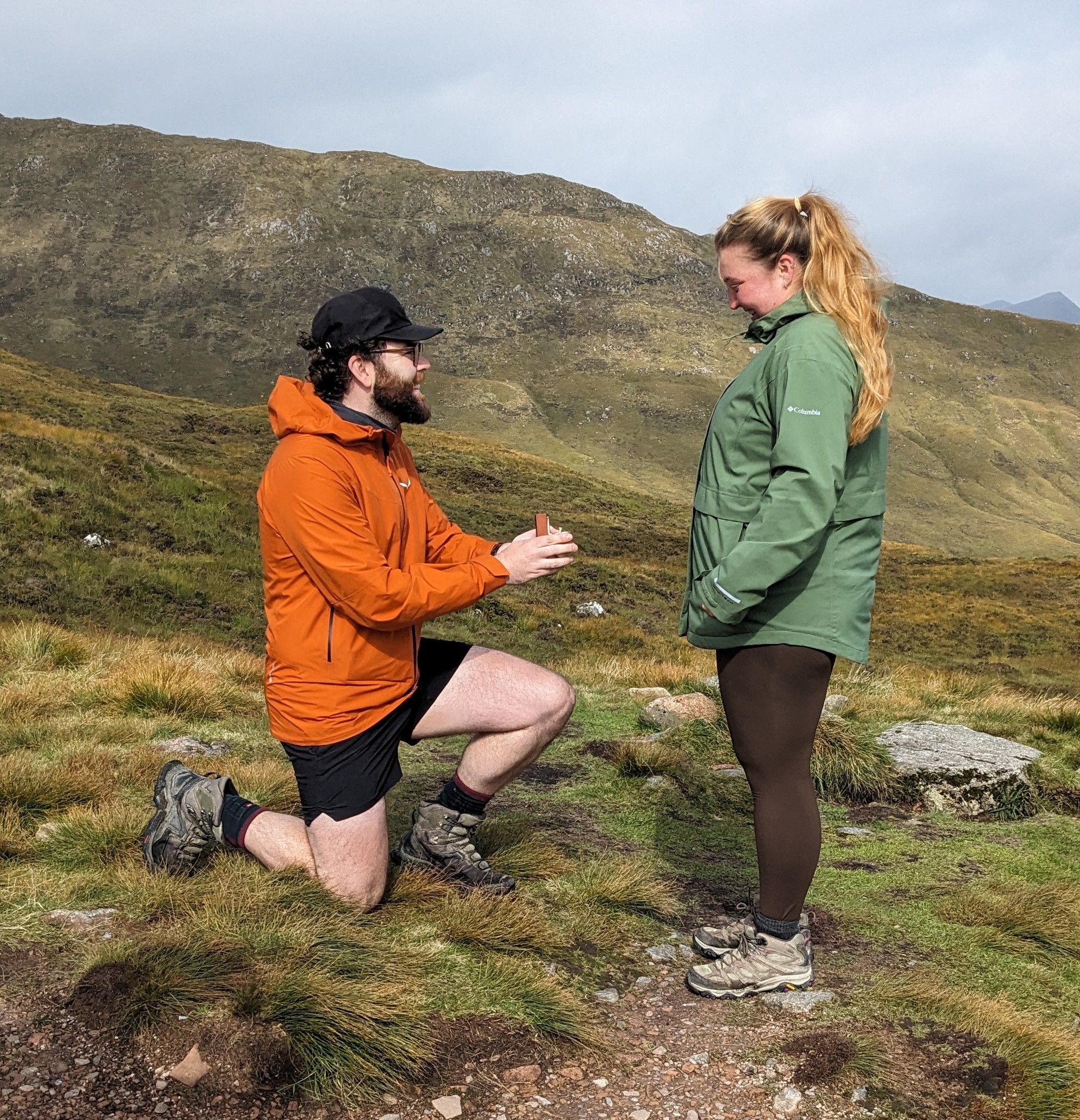
August 30 - The sun FINALLY peeked out and the rain took a break. Today's hike of 10 miles from Glencoe Mountain Resort to Kinlochleven gave us many opportunities to enjoy the beauty of the mountains and valleys, but the most beautiful of all was meeting Skye and Jack who had just gotten engaged at the highest point on the WHW (1850 ft). We celebrated with them and took some pictures before continuing down the other side of the mountain. Skye and Jack, if you read this, here's some advice from the hikers who've been hiking together for forty years. Listen to each other, be flexible, assume positive intent, forgive quickly, laugh and have fun!
The 800+ foot hike up the Devil's Staircase to the highest point was so much easier than we had anticipated. Our daily training of hill climbing with our packs on prepared us well!
The Devil's Staircase is a long series of switchbacks over a pass from one valley to another, built as a military road. It's amazing the amount of manual effort out into these roads that now make great trails.
There was a long downhill slog to get to Kinlochleven, but we took it slowly. Overall, today's hike was easy and relaxing.
We arrived in Kinlochleven early in the afternoon and bought some lunch food to enjoy in a nearby park. We walked around the entire town and then returned to Blackwater campground to use their really nice showers. We've never been this clean on a long distance hike before!
Kinlochleven sits nearly at sea level, but we have to climb over another pass into another valley to reach Ft. William on the sea. Tomorrow morning starts with a long 1,100 foot climb but it won't be as steep as this morning's.
After our late picnic lunch, we weren't hungry enough to make a meal this evening. But, we did eat a caramel brownie dessert that was left in the 'hiker box' here at the hostel/campground. People leave stuff they don't want and it's free to anyone.
Check out my current location on the map.
Posted: 08/30/2024
August 29 - There was a lull in the rain when we woke up at 6:30 so we took advantage of it by packing up and started hiking a bit after 7:00. The rain started up again right away but at least the tent and gear was all relatively dry.
The forecast has more rain all day and tapering off this evening to make way for three nice days. So, the plan is to hike just 8.5 miles to the Glencoe Mountain ski resort where Kelly was able to find a 'pod' for the night. Then, we'll have three days of longer hikes with nice weather and camping.
Today's walk was probably 50/50 rain for the 3.5 hours we were on trail. The terrain was open and rolling with hills around. The trail was very easy walking with just the usual flooded spots to navigate. We're following an 'old military road' built in the 1700s by the British government so forces could be deployed more rapidly if there was a Jacobite uprising.
Even though the views were still quite limited, this was what I was expecting when looking forward to a highlands hike. We could see it over the valley at times and we passed through miles of peat bog and heather.
The Scottish government has some big peatland restoration projects under way to restore some of the drained or over grazed peat areas. This is important because the peat is a huge carbon storage, natural environment, and sponge to help with flood reduction. We hiked through an area where a couple backhoes were working the ground in one of these projects.
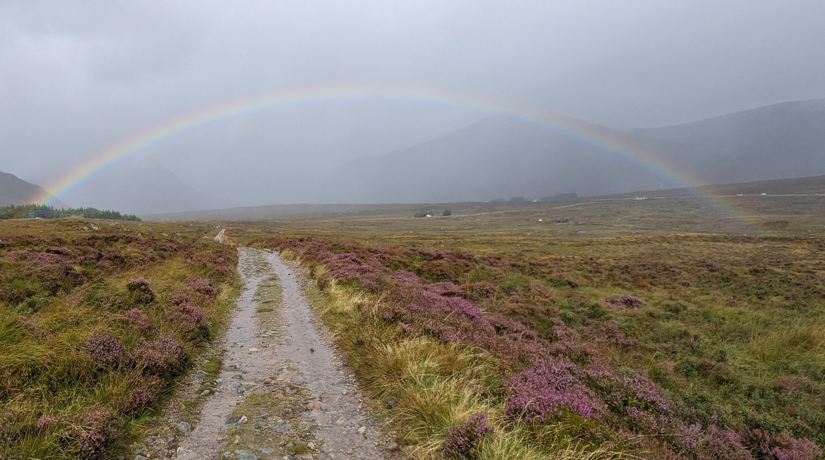
Just as we approached our goal for the day, the sun peeked out and gave us a wonderful rainbow which was my highlight. Since we arrived at our destination before noon, we had a very lazy afternoon sitting in the ski area cafe waiting for our check-in time. It was nice, but I didn't care for the haggis and venison burger we ordered - no more haggis for me.
This evening, after nice hot showers and one of our trail meals for dinner, we found a couple trail friends from a few days ago. They are from Wisconsin. We chatted with them, an Englishman, and an Irish so it was a great evening.
Check out my current location on the map.
Posted: 08/30/2024
08/29/2024
August 28 - Guest post by Kelly (Mrs. Dude).
Hiking Dude knows that what I hate more than anything is being wet and cold. Since we've had mostly cold, rainy days in Sweden and Scotland, I revised our WHW schedule a bit to give us a chance to dry out after rainy hiking days.
We've been camping every other night, and staying someplace dry (like a camping pod or hotel room if we're lucky) the other nights. Our days are shorter (hopefully less time in the rain) and we are trying to time our hiking hours to avoid the worst of the rain. We have three days left to hike and two of the days seem like they may be sunny(ish) according to Google.
Last night we stayed in a pod in Tyndrum where we rigged up a clothesline to dry everything out. We were also able to wash and dry some clothes! This morning we headed out by 7:30 a.m. because the morning weather prediction looked dry.
The trail from Tyndrum to The Bridge of Orchy was the easiest yet! We easily walked the 7 miles in about 2.5 hours. The trail wasn't as rocky or muddy or blocked by puddles as on previous days. The only thing slowing us down were the sheep posing for photos along the trail. Finally, Hiking Dude said, 'No more sheep photos!'
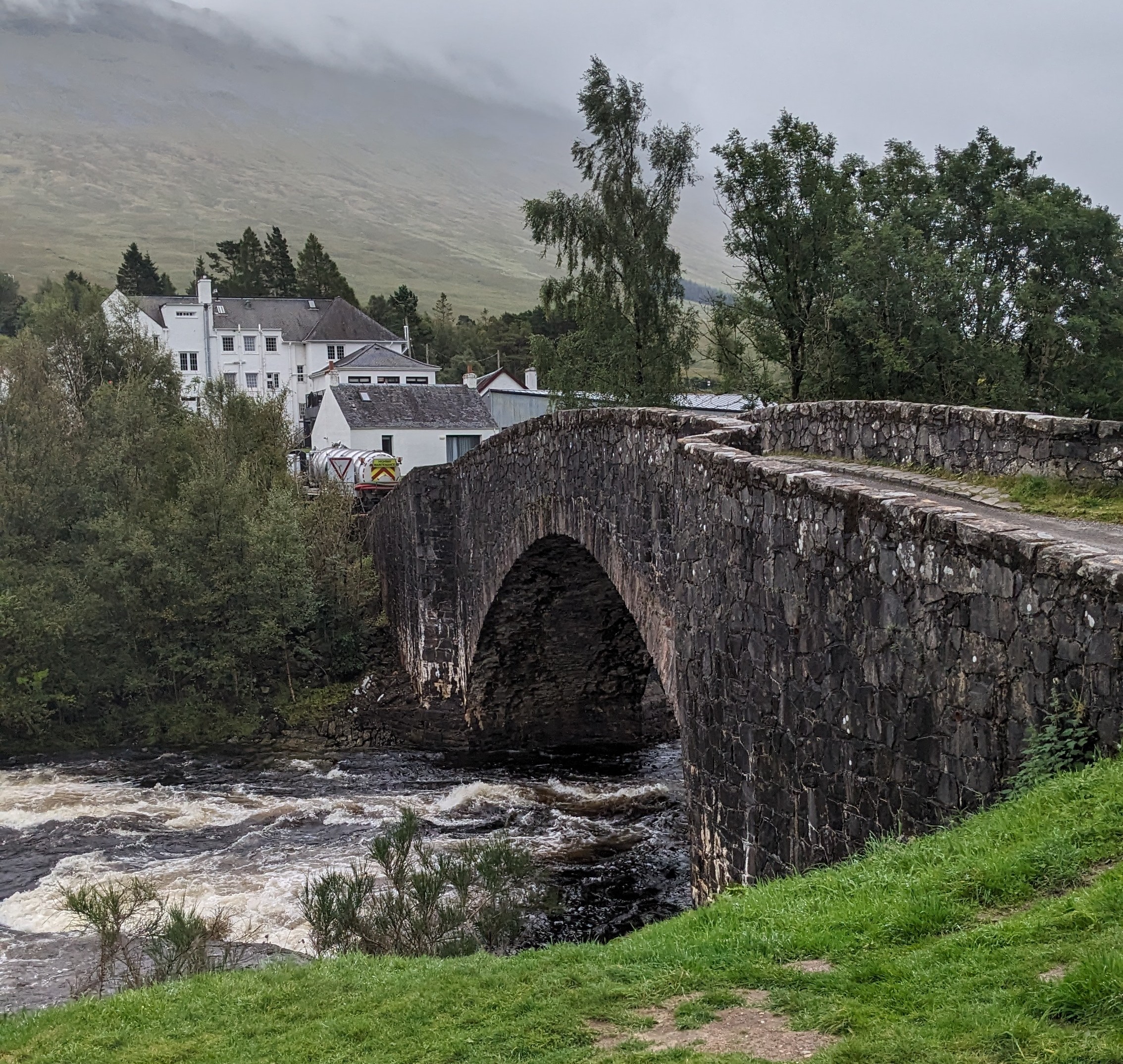
We stopped for a scone with cream and jelly, and something hot to drink at The Bridge of Orchy hotel and enjoyed relaxing and visiting with fellow hikers for about an hour. Then we headed out on the last couple of miles, up and over a hill and down again into Inveroran. We arrived by about 12:30. It rained during this part of the hike, but not too hard. The hill climb felt easier than we thought it would. All of the daily climbs, with our packs, on the local ski hill really helped our endurance!
I tried to get a room at the Inveroran Inn (actually Inveroran is just this inn and a convenience shop), but they were full, so we planned to wild camp just down the road, and then return for a nice dinner later in the evening. We found a great spot near the river to set up our tent, and the midges loved it also! Even though we were trying to quickly set up our tent in the drizzling rain, we dug through our packs to don our bug suits! Once the tent was set up, we walked up to the convenience shop to have a coke and hang out.
Then back to the tent to hang out and get unpacked. (Way too much hanging out for hiking dude, but he was a great sport!). Then at 4 pm we put on our 'nice' clothes and went to the Inn's bar to hang out until our 6:15 reservation. Luckily, we were offered an early table which we eagerly accepted.
Our meals were amazing - beautiful and delicious! I had lamb and Hiking Dude had snapper. If you have the opportunity to stay or eat here, do it! The owner and staff were very friendly and helpful. We made it back to our tent before the rain started and now we are in for the night and planning on a rainy (but short) day of hiking tomorrow.
There are six other tents here now as it becomes dark. For deer just visited, eating the grass and ignoring the people. Two of them have huge antlers!
Check out my current location on the map.
Posted: 08/29/2024
08/28/2024
August 27 - We woke (after fitful sleep) to heavy rain and strong wind. It actually was just more of the same from all night long.
Due to the weather, we changed our plans and only have 7.5 miles to walk today to the next small town with an opening at a campground with a 'pod'. This is a shed with beds and heating in it. Not very fancy, but a place to dry out and stay warm overnight.
As the wind gusts grew stronger while we were waiting/dozing this morning, a tent stake pulled out of the rocky, saturated ground - that was an exciting, wet couple of minutes to get it fixed.
A few more hours of waiting for the weather to subside and we packed up at about noon even though it was still raining. We did miss some brutal wind and rain, but we still had plenty of rain, overflowing streams, and mud all along our hike.
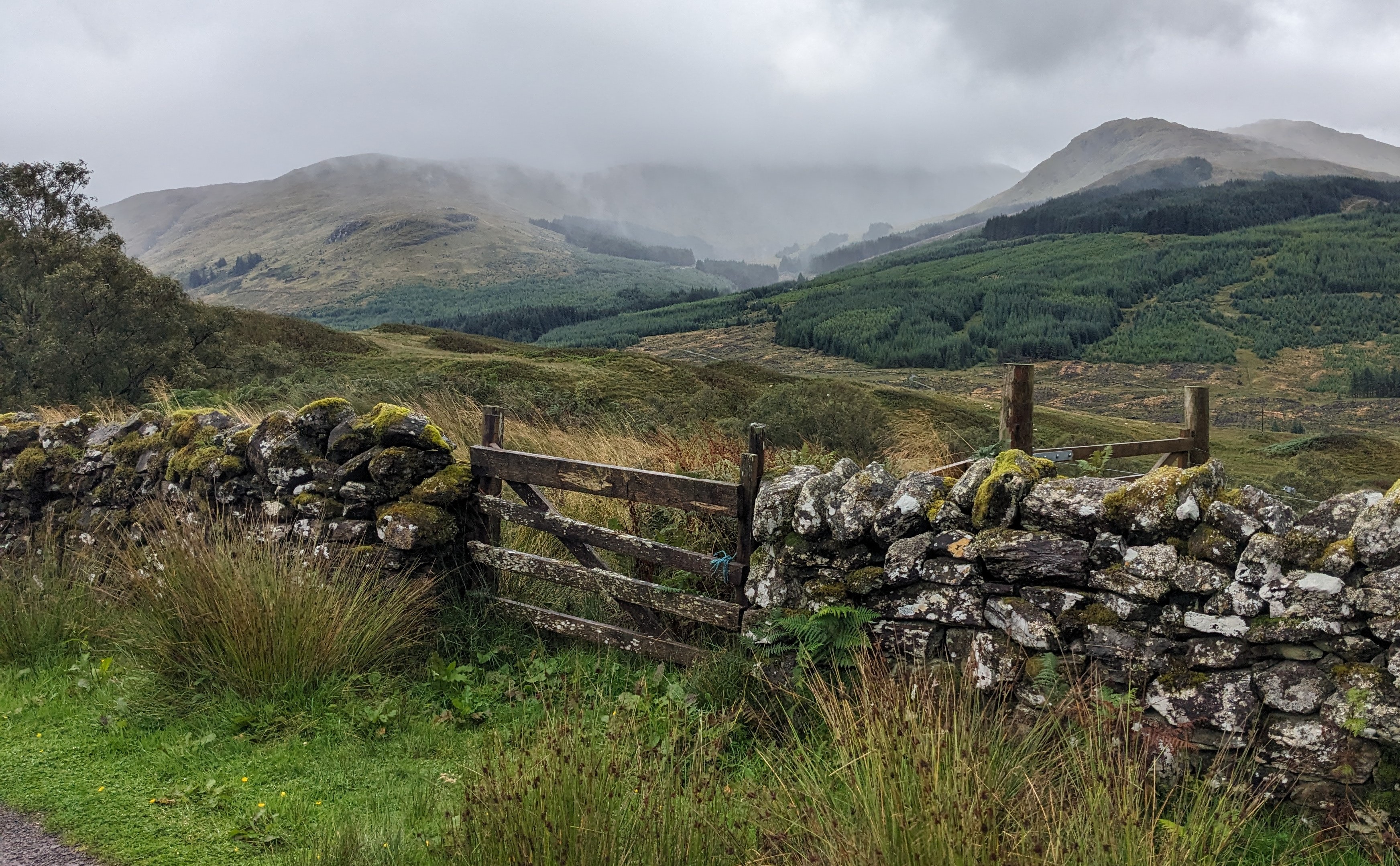
Not much to share, but we did see a few interesting things. We walked through an extremely mossy forest, passed a lot of heather, and saw more ancient rock fences and ruins.
Probably the most interesting was walking through what supposedly was the site of the last big defeat for Robert the Bruce before he went into hiding for 2 years.
Here at the lodging area, we washed clothes and took really hot showers. Then, a short walk to the only restaurant in town for an ok meal and we're back in our 'pod' drying gear and looking forward to a longer, rainy hike tomorrow.
Check out my current location on the map.
Posted: 08/28/2024
08/27/2024
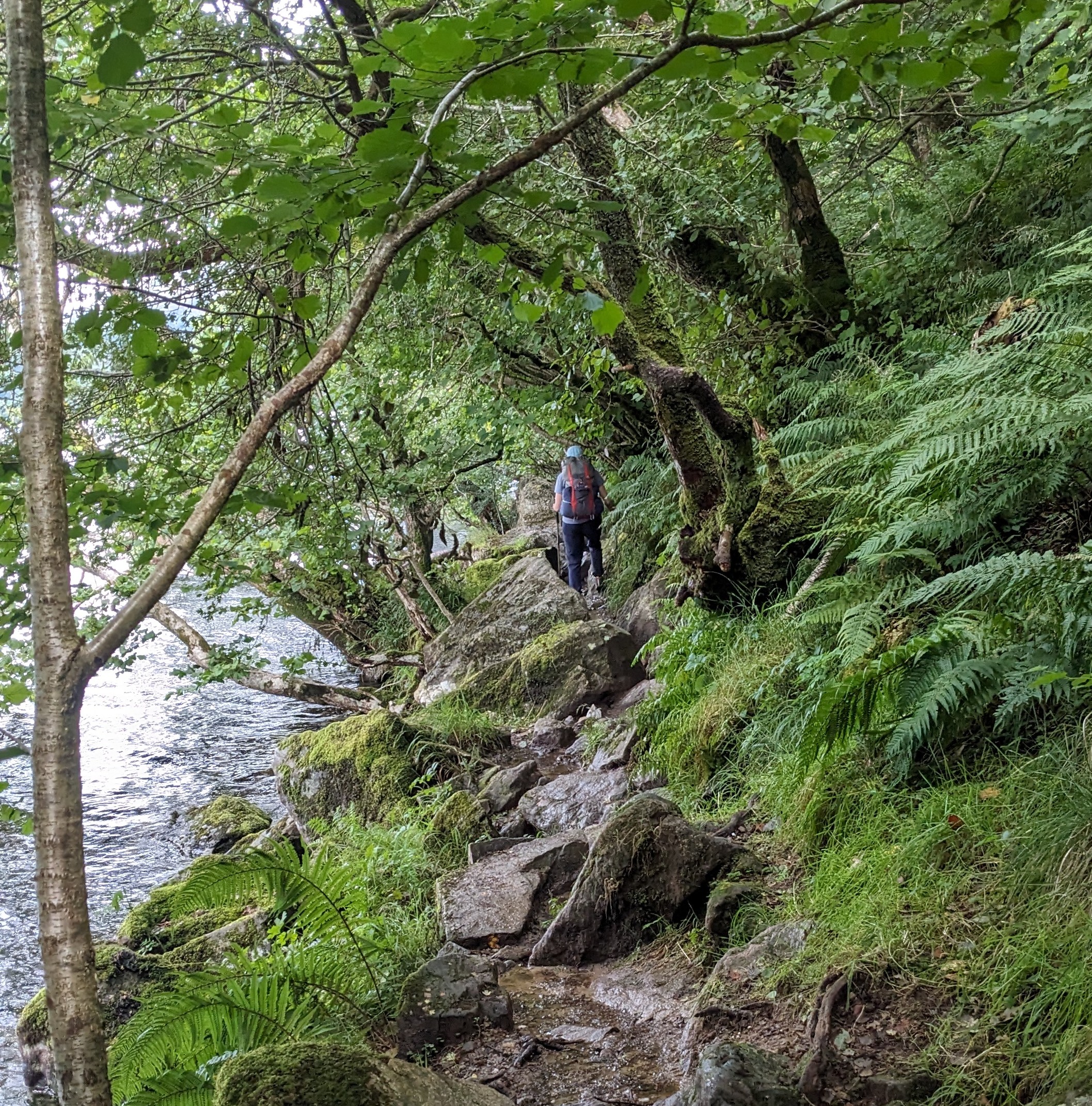
August 26 - This hotel was the best $$$ spent on the trip so far. A great night's sleep while staying warm and dry! It included a wonderful breakfast with yogurt, juices, sausage, bacon, eggs, potatoes, rolls, jams, ... so we didn't really need to eat much more as we hiked all day, starting a little after 8am.
Having Internet all along the trail so far has made modifying plans easier. And, with the rough and changing weather, we've been making changes.
For example, the forecast is good today but over an inch of rain tomorrow morning. So, we've decided to hike as far as we can today and stay in our tent tomorrow until the rain let's up (hopefully) and then have a short hike to some paid lodging to dry out again.
So, today we hiked for 10 hours and covered 18.5 miles. The weather was relatively terrific and we actually got to see some of the countryside.
I was expecting the WHW to be more open on highlands than it has been so far. Today's trail all along the east shore of Lac Lomond was extremely rocky and slow in a tight forest and much of yesterday was in forest as well. Lots of scrambling over big rocks today rather than walking, much left over mud and water from yesterday, but it wasn't raining.
Plenty of scenic little waterfalls along the way and some much larger ones tumbling down the hills on the far side of the lake. We also passed quite a few old ruins, some covered in blankets of moss, making me wonder who lived here, how long ago, and what they did.
We met some local guys outside a bothy and chatted a bit. We took a look inside and decided we'd have to be pretty desperate for shelter to stay in one, but it would be better than being stuck in a storm.
After the very popular Bienglas campground where most of the folks we met today stopped, we finally got out of the woods and had a couple hours hiking across open spaces. We stopped to set up our tent at about 6:15 p.m. on a fairly flat but soggy spot on a hillside covered in grazing sheep. A couple came by to investigate us.
We read that midges are a nuisance on the WHW but it took until this afternoon to find them. They are out in force this evening and it started raining just as we got the tent up.
So, with midges about and rain falling, we're skipping any cooking and just having a snack supper. We'll probably be here for about 16 hours.
Check out my current location on the map.
Posted: 08/27/2024
08/26/2024
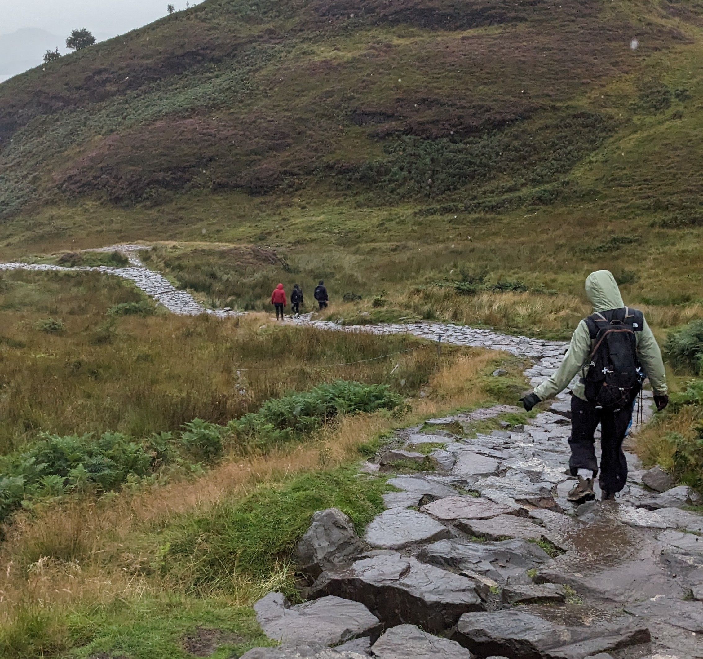
August 25 - Rain. That's about all there is to say about today.
It was raining when we got up and still raining 9 hours later when we reached our refuge for the night. We hiked for 7 hours and covered almost 16 miles to reach the Rorwardennan Hotel. Since we knew it was all rain, we've opted for a dry, warm spot for the night.
In the morning, we climbed the trail over Conic Hill which has wonderful views - when it's not stuck in a cloud. We did see sheep and heather and got to walk on a brand new rock trail under construction on the hill. It was a lot steeper than it looks!
After reaching the hotel, I enjoyed a long hot shower and now have clothes hanging all around the room drying overnight. We had dinner in the nextdoor bar - the steak pie was good.
Posted: 08/26/2024
Older Posts Newer Posts
Find more Hiking Resources at www.HikingDude.com


Follow Me
Recent Comments