Hiking Dude Blog
2025 - Aug Jul
2024 2023 2022 2021 2020 2019 2018 2017 2016 2015 2014 2013 2012 2011
09/19/2013
Chequamegon
 I walked 66000 steps on the trail today.
I traveled about 30 miles today.
All but the first 5 miles today were covered inside the Chequamegon national forest. I believe this is the first national forest we've passed through, and we'll have another 17 miles tomorrow before we emerge.
The name is pronounced she-WAM-a-gun (wam from wigwam). Buzz told us a story about how to remember it. Each spring, the Indian chief would decide when the waters were warm enough for bathing. He would put his toe in every morning and, when it was finally ok, he'd say 'She warm again'. That's the short version. :-)
Anyway, we hiked around the Mondeaux Flowage and had a terrific pizza made by Steve at the Mondeaux Lodge. Don't get the 16-inch, you'll never finish it! Steve was great to visit with and has a register to sign.
We hiked the top ridge of the Mondeaux Esker and Hemlock Esker - very neat.
We met two backpackers on the trail out for a few days. BIG packs.
When we reached a primitive camp site where we wanted to stay, we found it packed full with some outdoors wilderness camp group. So, we're down the trail a bit. And, after a long zfternoon of rain, it's trying one more time to get us wet. Tomorrow is to be dry, clear, and cool - according to the infallible weatherman!
I'm looking forward to a great day of hiking. Untortunately, having my feet and socks soaked all day has worn some skin raw. We'll see what the morning brings.
09/17/2013
Die, Mosquitos, Die
 I walked 43162 steps on the trail today.
I traveled about 21 miles today.
We called it a short day at Rusch Preserve where there are some free campsites and a pump well. The well water is brown. :-(
This is also the start of the 10mile side trail to Timm's Hill - Wisconsin's high point. (I won't be doing that)
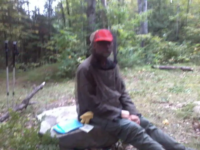
Even though we've had two sub-freezing nights, mosquitos continue to hound us - but not as aggressively and only in the afternoon and evening. You can see I'm still making use of my bug suit this evening.
In this established campsite, there is at least one pesky rodent searching for free food. We've no such visitors when camping wild out on the trail. But, last night, we did have a gang of turkeys wander by our tents making lots of noise. That was a treat!
Leave Comment
Posted: 09/17/2013
Posted: 09/17/2013
Lincoln County
 Slept in this morning since we did so many miles yesterday, it was 29 degrees, and we have a shuttle scheduled for tomorrow.I was toasty warm all night in my down jacket!
We started hiking a bit after 8am and are at Wood Lake park for a lunch stop.
We'll have a very short day tomorrow since we need to move the vehicle and get a shuttle back to the trail - doesn't do any good to hike past the drop-off point.
The trail segments in Lincoln county have been great - easy to navigate and nice forests. The volunteers have done a wonderful job. We crossed into Taylor county this morning and so far so good.
Hike On
09/16/2013
Longest Walk
 I walked 71328 steps on the trail today.
I traveled about 34 miles today.
In the New Wood segment, there are 3 large, old white pine. Adding up the miles in the trail guide, they are at about the 800 mile mark. Since we passed them today, this is now my longest hike - the Arizona Trail was 800 miles.
At the end of this long day, we walked over a brand new footbridge installed just this morning by a great group of volunteers. It is an excellent bridge over some chronically wet area. So, THANK YOU to the Lincoln County IAT folks!
Leave Comment
Posted: 09/16/2013
Posted: 09/16/2013
09/15/2013
Zero Day
 This Sunday was our first Zero Day of the month. It's been 2 weeks of hiking with no break. Ed and Louise of the Underdown Horse Club gave us a lift to my van after cleaning up camp this morning. Oh, by the way, it did rain all night and this morning so it was a good thing we stayed dry in the shed overnight.
With a vehicle, we took showers at a state park, did laundry, visited a library, and ate! We then drove to our next endpoint where we met Ruby, a wonderful IAT volunteer.
Ruby has taken us to her home where we've met her husband, had a terrific halibut dinner, and watched some fooball. Tomorrow, it's back on the trail with probably very cold but dry weather.
Helping Denny and Sassy, the horses, was a highlight of the day.
Leave Comment
Posted: 09/15/2013
Posted: 09/15/2013
09/14/2013
Horse Surprise
 I walked 56286 steps on the trail today.
I traveled about 26 miles today.
The mosquitos found us after the lookout tower so we covered up with bug netting and hiked on. We finished the very Up and Down Harrison Hills segment with a goal of reaching the Underdown Rec Area that had water.
When we arrived, the place was full of horse riders - the Underdown Horse Club was haing a ride today. About 100 horses and riders were here!
They welcomed us and invited us to join them for dinner. We are now getting ready to sleep in their storage shed so we don't have to set up tents with rain expected tonight.
It has been a wonderful evening visiting with some great, friendly folks. Tomorrow looks to be wet and cold so we may take a day off the trail since we've hiked every day since Lodi. We'll see.
By the way, horse folks have great potlucks!
Leave Comment
Posted: 09/14/2013
Posted: 09/14/2013
Top of the World
 I'm on top of the lookout tower on the high point of the Ice Age Trail! It's all downhill to Minnesota from here.
Sweeping views all around, including Rib Mountain way down by Wausau. It's all gresn now, but in a few weeks it will be a kaleidoscope of color.
Hike On
Leave Comment
Posted: 09/14/2013
Posted: 09/14/2013
09/13/2013
Valderi
 I walked 62682 steps on the trail today.
I traveled about 29 miles today.
This was a beautiful fall day of hiking. Cool air, crunchy leafs underfoot, and warming sunshine all day. A great day for a very long hike!
Towards late afternoon, a lady appeared by the picnic table at which we were taking a short break before doing our last couple hour leg of hiking. It turns out she is Valderi - hiking the trail eastbound, opposite us. She had a tiny pack of mostly water since she is not camping out on the trail each night. She has an online journal of her trip - I believe it is at epiciceagetrail.blogspot.com but maybe someone can leave a comment with the correct URL if not that.
Valderi gave us advice about the trail ahead that she received from the local chapter coordinator. Based on that, we took an alternate route around four miles and one of several reroutes past another spot.
The trail today was enjoyable and included some elevation gain. Tomorrow's walk should take us over the IAT's highest point.
Leave Comment
Posted: 09/13/2013
Posted: 09/13/2013
Lake Susan
 We have a long day today, hoping to reach the road above Merrill by Sunday. The trail ahead is reported to be rough, logged, and heavy ATV use - not to mention flooding from beaver activity. What fun! :-). We'll see how it goes. So far today has been great. We're taking alunch break at Lake Susan letting our shoes and socks dry from the heavy morning dew.
Leave Comment
Posted: 09/13/2013
Posted: 09/13/2013
09/12/2013
700 Miles
 I walked 67348 steps on the trail today.
I traveled about 28 miles today.
I'm glad to be finished with the Kettlebowl segment. There were a few spots where signs were hidden or missing and we had to backtrack a little way. Nothing big, but made for a longer day.
The Lumbercamp segment was almost completely easy-to-follow logging road or mowed path. We flushed over a dozen grouse and many deer. We even saw a bear print in the mud! Plus, some coyote prints.
We passed the 700 mile mark today just past Kettlebowl ski area. We also made the big turn from northeast to west so it's a relative straight shot to the MN border.
My hand is still swollen but has not gotten worse since lunch.
We are camped in a very rough logged out forest tonight. It's supposed to get pretty cold so that should help with bugs - just hope I stay warm.
Older Posts Newer Posts
Find more Hiking Resources at www.HikingDude.com


Follow Me
Recent Comments